Coasting Bargemaster
In Coasting Bargemaster, Bob Roberts tells of taking refuge, whilst in the Martinet, in an offshore anchorage:
“It is a desolate spot, many miles offshore, where the Maplin sands are divided from the Whitaker shoals by a semi-circle of water from three to four fathoms in depth at low tide.”
Coasting Bargemaster by Bob Roberts
He says that the anchorage is safe in all weather, apart from easterly, and credits the name to the ‘Essexmen’. Perhaps they applied the biblical meaning ironically.
Near Maplin Middle
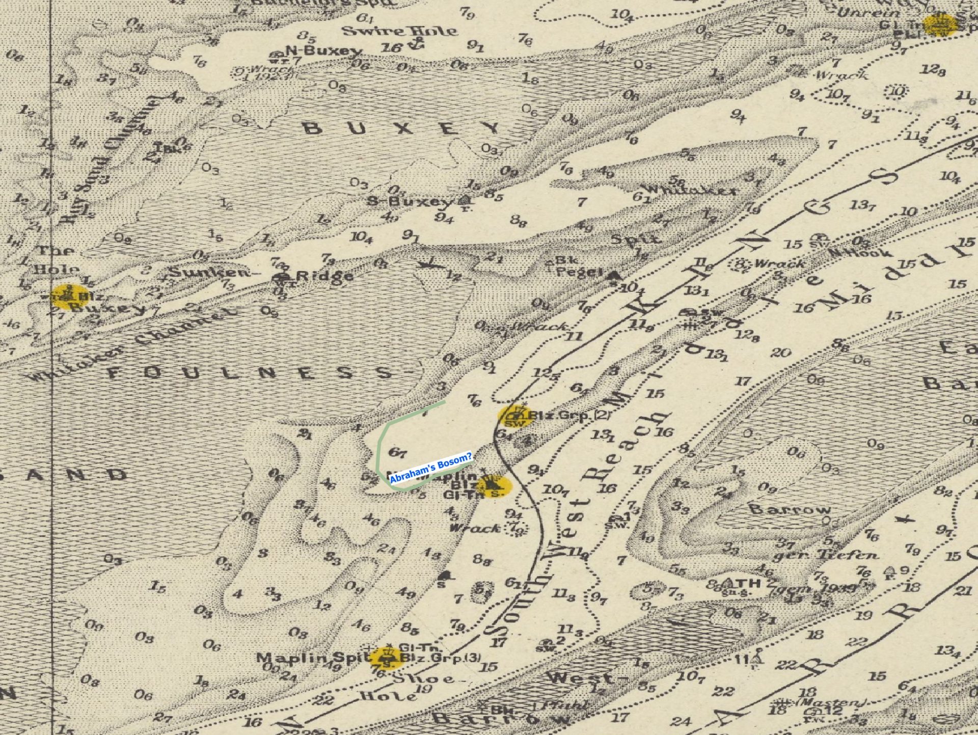
The actual location has not been found marked on a chart, a reasonable supposition is that it is about two nautical miles southwest of the Whitaker Beacon in the Foulness firing range area west of Mapin Middle (2023): this area, less than one mile square, provides shelter by a shoal area and the East Barrow. There are several wrecks in the area, perhaps caught by easterly storms.
How he found it in the dark just by sounding is a mystery. The occasion he describes was in wartime so there would have been few, or no lights and, indeed, many buoys had been removed.
Here is the location shown on a contemporary chart (depth in metres as this is a German copy of a British chart).

River Ore
Another Abraham’s Bosom is to be found on the River Ore near the Butley River opposite Inset Point1Steers describes how this area was formed J. A. Steers, The Coastline of England and Wales, 2nd edition (Cambridge: Cambridge University Press, 1964). This one looks far more comfortable than the Maplin one. KTL mentions this as a perfect deep-water haven.
- 1Steers describes how this area was formed J. A. Steers, The Coastline of England and Wales, 2nd edition (Cambridge: Cambridge University Press, 1964).
Image Credits and Sources
- Abrahams Bosom 1945 Kreigsmarine Estuary ex nls and georeferencer: National Library of Scotland Georeferencer
