The Sea Mark
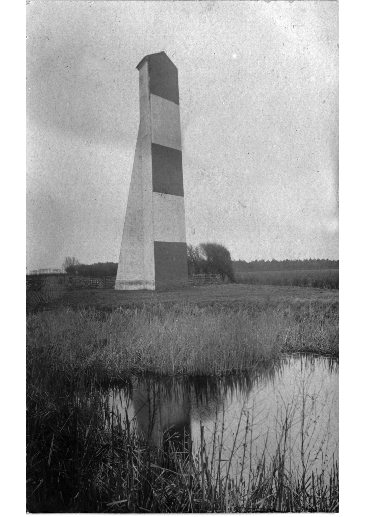
The Sledway was the safe route from deep water east of the Shipwash to Orwell and Woodbridge Havens, avoiding shoals. It was marked, until 1934, by a brick sea-mark on the Bawdsey Cliff when the sea-mark was demolished due to erosion. The bricks were used in local housebuilding1See Sir Cuthbert’s Fight with the Sea – RDA’s Deben Spring 2013 which says it was demolished in 1934 and the bricks used to build houses in East Lane.. The photograph dates to the late nineteenth or early twentieth century, as it appears some way from the cliff edge.

There are few visible landmarks along the coast and, as well as marking the Sledway, the beacon would have provided a cross-fix with Naze Tower (49m). The brick beacon is around 100′ (30m) high off the ground2For beacon visibility range add about 20m for cliff height. so would have been equal in visibility to the Tower. Was the triangular top meant to signify starboard? There are several other features in the area which have been used as nautical landmarks: Bawdsey Cliff, Butley Church, Boyton Wood, Boyton Mill and Alderton Rectory (Dr Frank’s House).
Sir James Thornhill, visiting Kings Fleet, mentions a sea-mark at Bawdsey in 1711, the Church then had a spire.
Mav 30th. … whence yon see Bargy (Bawdsey) whose Tower is tall and a sea mark, there is a ferry.
1711 diary of Sir James Thornhill
The sea-mark does not appear on the late eighteenth-century Burns, Chandler or Heather charts, which use only Bawdsey and Alderton Churches as marks: perhaps Thornhill saw the wooden beacon as on the 1683 chart which shows an un-named Bawdsey beacon: this was probably a wooden beacon, with a brazier that could be lit, and not brick. That chart gives clearing lines for the Sledway. There is a record of the construction cost being £346 before 1802 (presumably Spence’s survey)3Great Britain Commission Appointed to Inquire into the Condition of Lights Beacons Buoys and, Report of the Commissioners Appointed to Inquire Into the Condition and Management of Lights, Buoys and Beacons: Together with a Letter from Rear-Admiral W.A.B. Hamilton, Chairman of the Commission, and Appendix and Index (H.M. Stationery Office, 1861)..
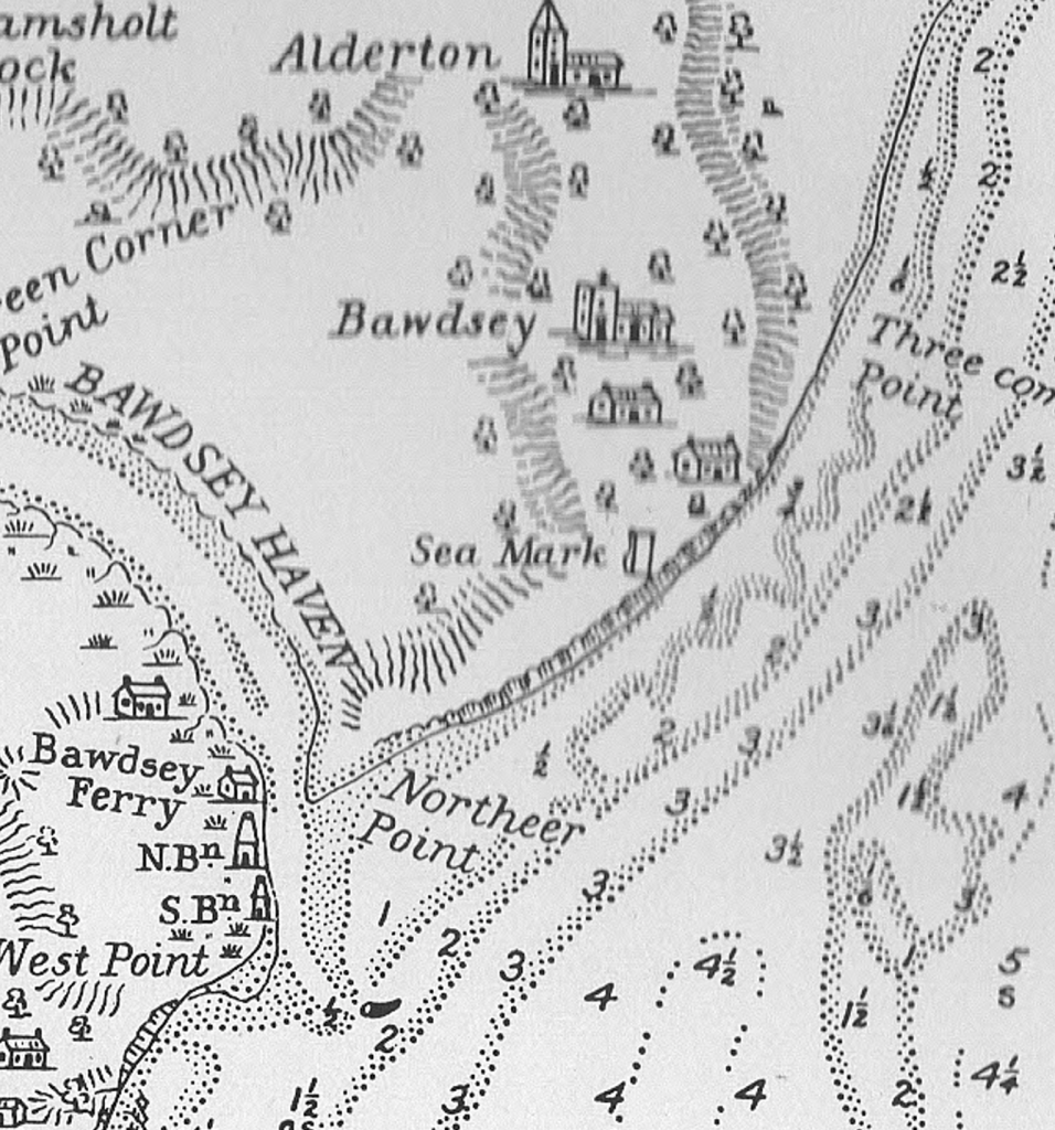
Spence’s 1804 chart and the 1845 Deben Survey show the sea-mark4 the sea-mark is not mentioned in the somewhat idiosyncratic 1844 Coaster’s Guide. The sketch on the 1804 chart omits the distinctive triangular top so this may have been incorporated on the rebuild. Note the churches.

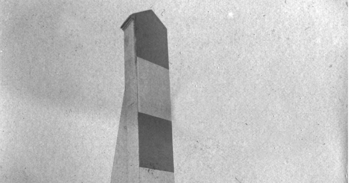
The seamark intrigued Edward Fitzgerald in the 1870s who described it as being all white, not the best colour scheme for visibility. The 1869 drawing shows no stripes but by 1892 Frank Cowper reported that:
“Bawdsey Cliff, with its triangular sea mark painted in red and white rings, which is a mark for the sledway outside, is very conspicuous; beyond the beacon, fading away in dots in the dim distance, are a string of martello towers, …”
So, a mark of some sort existed in 1711 and was probably a brick structure by 1804: it was rebuilt in 1831 and demolished in 1934. Nowadays, ships have the Deep Water Channel so neither the Sledway nor a seamark are required.
Older Marks
There have been marks on the cliffs since at least 15525W.G.Arnott, W G. Suffolk Estuary : The Story of the River Deben. N. Adlard, , 2D Impression, 1950. – The first sea mark on Bawdsey Cliff was in existence as far back as 1552 when it was referred to in an Admiralty suit. .

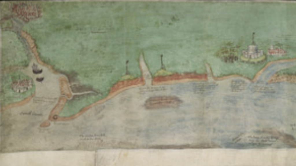
The 1538 chart at the British Library6A Coloured Chart of the Coast of Suffolk, from Orwell Haven to Gorlston, near Yarmouth shows marks or beacons on the cliffs on either side of the Deben. Whilst the Deben had been important in earlier centuries as Goseford Haven, by this time it was in decline. Arnott cites tall pylons visible twenty miles out to sea and provides a sketch of them. The 1683 chart shows ‘Felsto Becon’, on the Felixstowe cliff, and an un-named Bawdsey beacon: these are probably the same pair mentioned above and must have been substantial wooden structures.

.
Notes
- 15C Hakluyt Local Sailing Directions “oute of Orwell waynys for to goo oute at the slade your cours is est southest, for cause of the rigge (Ridge)and the Eokkis,(West Rocks) till ye com till xv. ffadome depe and for the long sande” – If we take the Waynys as being the mid-point between Wadgate Ledge SHM and Felixstowe Ledge SHM this works. The other features are Ridge and Rocks(West). Usefully this indicates that the “waynys” were somewhere between the modern Wadgate Ledge and Felixstowe Ledge buoys. Waynys or wains refers to a form of sea-wall perhaps connected with fishing weirs.
- 1588 Lucas Waghenears Dutch Atlas East Coast shows what appear to be the leading beacons, or meets, but no sea mark.
- 1686 Greenvile Collins Chart shows ‘Beacon’ but uses the Church as a sea-mark. References Sledway: – The Buoy of the Gunfleet* beareth from the Naze south east by east easterly. You may stand into seven and eight Fathom along the side of the West-Rocks* into the Sledway, keeping Balsey Church north by west and north north west till you bring Harwich Steeple on the Brewhouse (that lyeth to the northward of Languard-Fort) which will carry you clear of the Cork-ledge, on which is two Fathom and a half at low-water, and then stand to the westward, and keep Orford Church and Castle open of Balsey-Cliff a Sails breadth, till you have the Lights together, keeping them so till you are past the Andrews, and then follow the former Directions for sailing into Harwich.
- 1752 John Mount’s Sailing Directions make no mention of a sea mark at Bawdsey but are otherwise comprehensive suggesting the mark was not used at that time.
- 1794 Geo. Burns Chart does not show sea-mark and marks the “Sled” on Bawdsey Church.
- Late 18C Chandler and Heather charts do not show sea-mark and are vague on Sledway.
- 1804 Graeme Spence chart shows a sea-mark.
- 1845 Deben survey shows a sea-mark for the Sledway.
- 1844 The improved coaster’s guide, and Marine board examination, for the east coast – The Sledway is bounded by the SW end of Bawdsey Sand, the Kettle Bottom, and the SW end of the Whiting, on one side; the Cutler, Cork Knot and Rough, on the other side. The marks used are Butley Church, Boyton Mill and Boyton Wood. There is no mention of the sea-mark.
- 1869 North Sea Pilot – “Bawdsey Cliff is of a dark red colour, and bears upon its face numerous marks of recent land-slips. A large white house among wood, inland and to the northward of the cliff, a windmill at Alderton, and Bawdsey church, with its broad stunted tower, are all plain objects. Bawdsey sea-mark, an obelisk painted red and white in horizontal bands, stands close to the brink of the cliff towards its north-east end; in line with Bawdsey church, it leads through the Sledway between Bawdsey bank and the Roughs…”
- 1903 Meesum East Coast Rivers shows an Obelisk.
- 1915 USNO England East Coast Pilot Harwich extract -Bawdsey Sea Mark, an obelisk painted red and white in horizontal bands, stands near the northeast end of the cliff.
- 2007 England’s Historic Seascapes description uses the modern description of Sledway.
Footnotes
- 1See Sir Cuthbert’s Fight with the Sea – RDA’s Deben Spring 2013 which says it was demolished in 1934 and the bricks used to build houses in East Lane.
- 2For beacon visibility range add about 20m for cliff height.
- 3Great Britain Commission Appointed to Inquire into the Condition of Lights Beacons Buoys and, Report of the Commissioners Appointed to Inquire Into the Condition and Management of Lights, Buoys and Beacons: Together with a Letter from Rear-Admiral W.A.B. Hamilton, Chairman of the Commission, and Appendix and Index (H.M. Stationery Office, 1861).
- 4the sea-mark is not mentioned in the somewhat idiosyncratic 1844 Coaster’s Guide
- 5W.G.Arnott, W G. Suffolk Estuary : The Story of the River Deben. N. Adlard, , 2D Impression, 1950. – The first sea mark on Bawdsey Cliff was in existence as far back as 1552 when it was referred to in an Admiralty suit.
- 6
Image Credits and Sources
- FI Bawdsey-Seamark-from-Di-Coulting-1447×2048@2x_cr: Courtesy of Coulting, Di - Boathouse Cafe Bawdsey | All Rights Reserved
