Stone
There is a bed of stone between the Deben and the Naze which, over the years, has been mined as a building material. The northern part extends seawards from Cobbolds Point to Felixstowe Ledge. The point exists because the land north and south is softer and has eroded. The rock armour installed in the early twenty-first century now aims to preserve it.
Buoy
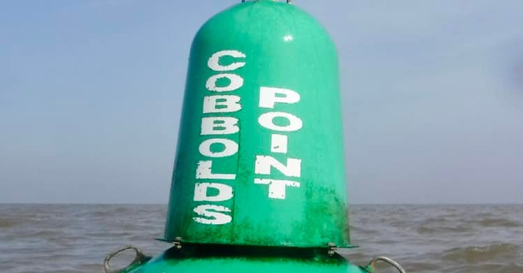
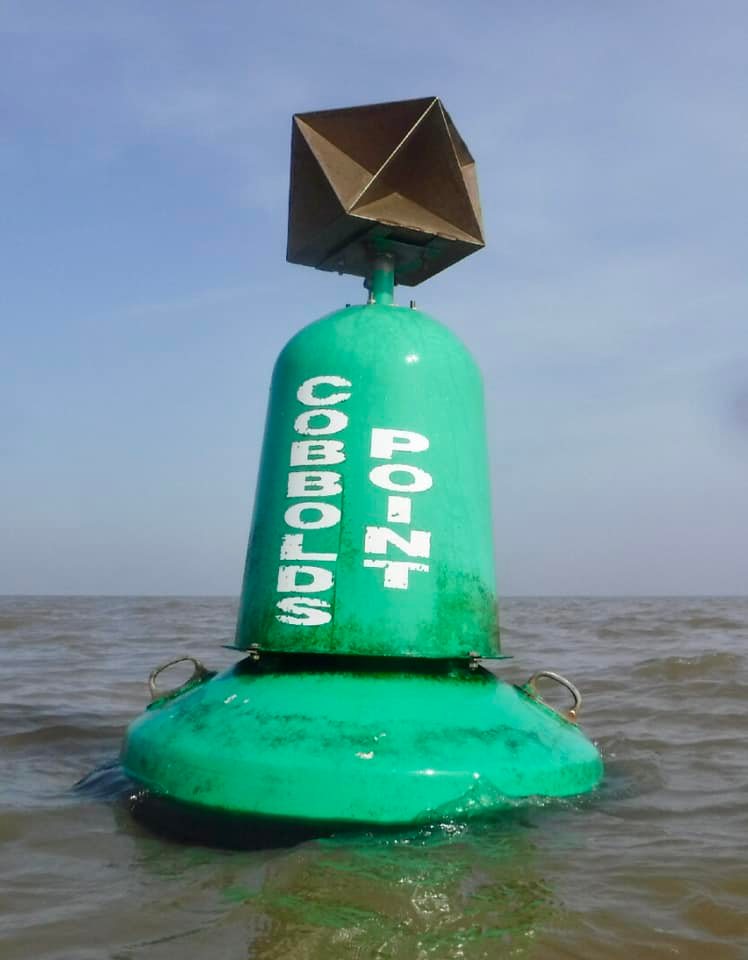
The small, seasonal Cobbolds Point buoy dates from the late 1990s is significant only for small vessels and, recently, as a destination for swimmers.
Middleton Common
From a 1748 Kirby map it can be seen that, just to the south, Middleton Common extended several hundred yards out from the current shoreline between the point and the Spa area. Indeed, this was a sufficient area to be the site of the 1667 Dutch invasion. Further to the south ‘Eringo Roots’ are marked, these are Sea Holly so the area was perhaps similar to the current Landguard Point area.
Other Names
Cobbolds Point appears on a 1938 map but it has had various names; Felixstowe Ness, Felixstowe Spit, Felixstowe Point, Home Point and Cottage Point. The Cobbold connection comes from the nearby house, which belonged to Sir Samuel Fludyer, that the Cobbold family occupied. The nearby public house is named after Fludyer.
The ‘Cottage’
Before this, the house had been a fishmonger’s cottage which Lieutenant-Governor Philip Thicknesse the Commanding Officer of Landguard Fort bought and developed. Of note is that he installed a Roman arch taken from the nearby Walton Castle ruins. There is more history of the house here. Thicknesse was a very interesting character and wrote three volumes of memoirs1See Memoirs and Anecdotes of Philip Thicknesse .
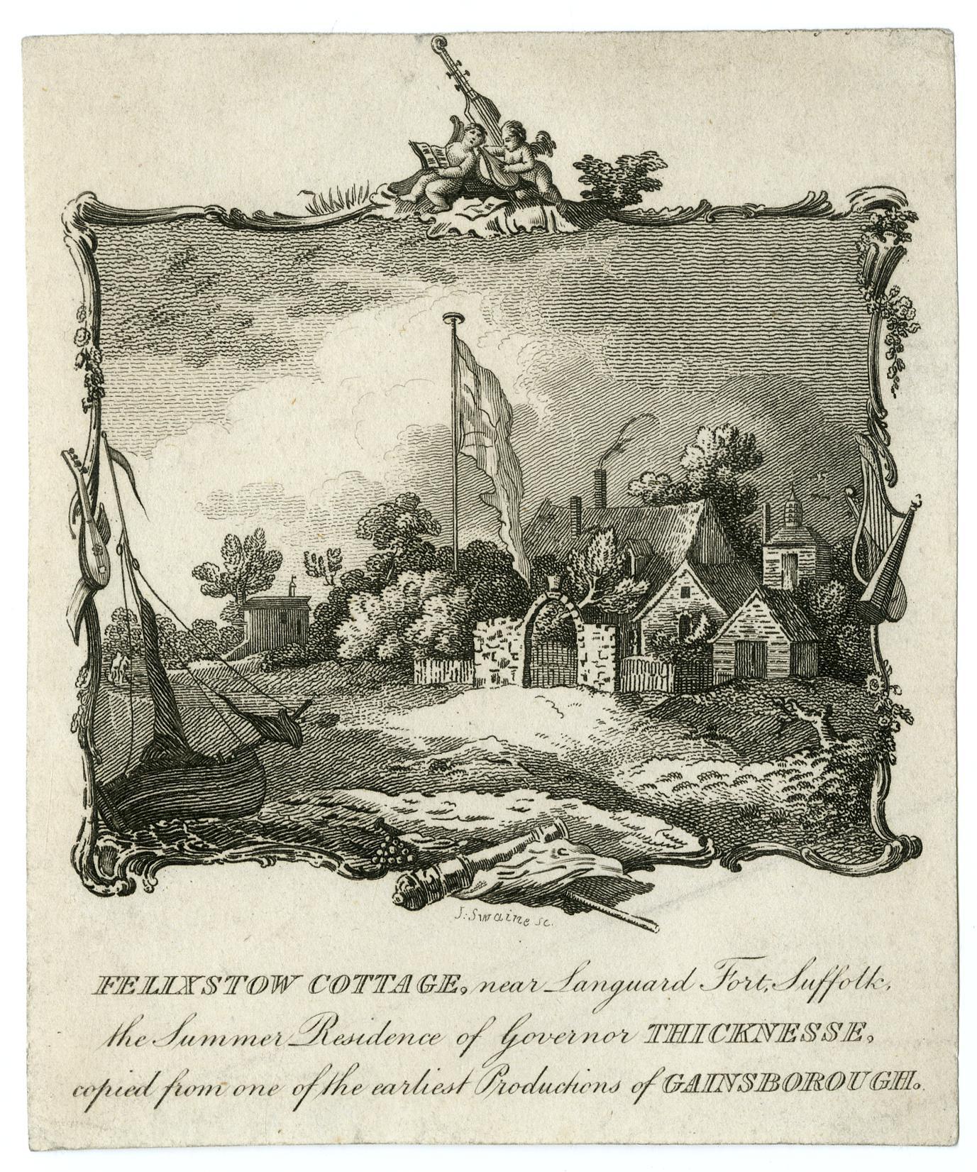
The gardens of the house demonstrated the extent of coastal erosion since, in the 1844 White’s Directory21844 White’s Directory available online. we learn that, in 1800, the gardens extended 200 yards seawards yet, by 1844 the sea was only 20 yards from the house, a loss of 180 yards in four decades.
Cement Stone
The 1804 Spence Chart shows a rocky shoreline with outlying rocks (+) although there are no buoys as in 1845. The cement stone industry did not start until the 1820s.
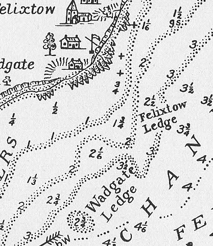
The mining had serious consequences as described in the 1869 Pilot.
… several large and handsome villas are near the water’s edge. The sea has made great ravages on this shore, and the remains of an old castle which formerly stood upon the cliff are occasionally uncovered at low water. This evil was increased by the partial removal of a massive ledge of cement stone from the frontage which had served the purpose of a breakwater, besides which, its removal permitted the unobstructed passage of shingle to the south-westward, to the great detriment of Harwich harbour. Several small buoys mark the outer limits of the remains of the ledge.
1869 Pilot Extract 3North Sea Pilot: Comprising the East Coast of England, from Berwick to North Foreland, Including the Rivers Thames and Medway. Part III. Hydrographic Office, Admiralty, 1869.
Measures to remedy this had been initiated by Captain Washington. The marker buoys were still there in 1892:
Felixstowe looks especially pretty this morning in the mid-day sun, the roofs of its many villas peeping out of their neat shrubberies and gardens, and dotting the slopes of the hill behind. Off the point there lies a nasty ledge of rocks, but they are securely walled in from any vessels which may be anxious to knock against them by a perfect fence of buoys. There are nine of them in rather less than a mile. We thought they took great care of the Maplin Sands, and it seemed difficult to get between any of the buoys thereabouts, but here—why it is a hedge, a park paling, a perfect wall. Passing this point we soon see the buoys marking Bawdsey Haven, as the entrance to the Woodbridge or Deben River is called.
1892 Frank Cowper 4Cowper, Frank, L. Upcott Gill, and A Bradley. Sailing Tours : The Yachtsman’s Guide to the Sailing Waters of the English Coast. Part 1, The Coasts of Essex and Suffolk, Containing Descriptions of Every Creek from the Thames to Aldborough. L. Upcott Gill, 1892.
Old Pier
These 1890 photographs show the rocky nature of the point and, what is presumably, the Old Pier just north of the Fludyers (Note Martello R is visible but now covered by the Bartlett). It is unclear what function the pier had although it seems to be in the same place as the sewer pipe.
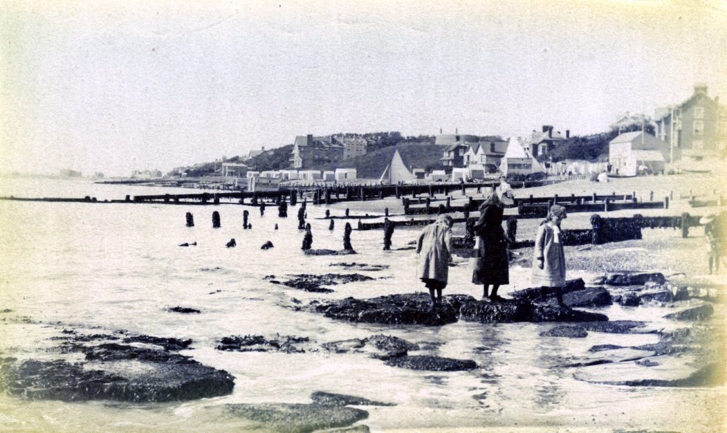
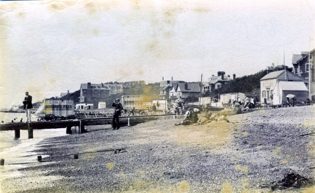
In 1948 the sewage outlet, visible in the 1949 photograph below, was marked by a Black/Yellow buoy and in 1984 a BWVS buoy is shown although this is further out to sea and south than the present Cobbolds Point buoy. Thankfully the pipe is now a mere stump and not used for effluent.
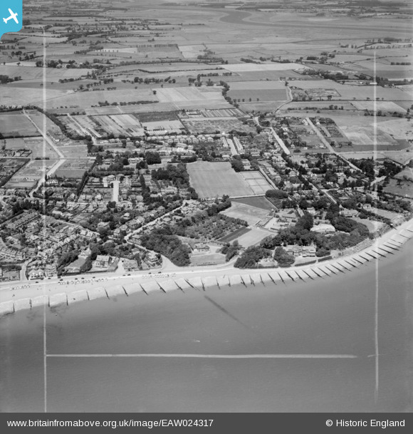
1949. Cobbolds Point and environs, Felixstowe Britain From Above
Notes
Previous names of the point:
- 1555 WCR Felixstowe Ness
- 1804 Spence chart shows no name but signal staff – also shown on 1815 Arrowsmith.
- 1829 Chart Felixstowe Spit
- 1838 OS Cottage Point
- 1879 OS 25″ shows “Cottage Point” and the old pier as it did in 1905.
Footnotes
- 1
- 2
- 3North Sea Pilot: Comprising the East Coast of England, from Berwick to North Foreland, Including the Rivers Thames and Medway. Part III. Hydrographic Office, Admiralty, 1869.
- 4Cowper, Frank, L. Upcott Gill, and A Bradley. Sailing Tours : The Yachtsman’s Guide to the Sailing Waters of the English Coast. Part 1, The Coasts of Essex and Suffolk, Containing Descriptions of Every Creek from the Thames to Aldborough. L. Upcott Gill, 1892.
Image Sources and Credits
Image Credits and Sources
- 2022-Cobbolds-Nigel-Seary: Nigel Seary 2021
- Felixstowe-Cottage: © The Trustees of the British Museum | CC BY 4.0 International
- 1804 Spence Chart extract Felixstowe Ledge: History of Harwich Harbour by H C Jones
- 1890-Ledge-ex-FB: Rural East Suffolk in Old Photographs FB Group
- 1890-Old-Pier-ex-FB: Rural East Suffolk in Old Photographs FB Group
- Britain From Above EAW024317 Felixstowe Cobbolds Point 1949: Britain From Above
- 1
- 2
- 3North Sea Pilot: Comprising the East Coast of England, from Berwick to North Foreland, Including the Rivers Thames and Medway. Part III. Hydrographic Office, Admiralty, 1869.
- 4Cowper, Frank, L. Upcott Gill, and A Bradley. Sailing Tours : The Yachtsman’s Guide to the Sailing Waters of the English Coast. Part 1, The Coasts of Essex and Suffolk, Containing Descriptions of Every Creek from the Thames to Aldborough. L. Upcott Gill, 1892.
Image Credits and Sources
- 2022-Cobbolds-Nigel-Seary: Nigel Seary 2021
- Felixstowe-Cottage: © The Trustees of the British Museum | CC BY 4.0 International
- 1804 Spence Chart extract Felixstowe Ledge: History of Harwich Harbour by H C Jones
- 1890-Ledge-ex-FB: Rural East Suffolk in Old Photographs FB Group
- 1890-Old-Pier-ex-FB: Rural East Suffolk in Old Photographs FB Group
- Britain From Above EAW024317 Felixstowe Cobbolds Point 1949: Britain From Above
