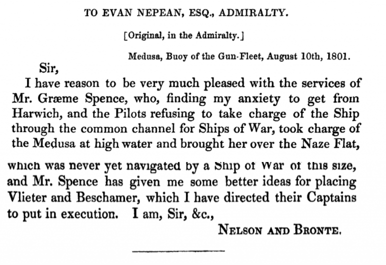
The Admiralty, in 1797, engaged Graeme Spence (1758- 1812) to survey from the Swin northward along the coasts of Essex and Suffolk and, by 1801, he had covered the Harwich area. In that year he guided Nelson and HMS Medusa to sea. Being the man who knew the waters best, Spence either volunteered or was volunteered, to pilot Medusa out to the head of the Gunfleet and was successful. A grateful Nelson commended him:

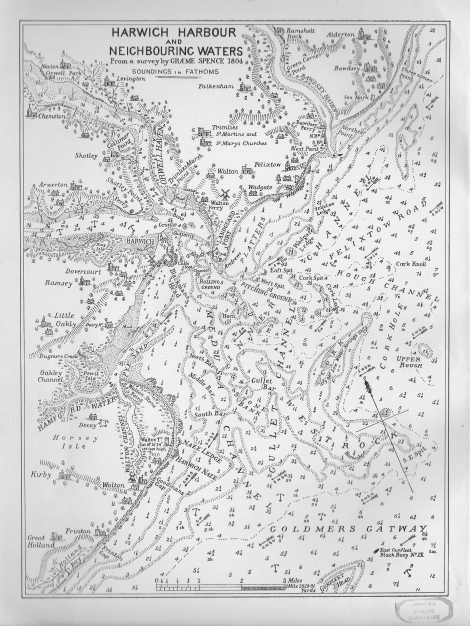
The very shallow channel had already been described so it was not Spence’s discovery, but it was his detailed knowledge that made the passage possible. It was first named on his own 1804 chart. He had previously shown his value as a pilot by saving the frigate Pegasus from shipwreck on the Scillies in 1790. Spence retired from active hydrography in 1803, young at forty-two, but continued working on sailing directions for his earlier work until his death in 1812. He remained a civilian despite spending his career either with the Royal Navy and, for a period, with Trinity House.

Notes on 1804 Graeme Spence Harwich Chart.
George Thomas Esq (Master R.N.) succeeded Spence in 1810 and made several surveys in the North Sea as well as in Scotland.
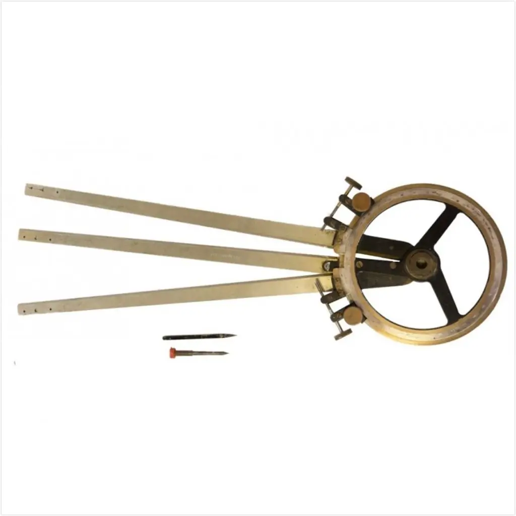
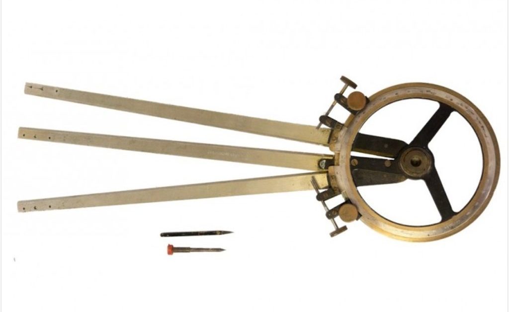
Spence is credited with the invention of the Station Pointer although it was probably developed by his Great uncle, Murdoch MacKenzie1More on Murdoch Mackenzie senior. and then refined by Spence and his uncle, also Murdoch MacKenzie2See Marine Surveying in Britain during the Seventeenth and Eighteenth Centuries, A. H. W. Robinson, The Geographical Journal, Vol. 123, No. 4 (Dec. 1957), pp. 449-45 . MacKenzie may well have developed his instrument from an original by Captain John Campbell3THE ORIGINS OF THE STATION POINTER by Susanna Fisher . The practice of Hydrographic Surveying was established by Murdoch Mackenzie Senior in: ‘A treatise of maritim surveying, in two parts: with a prefatory essay on draughts and surveys by Mckenzie, Murdoch, -1797‘. Spence would develop the techniques using his new tools. The first chart produced using this new, accurate, instrument was the north coast of Kent and was a major advance in detail and accuracy.

As well as the use of the Station Pointer the development of the Double Sextant was also one of Spence’s achievements, which together with Halley’s technique of “Resection” transformed the quality of surveys4The Nautical Magazine and Naval Chronicle 1842 p316 5Robinson, A.. “The Evolution of the English Nautical Chart.” Journal of Navigation 5 (1952): 362-374. 6Double sextant, see The British Sea Chart by John Blake 7This may have been invented by Huddart, see William Wallace’s chorograph (1839): a rare mathematical instrument by Alex D D Craik . In a few years, the Station Pointer was destined to become an indispensable part of every hydrographic surveyor’s equipment.
The ground was now prepared for the great task of charting the world which the newly founded Hydrographic Office was called upon to do during the nineteenth century.
Robinson, A. H. W. ‘Marine Surveying in Britain during the Seventeenth and Eighteenth Centuries8Robinson, A. H. W. ‘Marine Surveying in Britain during the Seventeenth and Eighteenth Centuries. The Geographical Journal 123, no. 4 (1957): 449–56. . – Robinson, A. H. W..
Notes
Questions
More research needed on the Double Sextant.
A strange co-incidence is that on the 1736 Kirby map a G.Thomas Esq. is shown at Ramsholt, too early to be this one. Was he related?
Sources
Dawson, L. S. (Llewellyn Styles). Memoirs of Hydrography [ : Including Brief Biographies of the Principal Officers Who Have Served in H.M. Naval Surveying Service between the Years 1750 and 1885. Eastbourne [England?] : H.W. Keay, 1885.
Footnotes
- 1More on Murdoch Mackenzie senior.
- 2See Marine Surveying in Britain during the Seventeenth and Eighteenth Centuries, A. H. W. Robinson, The Geographical Journal, Vol. 123, No. 4 (Dec. 1957), pp. 449-45
- 3THE ORIGINS OF THE STATION POINTER by Susanna Fisher
- 4
- 5
- 6Double sextant, see The British Sea Chart by John Blake
- 7This may have been invented by Huddart, see William Wallace’s chorograph (1839): a rare mathematical instrument by Alex D D Craik
- 8Robinson, A. H. W. ‘Marine Surveying in Britain during the Seventeenth and Eighteenth Centuries. The Geographical Journal 123, no. 4 (1957): 449–56.
Image Sources and Credits
Image Credits and Sources
- text-letter-description-automatically-generated: Google Books
- 1804-Spence-Chart-from-H-C-Jones: 1804 Harwich Harbour by Graeme Spence (Believed to be Public Domain)
- Station-Pointer: hydrography.pro
- 1More on Murdoch Mackenzie senior.
- 2See Marine Surveying in Britain during the Seventeenth and Eighteenth Centuries, A. H. W. Robinson, The Geographical Journal, Vol. 123, No. 4 (Dec. 1957), pp. 449-45
- 3THE ORIGINS OF THE STATION POINTER by Susanna Fisher
- 4
- 5
- 6Double sextant, see The British Sea Chart by John Blake
- 7This may have been invented by Huddart, see William Wallace’s chorograph (1839): a rare mathematical instrument by Alex D D Craik
- 8Robinson, A. H. W. ‘Marine Surveying in Britain during the Seventeenth and Eighteenth Centuries. The Geographical Journal 123, no. 4 (1957): 449–56.
Image Credits and Sources
- text-letter-description-automatically-generated: Google Books
- 1804-Spence-Chart-from-H-C-Jones: 1804 Harwich Harbour by Graeme Spence (Believed to be Public Domain)
- Station-Pointer: hydrography.pro
