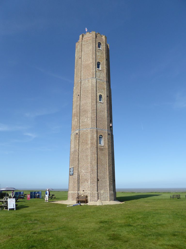
Trinity House erected the Naze Tower in 1720 as a sea mark for shipping1Tower Website : at 49m above Mean High Water Springs it is visible from well offshore. Washington’s 1852 Chart gives a transit of “Walton Hall north of the Tower” to clear Longsand Head (about 14NM out) and come through Goldmer’s Gat clearing the head of the Long Sand and the Gunfleet.

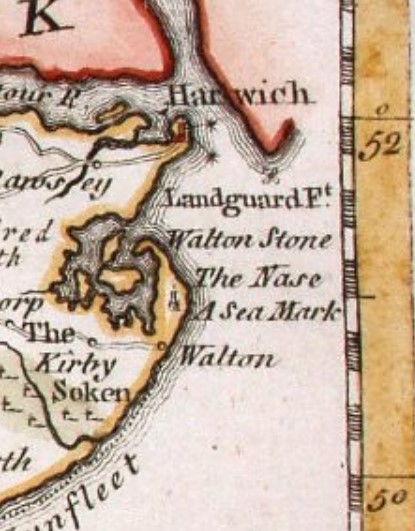
The tower appears on the 1759 Bowen Essex map.

There is mention of an earlier sea-mark but it is not mentioned in 1693 Greenvile Collins The Coasting Pilot:
Being over the Spits into the Wallet, steer away for the Naze, which may be known by the Trees, and a House that standeth on it; keep about half a mile, or a mile of from the Naze, to avoid the Stone Bank which hath but five foot water at low-water on it, and lyeth from the Naze Trees east by north about a mile and a half from the Naze Point;
Greenvile Collins
There were many Walton Halls, but this one remains, just west of the Tower. If there was ever an older beacon in the area it may have been further out to sea due to coastal erosion. The Naze very probably extended at least to the West Rocks in Roman times.
During World War Two the Tower was host to a Chain Home Low (CHL) RADAR array2Also See Early WW2 Radar Stations in Essex. | Times of war | Wickford Community Archive (wickfordhistory.org.uk) and RADAR at The Naze Tower – Signals.
Footnotes
Image Sources and Credits
Image Credits and Sources
- The Naze Tower, Walton-on the Naze By John Constable: Attributed to John Constable, Public domain, via Wikimedia Commons | Public Domain Mark 1.0
- 1
- 2
Image Credits and Sources
- The Naze Tower, Walton-on the Naze By John Constable: Attributed to John Constable, Public domain, via Wikimedia Commons | Public Domain Mark 1.0
