The Oriana Buoy
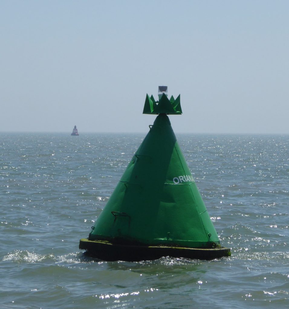
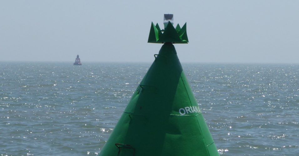
This Starboard Hand Mark with the legend ‘Oriana’ opposite Wallet No.4 should logically be Wallet No.1: oddly, it is un-named on charts. The buoy has been in position for some years, the photograph below shows the buoy in 2021. Note the elaborate topmark, it is clearly a vintage piece. Oriana and Medusa are the only known buoys in the area with female names.

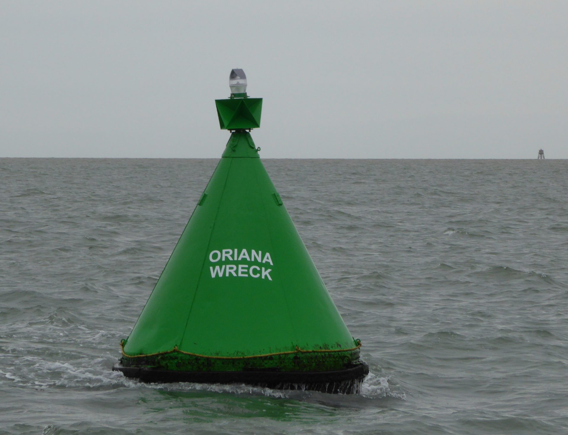
A visit in 2023 found the buoy re-painted and bearing the legend ‘Oriana Wreck’ with a modified topmark and grab-line at the base:

Wreck at this site
There is a wreck charted next to the buoy, and, according to the chart, it is swept to 2.7m CD on a seabed of around 11m so could have been sizable. The Admiralty Wreck database records this wreck as ID 14452 and HMS Oriana. The only shipwreck in the area of a vessel named Oriana was not in this location.
This old-style buoy is of the shape and colour of pre-IALA wreck buoys. Nowadays, the modern Yellow/Blue IALA style wreck buoys are deployed by THV Alert when required1 Wreck Marking buoys | Trinity House., this buoy is, of course, a starboard hand mark and not a wreck buoy.
The wreck is shown on the 1948 chart and, on the 1954 update is described as having masts showing so was quite likely a casualty of war. The Oriana’s masts were insubstantial and would barely be tall enough to reach from the seabed. No wreck in that position is shown on the 1945 Kriegsmarine Chart which was presumably reliable up to 1939 or so. There is a website for HMS Wildfire which shows no WW2 wreck at the site so probably the wreck occurred between 1939 and 1948: it may be on the 1943 Harwich to Ramsgate Chart but this is small scale.

United Kingdom Hydrographic Office, Public domain, via Wikimedia Commons( Depths in Fathoms)
A survey on 28 September 2023 failed to find a prominent object. The magenta rectangle is 20m by 5m, small for a wreck (Oriana was 35m by 4m). Whilst erratic the survey should have detected something if the wreck was near the indicated site: it may, of course, be some distance away if the marked position is that surveyed in the 1940s.

The Loss of the Oriana
The Royal Navy steam tug ST Oriana was towing a much-needed minesweeper from the Medway to Brightlingsea in January 1948 and at 2 p.m. was at the entrance to the Blackwater, near the Knoll buoy. According to the crew of her companion, the tug Vagrant, there was a tremendous explosion which lifted Oriana into the air and then she immediately sank. Fourteen men and a boy were lost2Accounts of sinking from newspapers..
Vagrant remained to mark the site but after a search by vessels dispatched to the scene, no survivors were found. Subsequently, divers were sent to investigate the wreck but it is unclear what, if anything, they found.
Oriana was 116 ft 0 in (35.36 m) long, with a beam of 27 feet 6 inches (8.38 m). She had a depth of 12 feet 7 inches (3.84 m) and a draught of 13 feet 6 inches (4.11 m). She was assessed at 295 GRT,3ST Oriana – Wikipedia
Mines at Large
The cause of the explosion was almost certainly a stray German mine. The Admiralty had cleared all of the British mines from our waters. It had been agreed that the mines on the Eastern coast of the North Sea would be cleared by the Kriegsmarine. However, the occupying forces had not permitted the German minesweepers to go to sea, thus leaving the mines in place. Winter storms had most probably caused this mine to drift across to the Essex coast. Lloyds of London reported that, over the previous year, eight-four vessels had been sunk by mines.
Empire Ships
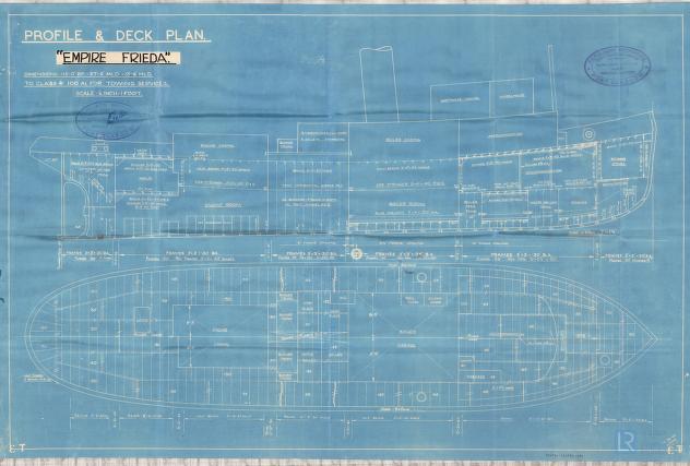
The SS Empire Frieda of 265GRT was built in 1946 by Ferguson Brothers of Glasgow. Thousands of ‘Empire’ ships of all types were built or acquired to supplement the U.K.’s Merchant Fleet during and after World War Two4Empire ship – Wikipedia. SS Empire Frieda was transferred to the Royal Navy in 1947 and re-named ST Oriana5ST Oriana – Wikipedia.

Buoy in the wrong place or wrong wreck?
ST Oriana is the only ship of that name known to have sunk in the vicinity of the Wallet. The Knoll buoy, near where the Oriana exploded, is about 2M northwest of the Swin Spitway and is along the route from the Medway to Brightlingsea.
The location of the Oriana buoy in the Wallet is not where Oriana sank, but about 9M to the northeast of the explosion site. So where is the wreck of Oriana? There are three wrecks in the Knoll area although, given the size of the explosion, there may have been little left.
There is a wreck marked by the Oriana buoy, which according to differences in charts sank sometime in the 1940s, so which wreck is that?
Questions
Sources conflict on location: Wallet, Brightlingsea, Knoll.
- Published: Tuesday 20 January 1948
Newspaper:Essex Newsman - SIXTEEN LOST OFF BRIGHTLINGSEA- SIXTEEN seamen were lost off Brightlingsea yesterday when their tug Oriana blew up. It is thought to have collided with a stray mine.
Why has Trinty House marked this wreck in this way?
Footnotes
Image Sources and Credits
Image Credits and Sources
- Admiralty_Chart_No_1975_Kentish_Knock_and_the_Naze_to_The_Nore_Published_1934-Extract: Admiralty_Chart_No_1975_Kentish_Knock_and_the_Naze_to_The_Nore,_Published_1934
- SS-Empire-Freida: Lloyd's Register Foundation
- 1
- 2
- 3ST Oriana – Wikipedia
- 4
- 5
Image Credits and Sources
- Admiralty_Chart_No_1975_Kentish_Knock_and_the_Naze_to_The_Nore_Published_1934-Extract: Admiralty_Chart_No_1975_Kentish_Knock_and_the_Naze_to_The_Nore,_Published_1934
- SS-Empire-Freida: Lloyd's Register Foundation
