As one sails past Dunwich these days, there is little to see and no reason to come near to land. In any case, the direct course to the next headland will be offshore just inside, or over, Dunwich Bank. As a reader of wooden navy fiction, it was the Jack Stannard trilogy1The Jack Stannard Trilogy starts with Destiny’s Tide’. https://jddavies.com/book/destinys-tide/. This mentions the “Kingsholme” and “Dain’s Quay” both now subsumed. Highly recommended. that prompted a look at the late medieval City.
Dunwich must have been impressive in the twelfth century, it was reported to be harder to attack than Walton Castle:
Leicester first, it is recorded, proposed to make a landing at Dunwich, the capture of which would have provided him with an excellent base from which to conduct further operations ; …” the strength thereof, it was terror and feare unto him to behould it, and soe retyred both he and his people.”
At Walton he met with a friendly welcome from the rebel Earl Bigod, whose castle commanded the ancient Wadgate Haven…
Dutt, W.A. THE NORFOLK AND SUFFOLK COAST
The city was similar to London in size in the fourteenth century and one of the ten largest towns in England at the Norman Conquest when the shoreline was around 1200m further east. It may also have been important in Roman times, as it was in Saxon, although the evidence is submerged. In that era, Dunwich Bank might have been part of the mainland. Surely Dunwich would have been a site for one of the Roman Saxon Shore forts and a lighthouse given its position?2Roman era documentary evidence for the Walton fort is sketchy and it clearly existed so why not one at Dunwich?
Apparently, before the destructive storms of the fourteenth century, there was a Dunwich Haven with a capacity of fifty or more ships which was also the access to the sea for Southwold and Blythburgh.3Dunwich Haven – Southwold and Its Vicinity, Ancient and Modern By Robert Wake · 1839 pp292
The storms in the fourteenth century also caused the erosion of Easton Ness, which gave shelter from north-easterly storms: this must have been a critical factor in the demise of Dunwich and ports to the south at Orford and Goseford.

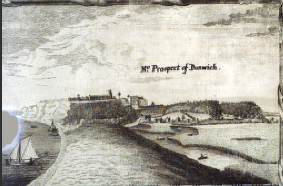
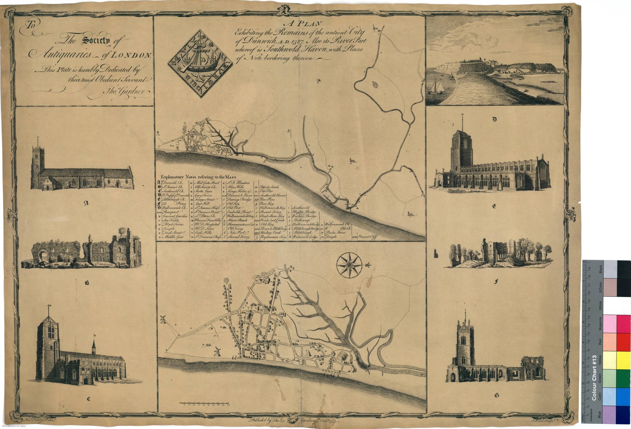
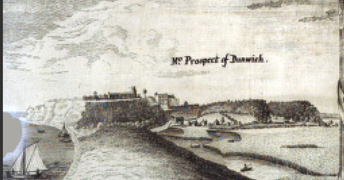
The drawing4Prospect of Dunwich from Gardner, Thomas. An Historical Account of Dunwich, Antiently a City, Now a Borough;: Blithburgh, Formerly a Town of Note, Now a Village; Southwold, Once a Village, Now a Town-Corporate; with Remarks on Some Places Contiguous Thereto … author, and sold, 1754. shows how, in the sixteenth century, Dunwich looked down from the cliff, although the cliff was, actually, only around forty feet high (13m). The area between the sea and the channel was known as the “Kingsholme”.5Drawing from: Thomas. An Historical Account of Dunwich, Antiently a City, Now a Borough;: Blithburgh, Formerly a Town of Note, Now a Village; Southwold, Once a Village, Now a Town-Corporate; with Remarks on Some Places Contiguous Thereto … author, and sold, 1754. Even then, the city had been retreating for centuries, there was once forest extending several miles southeast into, what is now, the sea. The map shows the extent of Dunwich at the time. It reveals several “old” quays and ferries showing adaptations already made.

Greenvile Collins’ Coasting Pilot, of the late seventeenth century, shows the coastal profile: Southwold was, by then, the larger town.
Dunwich , Walter-Swick and Sole, or Southwould go all in at one small Creek, and divides into three Branches. Dunwich on the south Branch, Sole on the north, and Walter-Swick in the middle. This is a Bar-Haven, where at high-water small Vessels go in; there is good Anchoring against these places from eight to twelve Fathom. South-would Church hath a high square Steeple, and standeth near the Sea-side, as you may see, in the makings of the Land numbred with the Letter V. Sole-Creek lyeth four Leagues from Orford-Ness north by east.
GREAT BRITAIN’s COASTING-PILOT. The SECOND PART.

Daniel Defoe writing around 1725 notes the navigational hazard caused by the long gone, ruined, city beneath the sea.6‘Vision of Britain | The Travels of Daniel Defoe | Full Text plus Mapping’. https://www.visionofbritain.org.uk/travellers/Defoe. and memory of the old entrance:
It is remarkable, that this town is now so much washed away by the sea, that what little trade they have, is carry’ d on by Walderswick, a little town near Swole, the vessels coming in there because the mines of Dunwich make the shore there unsafe and uneasie to the boats; from whence the northern coasting seamen a rude verse of their own using, and I suppose of their own making; as follows,
“Swoul And Dunwich, and Walderswick,
Daniel Defoe
All go in at one lousie creek.”
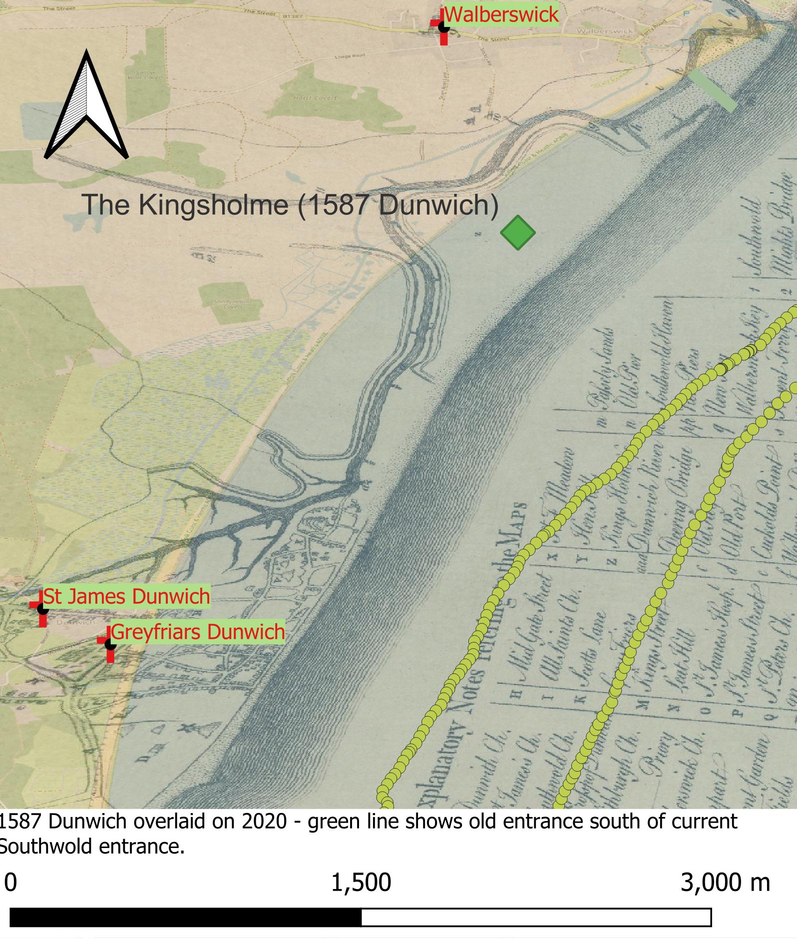
The image below shows the 1587 Remains of the antient City of Dunwich map overlaid on OpenStreetMap. It is not dimensionally accurate so does not fit perfectly; however, it gives an idea of how far the town extended into the sea. A thorough academic study7 Project Final Report – very thorough. ‘Dunwich, Suffolk: Mapping and Assessing the Inundated Medieval Town | Historic England’, 9 March 2013. describes the loss of around 500m of land since the date of the map, which is consistent with the overlay. As an illustration, this would be equivalent to the seafront at Felixstowe moving to the top of the Triangle on Hamilton Road. Clearly, this loss was in addition to a probably even greater loss of land in the first half of the Millenium.

The yellow dots show the track of a previous sailing trip. An imaginary diversion might be made on a future trip over the Passley Sands, into Defoe’s ‘lousie creek‘ to the New Port, turning to port, then up Horse Reach, past Walberswick Quay and then, along the Dunwich River keeping to port at Cuckold’s Point with the King’s Holm to the east, eventually berthing at the Old Quay below Hen Hills. It would, of course, be easier to turn to starboard and berth at Southwold which would have contributed to the decline of one and growth of the other.
Sources for further enquiry are given below. The Dunwich Project Report is thorough with many diagrams.
1587 Remains of the antient City of Dunwich
Sources
1754 An Historical Account of Dunwich, Antiently a City, Now a Borough, See pp39- for port. Also covers Southwold etc.
Southwold and Its Vicinity, Ancient and Modern By Robert Wake · 1839 Dunwich from pp285
Good write up on Dunwich, also has a storms database and some old maps (too small to be useful). Storms in 1286,1287,1328,1347,1362.
An Historical Account of Dunwich, Antiently a City, Now a Borough
BBC Radio 3 programme on Dunwich 1992 45 mins
Good description of the Geology including a sketch of the Kingsholme. THE SUFFOLK GEOCOAST DUNWICH: SUFFOLK’S LOST CITY
Dunwich Project Final Report – very thorough. ‘Dunwich, Suffolk: Mapping and Assessing the Inundated Medieval Town | Historic England’, 9 March 2013.
Excellent Gif showing changes in Sole Bay. from The Sea – Coastal erosion around Southwold (southwoldmuseum.org)

Footnotes
- 1The Jack Stannard Trilogy starts with Destiny’s Tide’. https://jddavies.com/book/destinys-tide/. This mentions the “Kingsholme” and “Dain’s Quay” both now subsumed. Highly recommended.
- 2Roman era documentary evidence for the Walton fort is sketchy and it clearly existed so why not one at Dunwich?
- 3Dunwich Haven – Southwold and Its Vicinity, Ancient and Modern By Robert Wake · 1839 pp292
- 4Prospect of Dunwich from Gardner, Thomas. An Historical Account of Dunwich, Antiently a City, Now a Borough;: Blithburgh, Formerly a Town of Note, Now a Village; Southwold, Once a Village, Now a Town-Corporate; with Remarks on Some Places Contiguous Thereto … author, and sold, 1754.
- 5Drawing from: Thomas. An Historical Account of Dunwich, Antiently a City, Now a Borough;: Blithburgh, Formerly a Town of Note, Now a Village; Southwold, Once a Village, Now a Town-Corporate; with Remarks on Some Places Contiguous Thereto … author, and sold, 1754.
- 6‘Vision of Britain | The Travels of Daniel Defoe | Full Text plus Mapping’. https://www.visionofbritain.org.uk/travellers/Defoe.
- 7Project Final Report – very thorough. ‘Dunwich, Suffolk: Mapping and Assessing the Inundated Medieval Town | Historic England’, 9 March 2013.
Image Credits and Sources
- : Drawing from: Thomas. An Historical Account of Dunwich, Antiently a City, Now a Borough; | Public Domain Mark 1.0
- : bnf.fr | CC0 1.0 Universal
