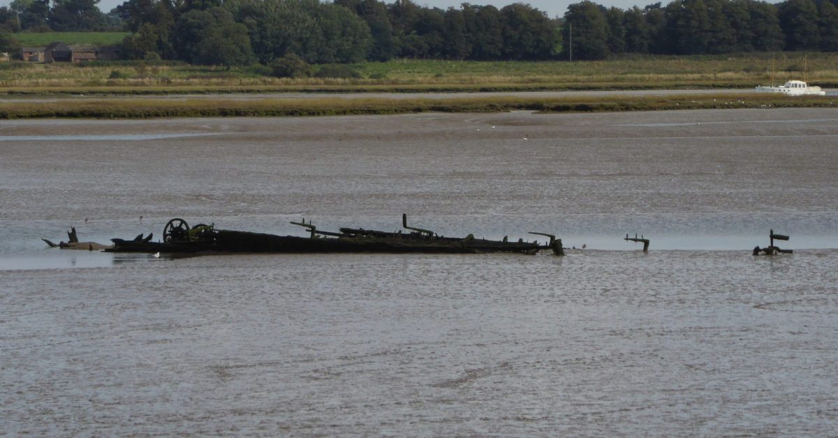
There is little activity at Kirton Creek nowadays. However, it was once the mouth of the Mill River and, after enclosure, boasted a brickworks. This was dependent upon barge transport which seemed quite challenging given the nature of the channel. A relic of that era is the hulk of a Thames Sailing Barge which is slowly being claimed by the mud.
The Creek
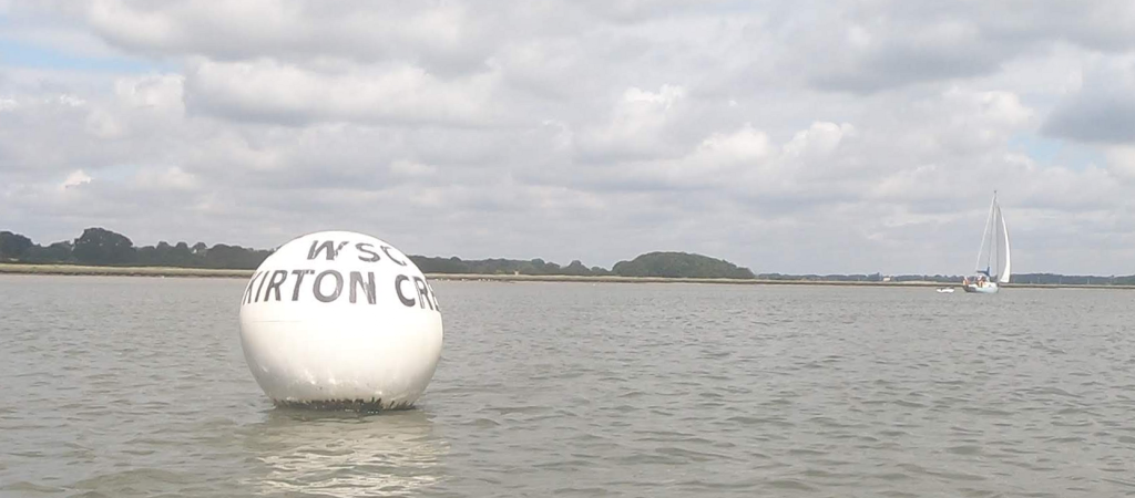
Kirton Creek is on the western side of Ramsholt Reach in the River Deben. The buoy is a Racing Mark and a little north of the creek itself.
From the land, a glance over the seawall by the sluice will show that the reclaimed land is below sea level. Before the seawalls were built, this was the Mill or Brightwell River, navigable at least to Newbourne. The creek, of course, only dates to the construction of the sea walls that closed off the Mill River. The image below is created from LIDAR data. The Mill River is to the west: what a pity we can no longer navigate it.

SB Three Sisters, the Hulk
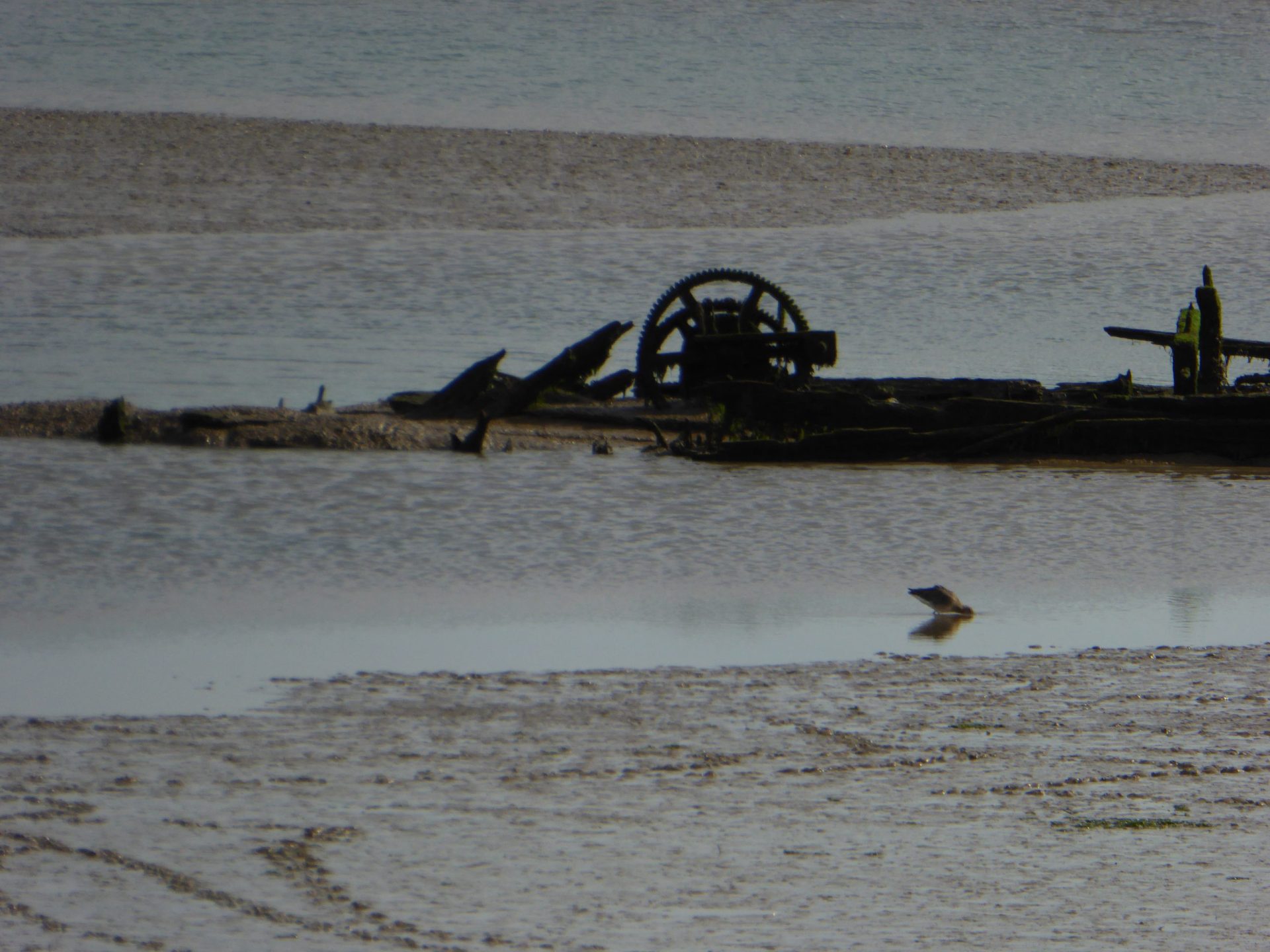
At most states of tide, the hulk of a barge is visible. This was the Thames sailing Barge Three Sisters1Three Sisters – Monument record HMY 008 – The Three Sisters of Maldon , abandoned here in December 1927, having brought sewage sludge from Ipswich to be spread on the fields2Three Sisters – Smith, R.W. (n.d.) The Thames Barge in Suffolk. , who could blame the crew, especially at that time of year? Maybe the owners (Fulchers since 1918)
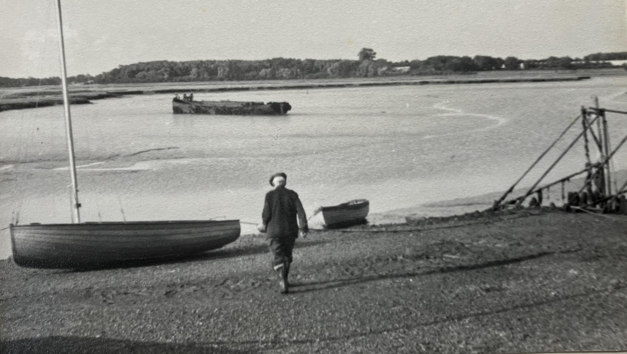
Three Sisters was built in 1865, dimensions were 72′ by 18′ with a draught of just under 5′3Barge details from – Chaffcutter Books. ‘The Thames Sailing Barge Compendium’. https://chaffcutterbooks.co.uk/product/the-thames-sailing-barge-compendium. The 1961 image shows around 5-6 feet of intact hull visible: so, after thirty-four years, she had survived well up to that time. The following photograph is from 2021, sixty years later and ninety-six years since abandonment. The barge would need 4.4m of tide to float over the mud to where she is now. As the height of the Spring tides is only 3.8m, the barge must have been unladen or drifted there on a surging tide, or perhaps the mud has increased. When will she be completely lost to mud? Will she last until 2050?
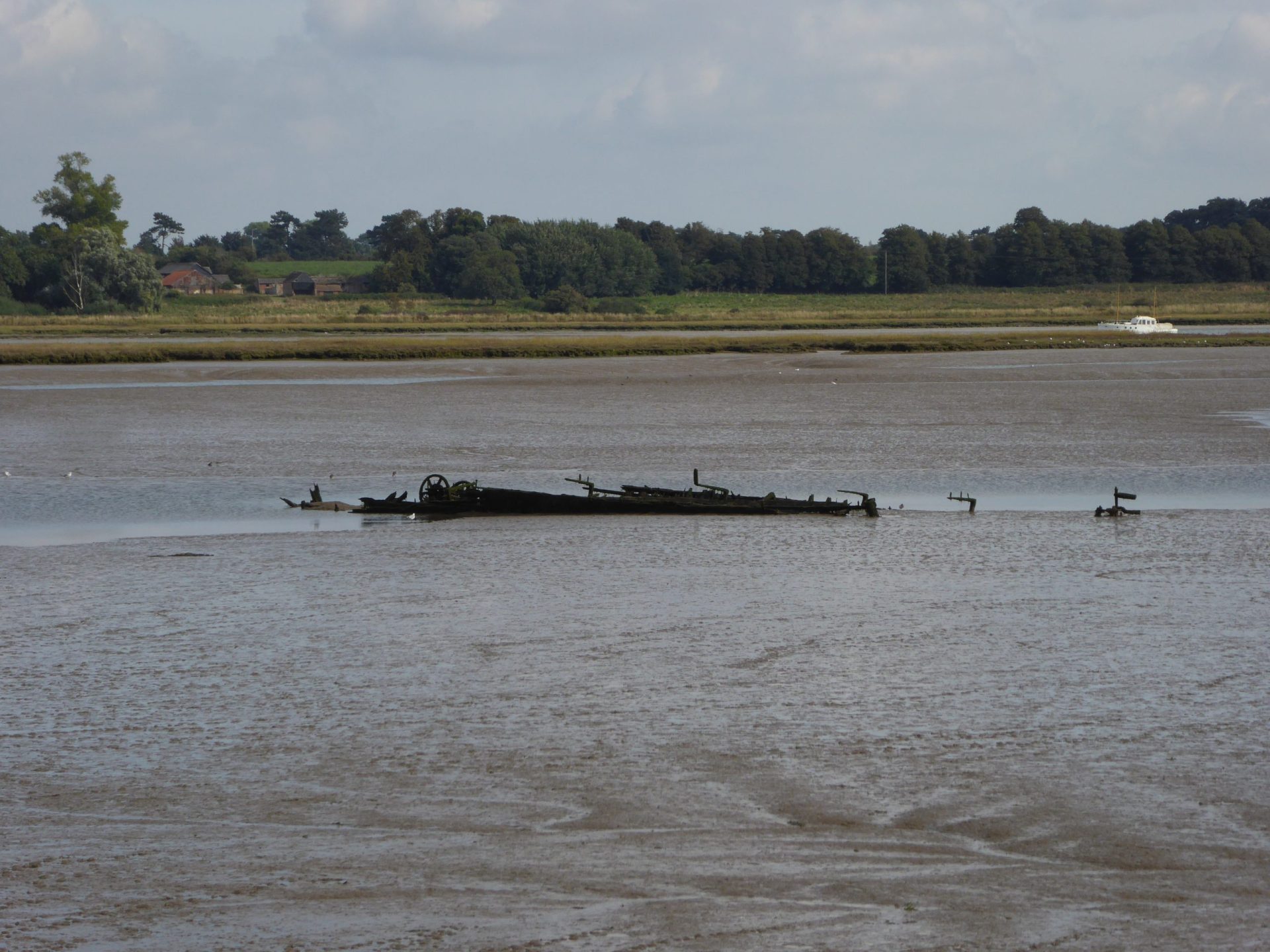
Expand for The Remains of SB Three Sisters
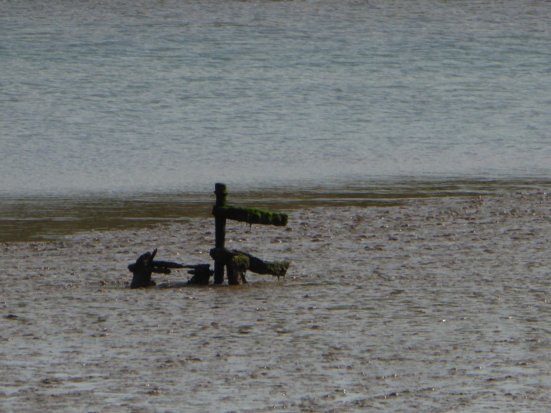
Trying to get close, Kirton Creek was visited by kayak in 2021. There was a narrow window of tidal height: there had to be about a foot (0.3m) of water over the mud so that the kayak would float but, as the wreck is only a couple of feet (0.6m) above it, the barge would quickly disappear as the tide rose. On arrival there was around 2.8m of tide showing that the barge is on mud which dries at about 2.6m so ceases to be visible at just over 3m of tide. With a draught of, say, 5 or 6 feet (1.8m) a barge would need 4.4m of tide to float over the mud to where it is now. As the height of the tide at Spring tides is only 3.8m, the barge must have been unladen with reduced draught or drifted there on a surge tide, or the mud has deepened.
The hulk, winch and rudderstock are still visible in the mud, but all is slowly sinking and, surely, will be gone in a few more decades. Three Sisters would have been originally tiller-steered.


The Dock
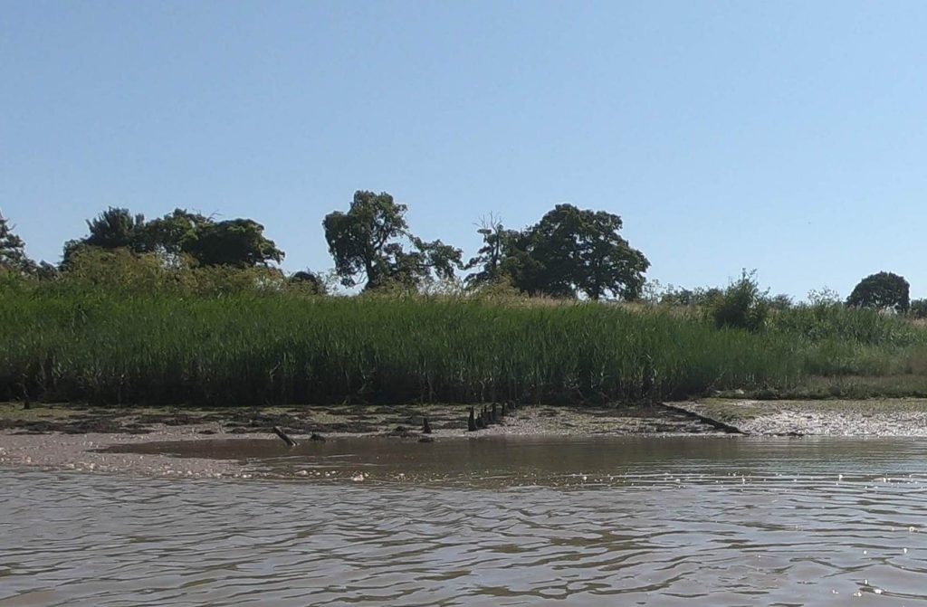
There are remains of a dock on the southwestern corner of the creek, near the site of a nineteenth-century brickwork of which nothing visible remains. Suffolk Heritage records the site4Brickworks – Monument record KIR 025 – Remains of a Post Medieval brickworks which is shown on the 1890s Ordnance Survey map. The dock5Dock – Monument record KIR 024 – Post Medieval landing pier obviously belonged to it. There were several brickworks in the area such as at Methersgate and Butley. One wonders why bricks would be made in such inaccessible places.
The above photograph was taken from the shore with a tidal height of about 1.6m, according to LIDAR data the area near the dock is 2.6m drying: given a 1.8m draught then about 4.4m of tide would be needed to settle next to the dock. Perhaps the mud has accumulated but it seems a close call6MHWS 2.9m, MHWN 3.3m – interpolated between Woodbridge and Woodbridge Haven.
As well as serving the brickwork the dock was also used by farms to ship out crops and bring in materials. In the early twentieth century one of these was sewage sludge from Ipswich, used as fertiliser. Three Sisters was delivering this on her final voyage.
Robert Simper gives an account of this dock:
“Back across the river at the head of Kirton Creek was Kirton Dock, built in 1880, for the local brickworks. From what is left of this dock it appears to have been part of the foreshore dug out and then given a hard bottom so that a barge could sit there, and horses and carts could come down beside the barge and load straight over the rail. Kirton Dock was last used by a farm barge in 1933 probably for carrying sugar beet to the Ipswich factory.”
Robert Simper 7Barge Wharves on the River Deben – RDA Part 1: Bawdsey Ferry up to Hemley Dock – extract
Navigating the Channel
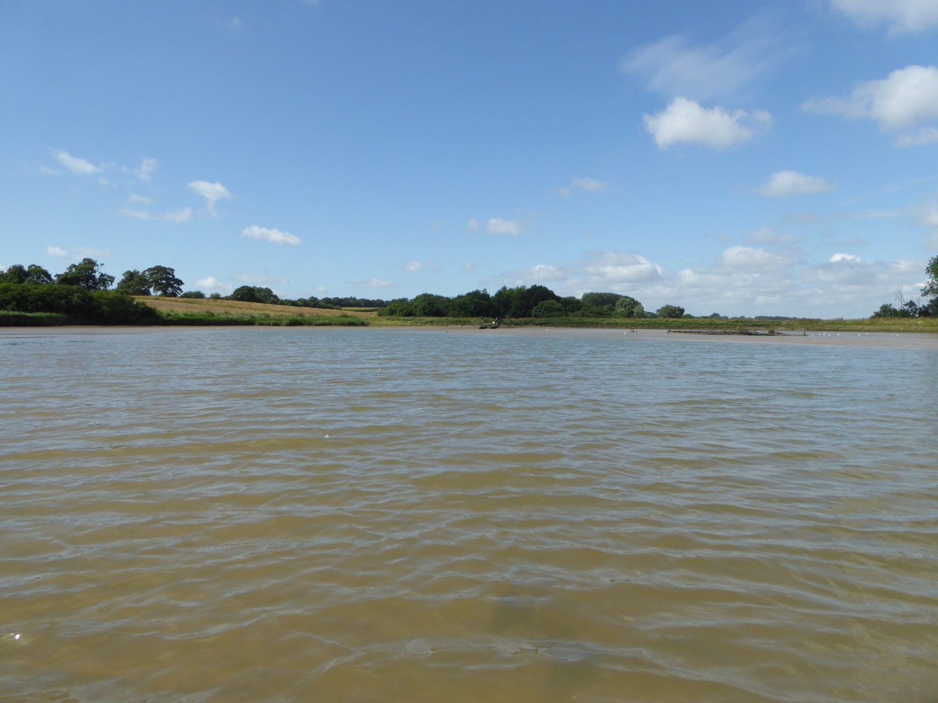
A kayak visit was made in 2021, at a lower tide level, so that the channel could be seen. At the entrance to the channel, there is a bar with a measured depth of about 0.5m to 1m drying. For a draught of 1.8m a tidal height of 2.5m would, therefore, be needed to enter the creek, so it could be entered even on a neap tide.
Once in the channel, there is more depth than at the bar so being afloat is not a problem. However, as the barge was 72 feet (22m) long, the difficulty lay in the contorted shape of the channel which is only about 6m – 10m wide and sinuous. Clearly, sailing was not an option.
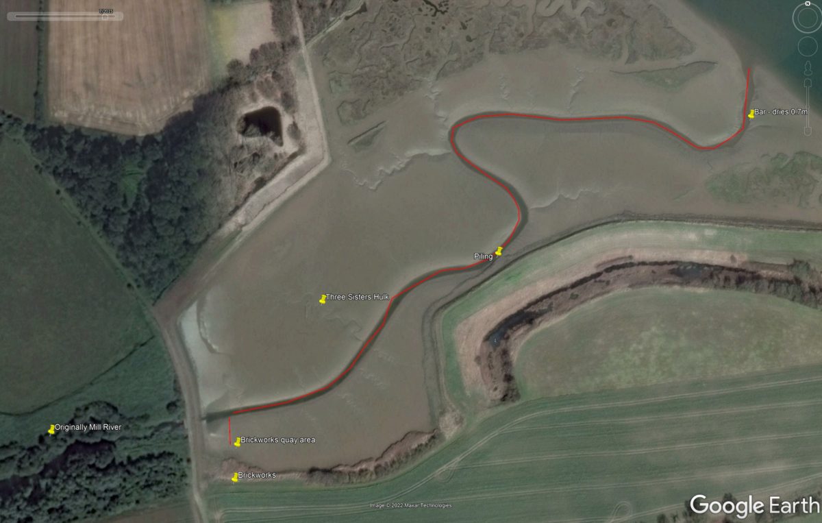
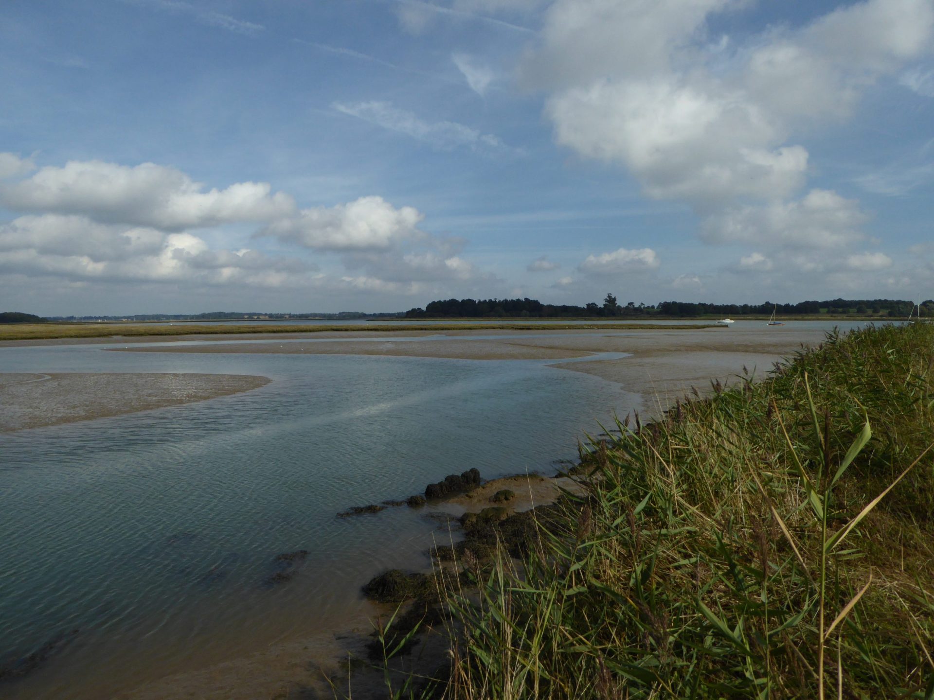
The banks of the channel dry to about 2.8m over Chart Datum so could, just about, still be visible on entry. Once the banks were covered the channel would be difficult to find, although withies could have been positioned. Most probably the barge would have to have been poled along the 700m of the channel, the tidal stream would help a little.
Posts halfway along Channel
There are piles or posts halfway along the narrow, torturous channel. This looks like a dock but must be part of the modern sea defences.
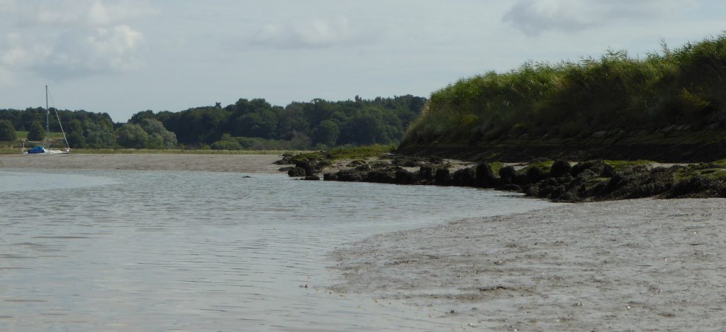
Once near the quay, the channel is about 20m away separated by a bank of mud (this may have deepened over the years) so a barge might need to wait for high water. There may just have been room to turn at high water or, if not, to pole out astern.
It was an interesting exercise to try and understand the navigation of this channel. Perhaps these notes may have some value when the hulk has disappeared under the mud.
Vessel Details
Name: Three Sisters, Official No.: 123686, Owner: Fulchers since 1918, Year built: 1874, Built at: Ipswich, Built by: , GRT: 42, Dimensions ft: NA,
Questions
Get a present-day image to match the 1961 photograph.
More on the brickworks?
Footnotes
There is an excellent writeup on the River Deben Site (pdf download) describing some memories and more on the history.
- 1Three Sisters – Monument record HMY 008 – The Three Sisters of Maldon
- 2Three Sisters – Smith, R.W. (n.d.) The Thames Barge in Suffolk.
- 3Barge details from – Chaffcutter Books. ‘The Thames Sailing Barge Compendium’. https://chaffcutterbooks.co.uk/product/the-thames-sailing-barge-compendium.
- 4
- 5
- 6MHWS 2.9m, MHWN 3.3m – interpolated between Woodbridge and Woodbridge Haven
- 7Barge Wharves on the River Deben – RDA Part 1: Bawdsey Ferry up to Hemley Dock – extract
Image Sources and Credits
Image Credits and Sources
- 1961-Kirton-Creek-Rural-East-Suffolk-In-Old-Photographs-Facebook-from-Sarah-Carr: Rural East Suffolk In Old Photographs Facebook from Sarah Carr
- Kirton Creek Google Earth 2015: Kirton Creek Google Earth 2015
- 1Three Sisters – Monument record HMY 008 – The Three Sisters of Maldon
- 2Three Sisters – Smith, R.W. (n.d.) The Thames Barge in Suffolk.
- 3Barge details from – Chaffcutter Books. ‘The Thames Sailing Barge Compendium’. https://chaffcutterbooks.co.uk/product/the-thames-sailing-barge-compendium.
- 4
- 5
- 6MHWS 2.9m, MHWN 3.3m – interpolated between Woodbridge and Woodbridge Haven
- 7Barge Wharves on the River Deben – RDA Part 1: Bawdsey Ferry up to Hemley Dock – extract
Image Credits and Sources
- 1961-Kirton-Creek-Rural-East-Suffolk-In-Old-Photographs-Facebook-from-Sarah-Carr: Rural East Suffolk In Old Photographs Facebook from Sarah Carr
- Kirton Creek Google Earth 2015: Kirton Creek Google Earth 2015
