Stone Bank first appears, as ‘Stone Banck’, on Greenvile Collins’ 1686 chart of the local coast. The Stone Bank buoy dates to 1821 and was perhaps positioned to assist the mining of Cement Stone which was an important industry at that time. In 1903 the buoy is RWVS with a cross 1East Coast Rivers – Meesum still in place in 1915 as:
“A can buoy, painted in red and white vertical stripes, marked ,Stone Bank’, and surmounted by a cage, …”21915 USNO England East Coast Pilot .
By 1945 on the Kriegsmarine Chart31945 Kreismarine chart at nls the buoy had changed to RW Chequered Can with a can topmark and is still the same in 196541965 East Coast Rivers . By 1965 Medusa was a lit, black cone, at that time SHMs were red or black cones and green would have marked a wreck. By 1977 it would have complied with the IALA system.

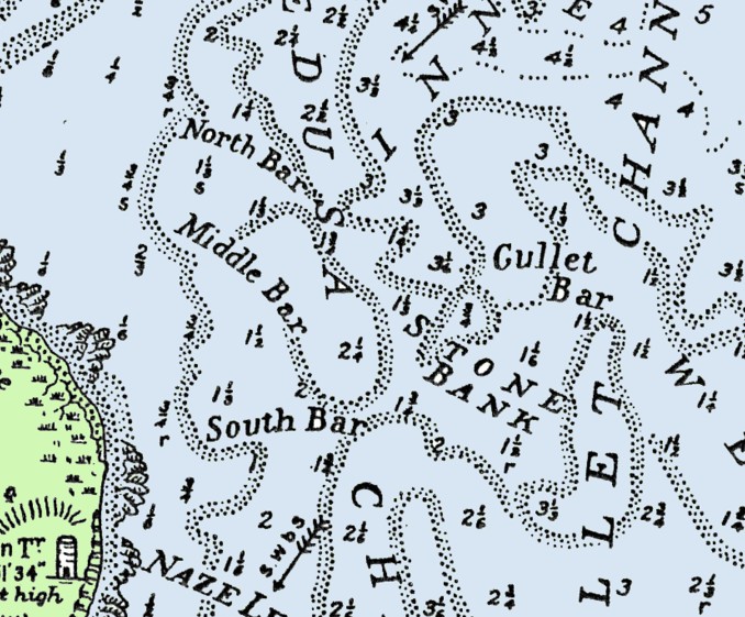
The bank appears on Graeme Spence’s 1804 Chart, note the bars and that no buoy is marked. The least depth is under 5′ or 1.5m (above the “T” in Stone) with 7′ to 8′ nearby. The buoy marks the shoal area at the centre of the Medusa Channel and is so named since it is, or was, covered with stones or rocks. It was the main obstacle in getting Nelson out to sea in 1801.
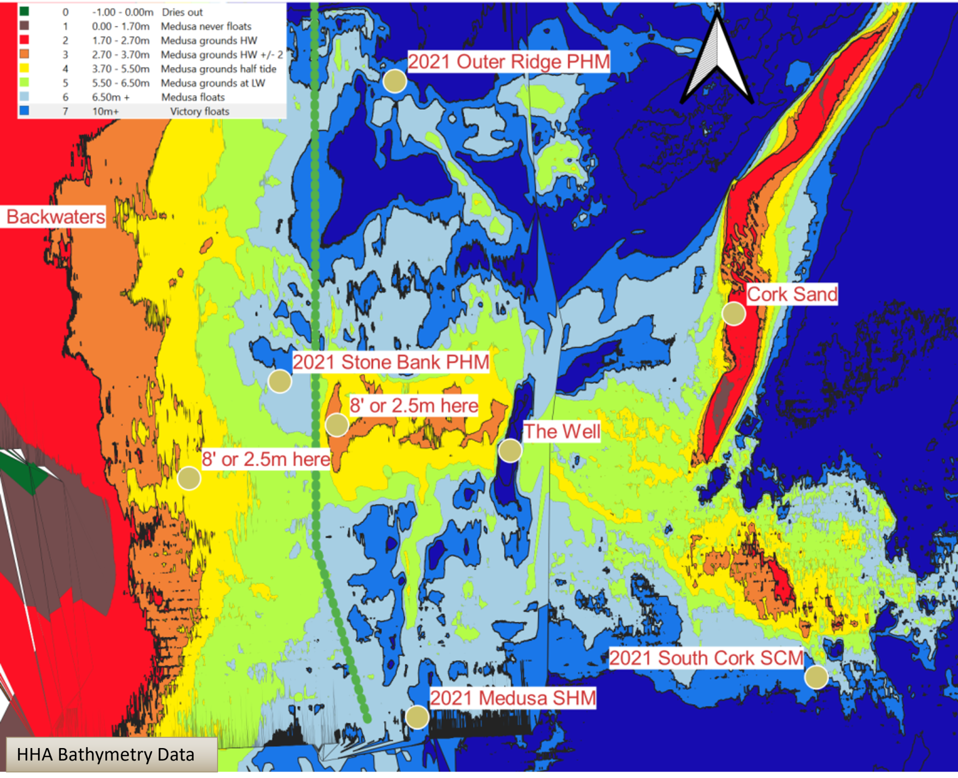
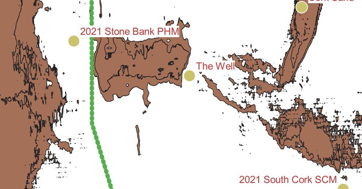
This diagram produced from modern HHA Bathymetry data shows the areas shallower than 8′ (2.4m). The shallow Medusa Channel is to the left and the deeper, narrower Gullet Channel to the right, now known as the ‘Well’. Depths have changed since the Spence chart was drawn due to the removal of the cement stone.

For the humble yacht sailor, the depth is generally adequate other than at LW Springs when some care is needed, although this is, of course, a good time for a passage out or home.
Footnotes
- 1East Coast Rivers – Meesum
- 2
- 3
- 41965 East Coast Rivers
Image Sources and Credits
Image Credits and Sources
- Harwich_Harbour_1804_Stone Bank: 1804 Graeme Spence Chart
- 1East Coast Rivers – Meesum
- 2
- 3
- 41965 East Coast Rivers
Image Credits and Sources
- Harwich_Harbour_1804_Stone Bank: 1804 Graeme Spence Chart
