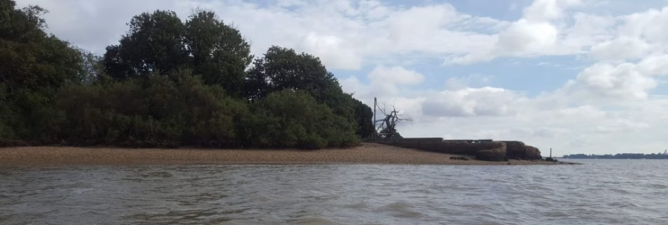
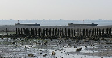
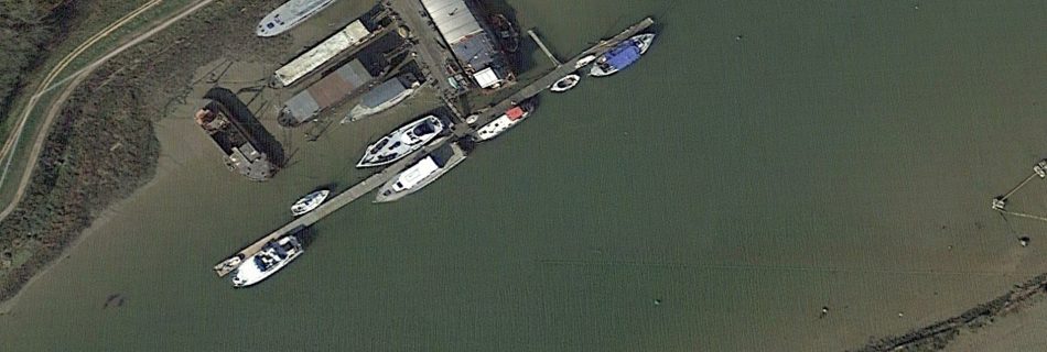
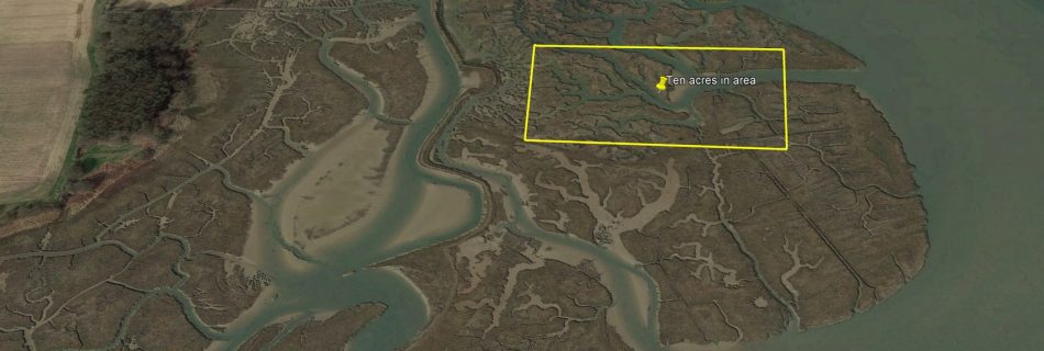
Oyster Beds Opposite Falkenham Creek
There are disused Oyster Beds opposite Falkenham Creek shown on the 1902 map but not on the 1881 map, so late nineteenth century. The shape is more regular than the cuttings at Waldringfield, although the depths are similar.
1764 Carte des entrees de la Tamise
From David Rumsey Collection from Le Neptune Francois
Pool at Orwell Park
An owner of Orwell Park was George Tomline who was a key figure in the development of Felixstowe Port and a major landowner on the peninsula (see Edward Fitzgerald). An interesting feature of Orwell Park is the boat house with a concrete pool with iron steps for access. Originally built by E. G. Pretyman, heir …
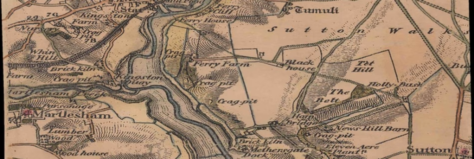
1837 Colby Map of Deben Area
Scanned from Personal Collection. Note the seawalls, or lack, at Waldringfield quay, Horse in channel.

Cutler and Redbeard Sands
Nowadays we are familiar with Cutler Sand as a 2m shoal about one and a half miles off Bawdsey Cliff, but few have heard of Redbeard. There was a Cutler or Curtiller ship-owning family in the Bawdsey area from the twelfth century, so this is probably the origin of the name of the Cutler Sand. …
Foulger’s Gat
Foulger’s Gat, pronounced ‘Fullgers’ is a swatchway across the Long Sand connecting the Black Deep to the Knock Deep. It has a least depth of around 3m and is now surrounded by the London Array windfarm, although still usable by yachts.
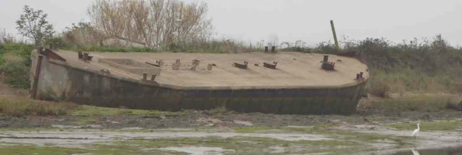
Ferro Concrete Barges (FCBs) Introduction
The first vessels of this type investigated turned out to be metal lighters: I’d been passing them for years assuming them to be concrete. It was through contacting Richard Lewis, who writes on the subject and has www.thecretefleet.com website, that the subject became clearer. Working from Northern Ireland he has identified perhaps all of the …
Ferro Concrete Barges on the Stour
There are Ferro Concrete Bargesthe Stour at Harwich,, Mistley and in Ewarton Bay.
Ferro Concrete Barges on the Orwell
There are at least two Ferro Concrete Barges at Pin Mill on the Orwell. One is a stem head, used as a houseboat, and one an open swim head. Another is buried under Ipswich Grain Dock.
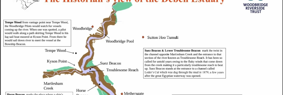
The Historian’s view of the Deben Estuary
On the Woodbridge Riverside Trust website: is An interesting map of the Deben with some historical notes. It has a different explanation of the name Kingsfleet.
John Posford

1918 WW1 Mine Fields
World War I: Understanding the War at Sea Through Maps | Worlds Revealed (loc.gov)
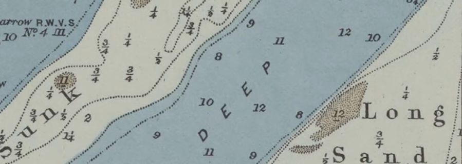
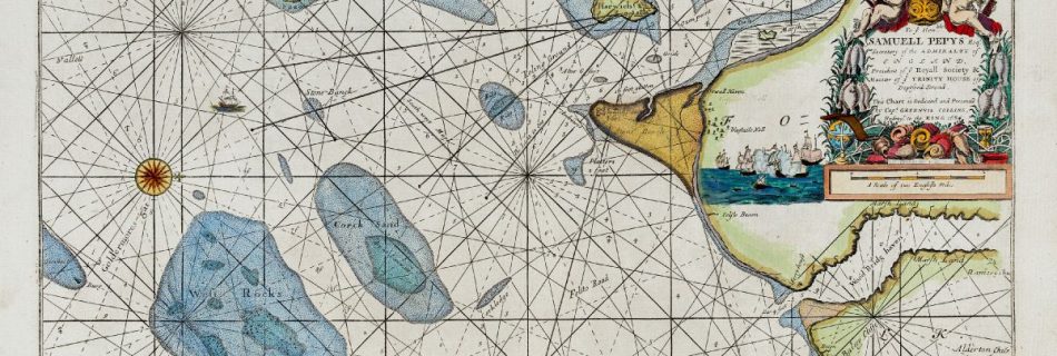
1883 The set of tides at half ebb and half flood
From the David Rumsey Collection.
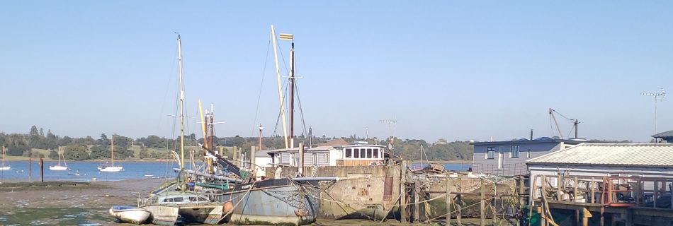
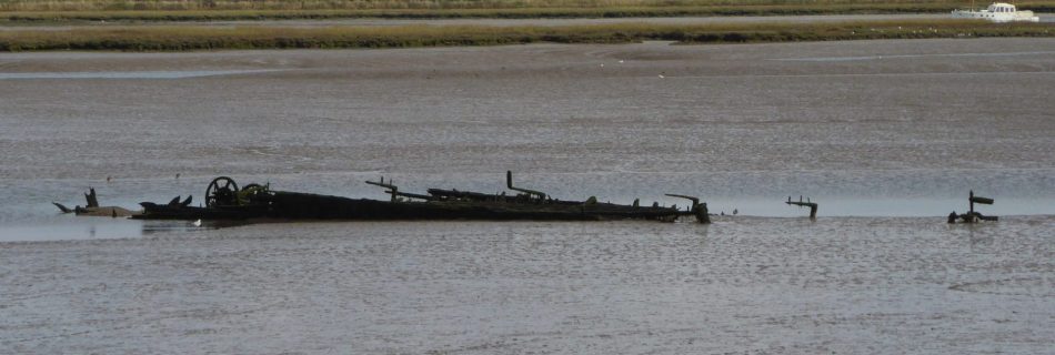
Metal Lighter Hulk on the Stour
A hulk (69’x20′ ) sits on the mud in Bathside Bay (drying height 3.8m CD) and has been there since at least 2000. This looks very much like an old steel Thames lighter.
Barges, Lighters and FCBs
Barges, lighters and Ferro Concrte Barges (FCBs) can be confused one with another.
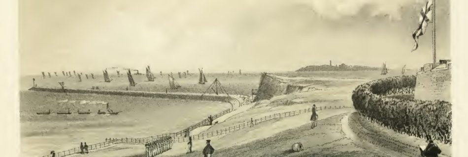
Felixstowe Pier
Opened in 1905 with a length of 2640′ / 800m: the modern length is 450′ / 140m. During World War Two the Pier was partially demolished to reduce invasion risk. The outer part was later removed. Felixstowe Pier – Wikipedia
Bawdsey and Alderton Churches
Both Bawdsey and Alderton church towers were once used for navigation. Alderton’s spire collapsed in 1821, killing a cow! So, because the diminished church became unsatisfactory for navigation, the sea-mark was rebuilt in 1831 and again in 1837. Next, in 1841, boys set fire to the thatched nave of Bawdsey Church with Guy Fawkes night …
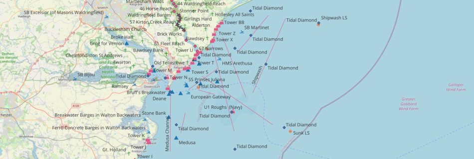
Chart View
Click on pins to link to the post. The control Icon permits the base map to be changed and different layers to be (de)selected. Where pins are close together it may be necessary to zoom in to resolve them.
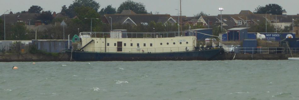
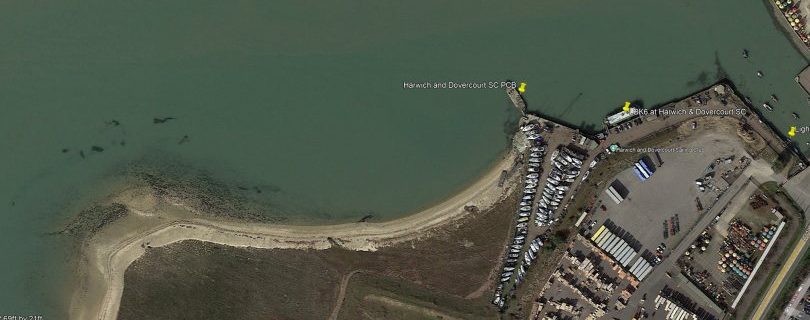
LBK6 – Landing Barge Kitchen at Harwich
The fighting men who landed on D-Day needed to be fed so ten Landing Barge Kitchen (LBK) were built for the task. These were adapted from steel Thames Lighters by fitting two petrol engines and building the kitchen on the lighter. Crossing from Langstone Harbour to Sword Beach on D-Day, with the 35th LB Flotilla, …
HHA Tidal Surges
14AUG24 there was a surge, it built up very quickly as can be seen from the graph. Two stream measurements were made from a yacht taking the difference between STW and SOG. HHA Tide Data for the period here, times are BST. HW 0700 3.3m, LW 1245 1.4m, HW 1930 3.3m Range 1.85 average (neap …
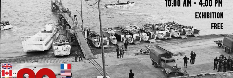
Woolverstone, D-Day at 80 Exhibition
On 6 June 1944, Allied troops landed on the Normandy beaches and the battle to liberate Europe began. 80 years on since D-Day, the largest amphibious invasion in the history of warfare, we remember those who made the ultimate sacrifice in defence of our freedom. The small village of Woolverstone had a vital part to play in these tumultuous times.
Ferro Concrete Barges in Walton Backwaters
Five Ferro Concrete Barges, FCBs, in Walton Backwaters at Foundry Reach and Tichmarsh Marina. From WW2.
Cartography Unchained
An interesting website with various research papers relevant to some topics on this site.
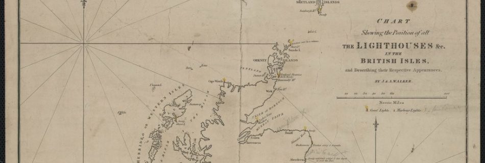
1830 Chart of Lighthouses & Lightships
Zoomable version here. Also see Tizard for Thames Estuary.
1807 William Heather – The New British Channel Pilot
1807 W Heather The New British Channel Pilot. Containing Sailing Directions from London and Yarmouth to Liverpool, and from Ostend to Brest.

Charles Baggage and Buoys
The mathematician, Charles Babbage, took note of the problems with shipping and produced ‘Notes Respecting Lighthouses‘ in 1852. This proposed an elegant system for coding lighthouses and anticipated the use of lighted buoys by more than twenty years. He was, of course, ignored by the British authorities, although the Russians1See p220 Good words, ed. by …
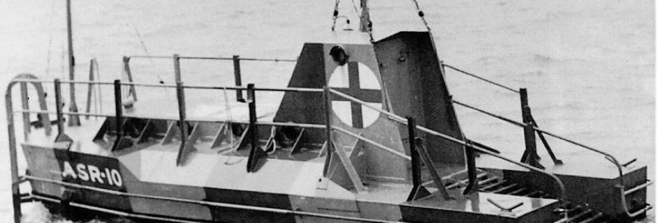
World War Two Air Sea Rescue Buoys or Floats
Both Britain and Germany deployed Refuge Floats for airmen in the North Sea and Channel. How many lives were saved is unclear. Examples still exist – see the notes. RAF Rescue Float More information: RAF Boats 1918 – 1986 and a 3D view at Scottish Maritime Museum German Air Sea Rescue Buoy – Lobster Pot …
Submarine Sound Buoys
At the start of the twentieth century the Submarine Signal Company of Boston developed a system of electric bells that could be installed below water in lightships or, potentially, buoys. These could transmit underwater signals. Using a receiver an operator could determine the range and direction of the signal.
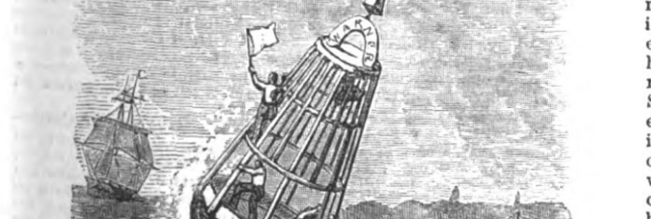
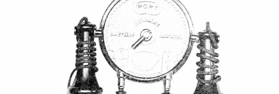
Captain Peacock’s Refuge Buoy
Refuge Buoys were used in the late nineteenth century to assist shipwrecked mariners.
1945 The Pilots Guide to the Thames Estuary …
The Pilots Guide to the Thames Estuary and the Norfolk broads for yachtsmen by w. eric wilson d.s.o & douglas branson, d.s.c.,r.n. Available to borrow online. It was corrected to 1949—a useful history section at the beginning.

*Local Buoy History
These notes cover from the Blackwater to the Ore in chronological order. A fifteenth-century pilot guide describes the ‘Waynes and Weirs at Orwell (Harwich) Haven’, the entrance was quite different with many fishing weirs such as Andrews and Platters. These most likely necessitated the services of a pilot to be safely navigated. The Spitway may …
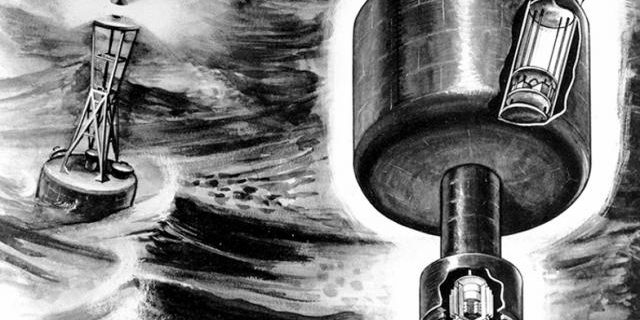
The Atomic Buoy
In the mid-twentieth century, there were many experiments to provide long-lasting sources of power for buoy lighting. Replacing batteries or gas at sea was hazardous and costly work Many options were tried such as seawater generators. An interesting one was the ‘Atomic Buoy’, powered by the radioactive isotope, Strontium-901U.S. Naval Institute. ‘The Atomic Buoy Experiment’, …
Breakwater Lighters at Sales Point Bradwell
Sales Point at Bradwell in the Blackwater is protected by Ferro Concrete Barges or FCBs.
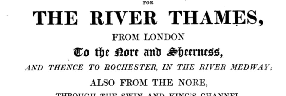
1847 Sailing directions for the river Thames, from London…Norie
Sailing directions for the river Thames, from London, to the Nore and Sheerness, and thence to Rochester, in the river Medway; also from the Nore, through the Swin and King’s channel, to Harwich, Hollesley bay, Orfordness, & Yarmouth: and through the Queen’s, South and Prince’s channels, to Margate, Ramsgate, the Downs, and Dover. To which …
Read more “1847 Sailing directions for the river Thames, from London…Norie”
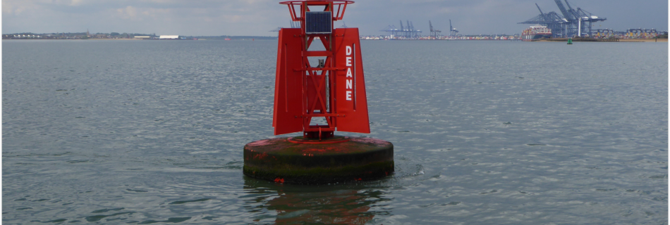
Deane, Sir Anthony
Anthony Deane, friend of Pepys, built ships at Harwich and help repel the Dutch. He wrote his Doctrine of Shipbuilding and was key to building the Royal Navy. He is commemorated only by the Red Buoy at Harwich.

Verse
A random collection of nautical verse.
Haven Collection
Harwich Haven’s history explored through buoys, navigational features and people. Charts, maps of the Felixstowe, Harwich and local sea area.

The Sledway
On the modern (2015) charts the Sledway is the channel between Cutler Sand to the West and Bawdsey Bank to the East. However, historically, the Sledway is the navigable sea bounded by the Cutler, Bawdsey Bank, Shipwash, Threshold, Roughs, Ridge and Cork, which affords access to the Havens. A sense of this is given in …
1952 to 1970 Thames Estuary
Variants of 1934 chart. 1952 Admiralty Chart No 1975 Kentish Knock and the Naze to The Nore, Published 1934.jpg – Wikimedia Commons 1953 :Admiralty Chart No 1610 North Foreland to Orfordness, Published 1953.jpg – Wikimedia Commons 1970 Admiralty_Chart_No_1610_North_Foreland_to_Orfordness%2C_Published_1953.jpg
1966 Admiralty Chart No 2693 Approaches to Harwich
Full size on file.
1896 Concise Navigating Directions for the River Thames (Harwich Plate)
Geo-referenced Harwich area. The British Library, No restrictions, via Wikimedia Commons Other plates in series- Wikimedia Commons Available here with charts and sailing directions.
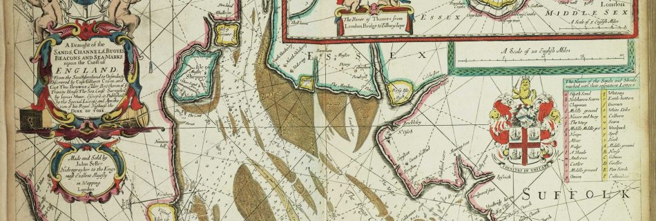
1675 Thames Estuary
https://commons.wikimedia.org/wiki/File:A_draught_of_the_sands,_channels,_buoyes,_beacons_and_sea-marks_upon_the_coast_of_England-_from_the_Southforeland_to_Orfordness._Discovered_by_Capt._Gilbert_Crane,_and_Capt._Tho-_Browne,_Elder_Bretheren_of_ye_Trinity_House._RMG_F8058.tiff John Darby; Lamb, Francis; Seller, John, Public domain, via Wikimedia Commons
Sheerness Minesweepers – HMS Wildfire
This site has a wealth of information about the HMS Wildfire shore base at Sheerness in World War Two. There is a ship and wreck database as well as an excellent article on the defensive barrier.

Log Calibration
A yacht’s log records the distance travelled through the water and, from that, derives speed (there are other types of log such as Doppler which work differently). Because the log wheel is subject to the marine environment, such as weed, it ought to be tested often and calibrated to be reliable. Many sailors are perhaps …

Shoal Waters: Sailing Just for Fun by A.C.Stock
A delightful book about sailing Shoal Waters, a 16′ boat, around the Thames Estuary and covering 70,000 miles or so from her base at Heybridge. The website has background and a number of articles. Shoal Waters continued her travels with a new owner after the death of Charles Stock and, in 2023, was for sale …
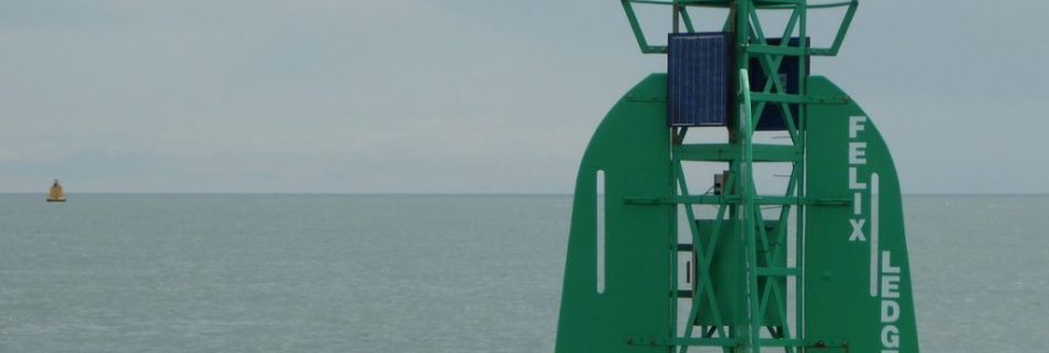
Felixstowe Ledge
There is a bed of stone between the Deben and the Naze which has been mined as a building material. The northern part extends seawards from Cobbolds Point to Felixstowe Ledge. The point exists because the land north and south is softer and has eroded. The rock armour installed in the 2000s aims to preserve …
Gunfleet Old Light House and Beacon.
Also see: Gunfleet Sand 1736 Wooden Beacon A wooden beacon was installed by Trinity House in 1736: this was shown on the 1790 Stanier and 1852 Imray charts and, presumably, would have been a similar structure to the Whittaker Beacon. 1850 Screwpile Lighthouse The wooden beacon was replaced …
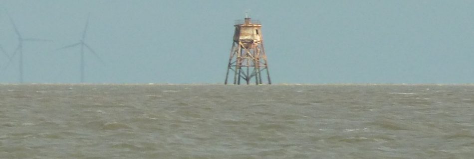
Sunk Head Tower – what remains?
Commissioning 1942 H.M. Fort Sunk Head (U2) was the second Maunsell Navy Tower to be installed during World War Two in the Thames Estuary for Air Defence. After her commissioning at Tilbury, she was towed out on June 1st 1942: unlike The Maiden Voyage of Roughs Tower, the trip to the site was quick and …
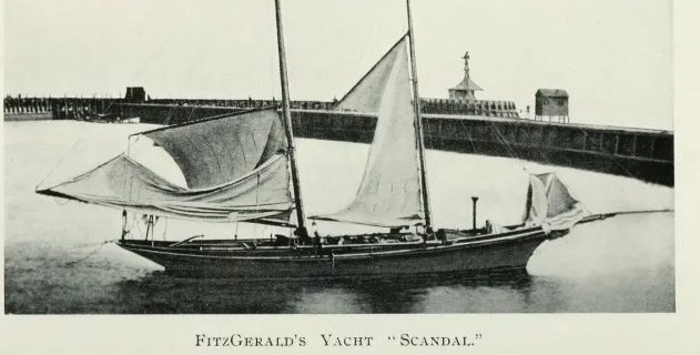
Edward Fitzgerald and Yacht Scandal
Edward Fitzgerald (1809-1883) was from a wealthy family and a gentleman of leisure. Known primarily for his translation of a Persian poem he was of a bohemian disposition and lived an unconventional life. He was one of the ‘Woodbridge Wits’, a group of poets and artists, which included Thomas Churchyard, George Crabbe and Bernard Barton. …
Sea Words And Phrases Along The Suffolk Coast- Edward Fitzgerald
Fitzgerald collected words and phrases from local sailors and fishermen which were published in the East Anglian. The full text is available here. This is a short selection:
SYH Berth Survey June 2022
As part of a plan to survey sections of the marina for depth, it was necessary to establish the difference in tidal height between SYH and the tide gauge at Harwich (HHA). The HHA gauge gives predicted and actual tide for every ten minutes on a 24-hour basis: the data can be read into a …
Roman Weather Lore
A fictionalised account of the departure of the legions from Britain is given in the ‘The Count of the Saxon Shore by Alfred John Church’, set in the early fifth century. An interesting snippet from this, the time was mid-October: But I must say, saving your presence, that it is against all rules of a …
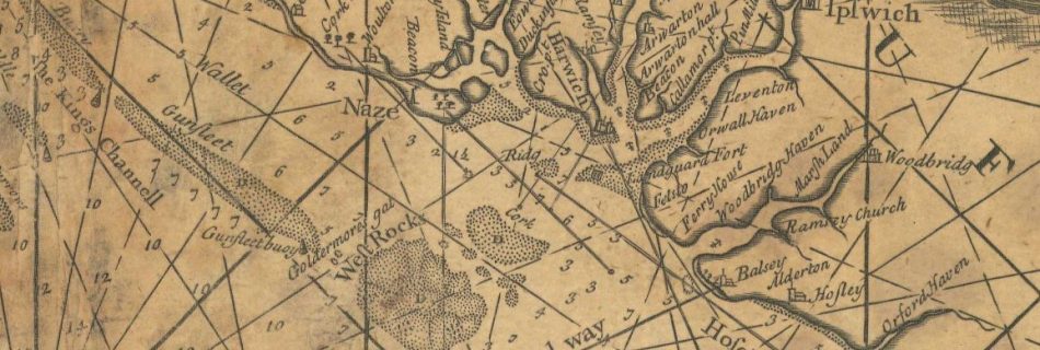
1683 Greenvile Collins chart of Harwich Haven
A great deal of local interest within this chart. Vintage Maps – excellent selection: (Grahame Spence Charts – If you like to download the image of this map with a resolution of 1200 pixels, please follow the link below. You can use this image for publication on your personal or commercial websites for free if you set …
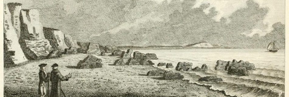
The Ruins of Walton Castle
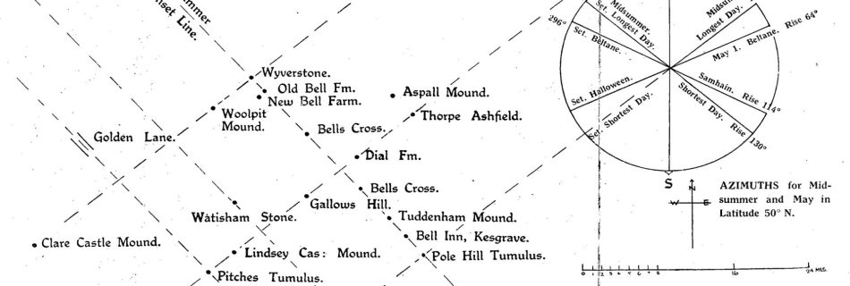
Ancient Alignment of Walton Castle
A final curiosity is that an astronomical alignment has been suggested between the site, which in the past would have been around 25m high, through various ‘bel’ sites and Thetford Castle.1Alignments – Hudson, H. ‘Volume XXI Part 2 (1932)_Ancient Sun Alignments the Meaning of Mounds and Mark Stones H Hudson Welcome to the website of …
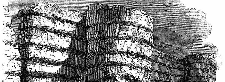
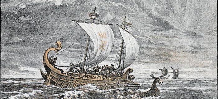
The Roman Fort
In the Fourth Century, a Roman fort dominated the Woodbridge and Orwell Havens. It was part of a defensive chain from the Wash to the South Coast mirrored on the coast of Europe. Probably built to deter Scandinavian raiders it was commanded by the ‘Count of the Saxon Shore’, whose base was at the Isle of Wight.
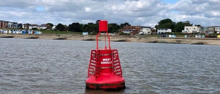
West Knolls
The buoys marking the Deben entrance change frequently in both position and name. West Knolls marks one of the moving mounds of shingle and may be retired for a decade or so when the channel shifts to the North. ‘Knoll’ generally refers to a small hill or mound of sand or shingle, sometimes intertidal. They …
SS Richard Montgomery
SS Richard Montgomery on youtube. Beware the shallow water to the east at LW. There is a plan to remove the masts. See SS Richard Montgomery – Wikipedia – a United States ship named after an Irish soldier in the Revolutionary War and sunk whilst departing for the Normandy invasion beaches with ammuntion.
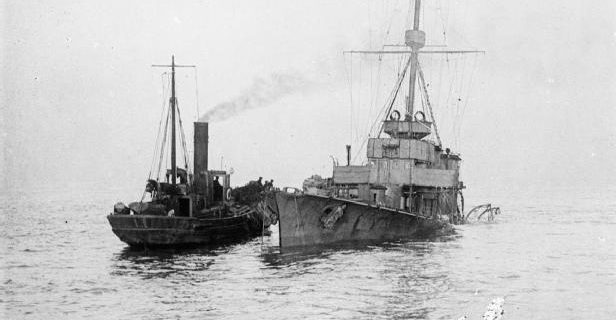
H.M.S Arethusa
Arethusa was a Royal Navy Light Cruiser stationed at Harwich under Admiral Tyrwhitt during the Great War. She served as his flagship at the Battle of Heligoland Bight (1914). On the 11th of February 1916, she struck a German mine: whilst being towed back to the port, Arethusa sank near the Cutler sandbank off Woodbridge …

Keep Turning Left
A series of videos covering the UK but many are local.

Abraham’s Bosom
Coasting Bargemaster In Coasting Bargemaster, Bob Roberts tells of taking refuge, whilst in the Martinet, in an offshore anchorage: “It is a desolate spot, many miles offshore, where the Maplin sands are divided from the Whitaker shoals by a semi-circle of water from three to four fathoms in depth at low tide.” Coasting Bargemaster by …
Extract from Dicken’s Dictionary – Barges
In the 1885 Dickens Thames Dictionary ‘Barges’ entry, he covers both dumb and sailing barges, his assessment of dumb barges and Thames Watermen is interesting and not complimentary. Here is what he says about sailing barges. It is a singular fact, not unnoticed by the committee, that whereas the men who work in the dumb …
*Modern Local Charts and Pilots
Not online as most are still copyrighted. All these are on file.
Southwold and Its Vicinity- R.Wake
Southwold and Its Vicinity, Ancient and Modern By Robert Wake · 1839 The last part covers Dunwich.
Defence Collection
The East Coast has always been under attack by the sea and our neighbours. These items relate to that ongoing conflict.
Collections
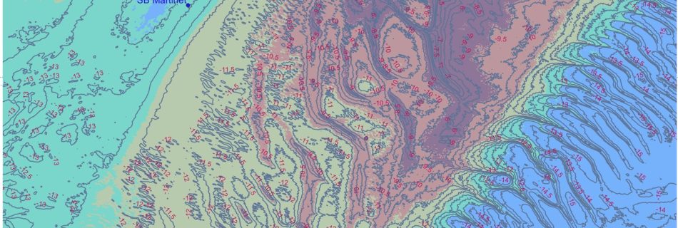
Deben Soundings
Deben Soundings FB Suffolk Inlets HB – good images from Sentinel data on the bar. Bawdsey tide gauge.
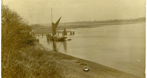
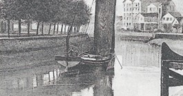
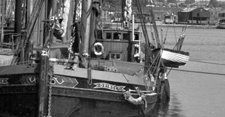
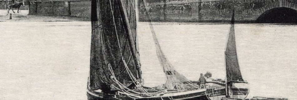
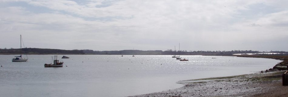
Barges at Waldringfield
The Waldringfield village sign represents the coprolite, cement and muckand straw tades that were carried out by sailing barge in the nineteenth and early twentieth centuries. Waldringfield is best placed on the the Deben for this activity.
Yachting Monthly & Hunt’s Yachting
An incomplete selection of issues from 1933 to 1953 is available here. Lovely to read. 1852 Hunt’s Yachting Magazine – Google Play Books – mainly club-oriented. Others are available until 1867. Yachting Magazine – available on CD
SB Mystery or K.C. at Melton
The position of Mystery is wrong in the SB Compendium, being near Easton, but the description as a walkway fits. Perhaps this was the K.C., both remain to be resolved.
River Deben Association Archive
This archive of earlier copies of the ‘Deben’ magazine is a trove of hidden treasures and readers will find their time in reviewing it rewarded. To read. Tribes of the Deben Anglo Saxons. Gosnold Autumn 2000, also various other history pieces. Wrecks on the Deben – Spring 2000
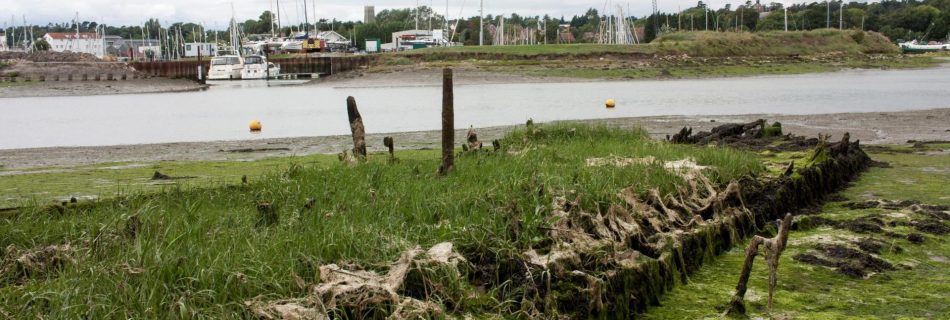
House Barges at Waldringfield
Muck and Straw Barges at Waldringfield
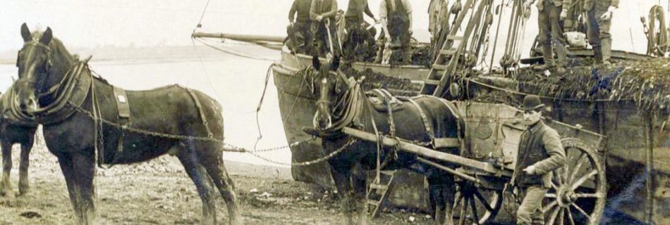
Towards the end of the nineteenth century, London was the largest city in the world and road transport was powered by horse: fifty-thousand horses were required just to keep Victorian London’s public transport running, another ten thousand horses for hansom cabs, and countless more to substitute for white vans made around 300,000 horses producing, say, …
Coprolite from Waldringfield – SB Ammonite, Fossil, Nautilus
Coprolite is a phosphate material that come from Red Grag. It was used to make fertiliser by Packards and Fisons. It was collected from Waldringfield by Barges Ammonite, Fossil, Nautilus and Dewdrop.
SB Elsie Bertha
Naming Frank Mason ordered Elsie Bertha in 1878 from Miltons, a Kent builder. This was Masons’ third vessel and was named for his daughter who had died aged five months. Skatty Her final skipper, Arthur Catchpole, was a smartly dressed man and was known as Skatty., he would have nothing to do with the orthodox seaman’s blue …
SB Jumbo
Masons probably had Jumbo from new in 1883. Shipping movement records show Jumbo with Brooks as the master in London in August 1888 and Quantrill in 1900. Whether or not she was sold with the rest of the fleet to Cranfields is uncertain but by 1916 she was registered with the Cotton Powder Co., City, London. War …
SB Orinoco
As Elsie Bertha was lost in 1894 it is probable that Orinoco, bought new in 1895, was her replacement. At some point, she was fitted with a deckhouse and, conceivably converted to wheel steering although she may have had this originally. Masons were rather unsporting on a Friday in 18971For an account of the 1897 …
SB Excelsior
Masons bought Excelsior second-hand in 1888 as their fourth vessel. Along with the remainder of the fleet she was sold to Cranfields in 1912 eventually being used for training as she was, by then, their smallest barge.
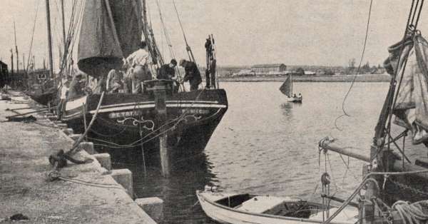
SB Petrel
Petrel was built by Orvis in Ipswich in 1892 as Masons fourth vessel. The first three had a family-related name so it is unclear why she was called Petrel. Fred Strange was skipper in 1894, she competed In the Harwich Race in 1897, see Orinoco. Quantrill was skipper in 1905. Arthur Catchpole (see Elsie Bertha) had …
SB Grace
Grace was Masons second barge built at their own yard at Stoke, Ipswich in 1874 and named for George Mason’s daughter Grace Eliza. Along with the rest of the Masons fleet, she would have carried cement and mixed cargoes to and from Waldringfield. Ernest Smith, one-time mate on Augusta, and his brother Isaac continued sailing …
SB Augusta
Augusta was Masons’ first barge built at their own yard at Stoke, Ipswich in 1874 and named for George Mason’s daughter Augusta. Along with the rest of the Masons’ fleet, she would have carried cement and mixed cargoes to and from Waldringfield.
Masons (Cement) Barges
Masons Cement Works at Waldringfield from 1860s to 1907. Some sailing barges belonged to the factory,others not. Mud dug at Hemley Point. Fates of the barges mostly known.
Mud Digging at Hemley for the Cement Works
Portland cement was made at Masons Cement Works in Waldringfield on the Deben. 120,000 tons of mud was taken Hemley Point and Early Creek in SB Kingfisher
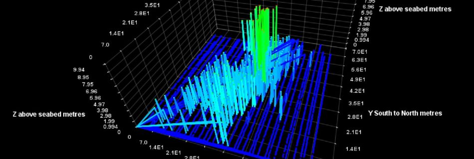
Elevation and Depth data & Sea Level
Also see Walton on the Naze tides – variation LIDAR is a Laser-based surveying technique that provides elevation data across a land area. There are various types of survey data that can be downloaded and then processed to show a given area. The raw data will include buildings and vehicles, this is the DSM version. …
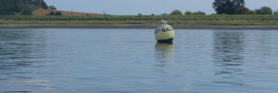
Galleons & Girling’s Hard
The Galleon’s racing mark is most likely misnamed. The hard to the southeast was once known as Girling’s Hard. There are records of the Girling family owning land in the area as far back as 1521. So, barring a convincing Galleon tale that is probably the origin. In the late nineteenth century, …
Deben Reaches and Marks
For sailors, much of the navigational interest of the Deben is getting in and out of Woodbridge Haven: there is, however, the more prosaic topic of how the way to Woodbridge has been marked over the years. This is a tour through the sources and changes. George Arnott says the first reference to beacons was …
Barge Collection
A collection of items about Thames Sailing Barges on the River Deben especially at Waldringfield and Masons Cement Works.
Deben Collection
There are sufficient Deben items to justify a separate section albeit they are not an attempt to cover the river comprehensively. See the Sources section for further reading.
SS Prinses Juliana
The cross-Channel steamer Prinses Juliana (1909) was wrecked off Felixstowe. On 1 February 1916, she struck a mine from UC-5 while on a voyage with passengers from Vlissingen (Flushing) to Tilbury and was grounded. Ultimately the ship became a total wreck. There is confusion in online sources between Juliana and …
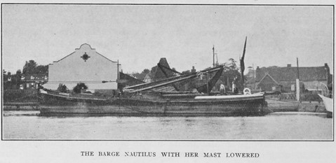
SB Martinet in Hollesley Bay
Bob Roberts, in Coasting Bargemaster, tells a compelling tale of how his ship, the ‘boomie’ barge Martinet, was wrecked in World War Two. He wrote that the ship wanted to kill its crew, and he had been in trouble before, having …
SB Dover Castle
Built in 1872, Dover Castle was operated on the Deben by Robert Skinner from 1923, this was the twilight period of barge traffic on the Deben: she was in her dotage, having been bought cheaply and worked with old sails in poor condition. In 1930 she was run onto the left bank opposite the Tide …
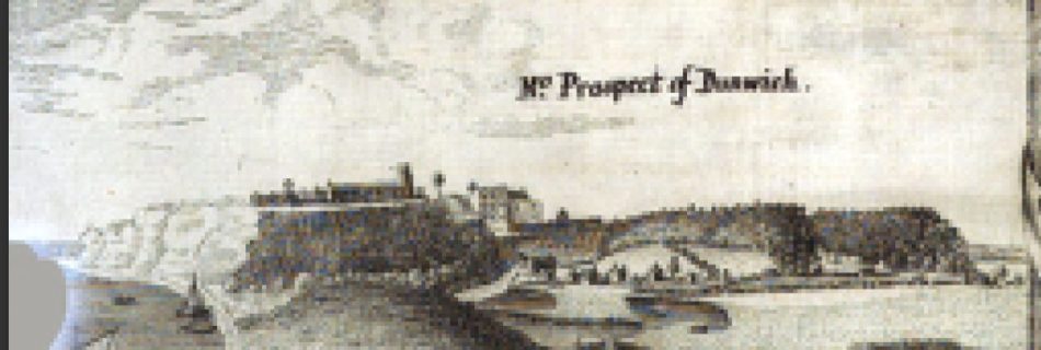
Sailing past Dunwich in the Seventeenth Century
As one sails past Dunwich these days, there is little to see and no reason to come near to land. In any case, the direct course to the next headland will be offshore just inside, or over, Dunwich Bank. As a reader of wooden navy fiction, it was the Jack Stannard trilogy that prompted a …
1698 Greenvile Collins Thames Estuary
A large scale chart of Kent to Yarmouth. His other charts are more useful. Captain Greenvile Collins, Public domain, via Wikimedia Commons Available here.

1682 Thames Estuary John Thornton
Available here.
1678 Essex by William Morgan
Shows Burnham near the sea, Ray Sand, Landguard fort. Shows marshes between Stour and Blackwater.

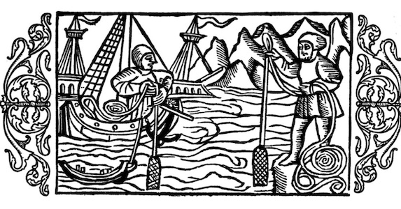
1574 A regiment for the Sea – William Bourne
1574 A regiment for the sea William Bourne – about navigation techniques, not a pilot.
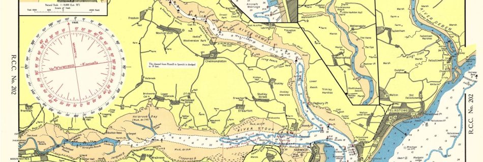
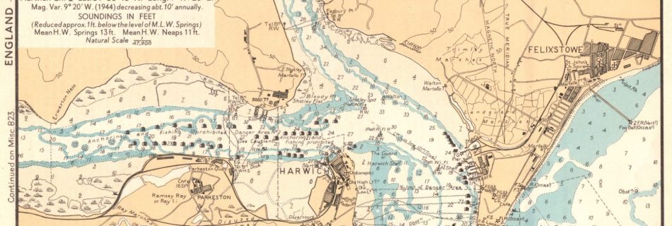
1949 Royal Cruising Club Local Rivers
1943/4 War Department Charts
These were originally in a ring bound set and are not much larger than A5 size. If there is one of the Deben it is elusive. These are from personal collection.
1815 Arrowsmith Suffolk and Essex
Shows land and sandbanks. High definition.