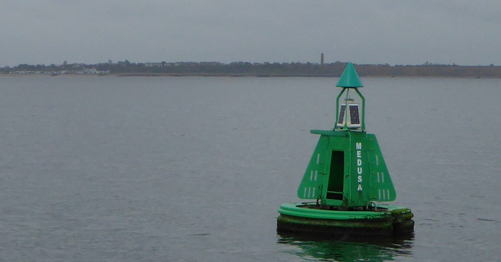
The green starboard hand buoy, off Walton on the Naze in Essex, is named after HMS Medusa and is the only female buoy in our area. In Greek Mythology, Medusa was a horrid monster with a tangle of snakes for hair, anyone who looked directly at her instantly turned to stone. Because of this the use of a mirror is recommended. Appropriately, her neighbour in the Medusa Channel is Stone Bank.
Today’s Buoy
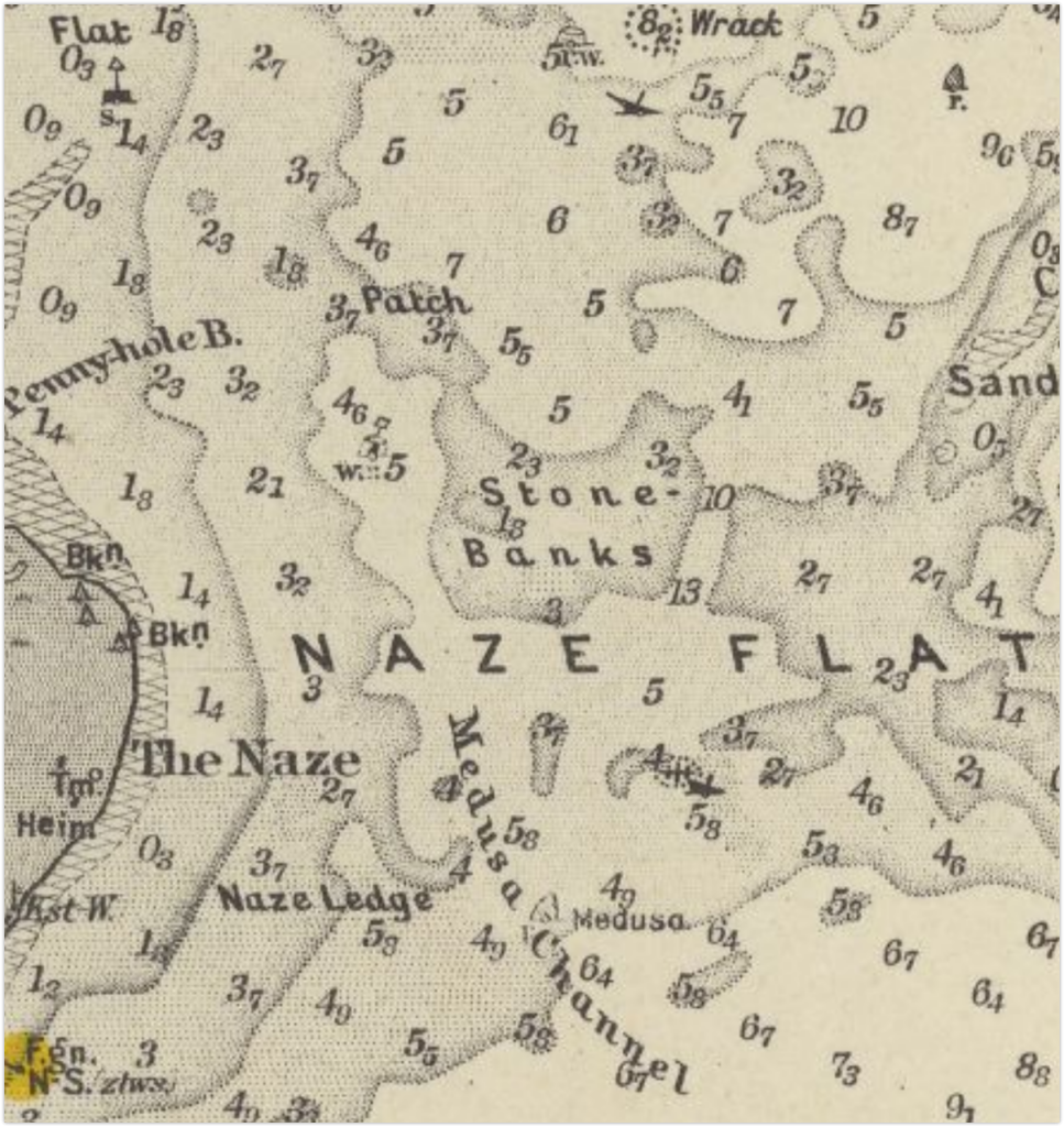
The buoy was not shown in the 1935 Pilot but was in place by 19451Medusa buoy was shown on the Kreigsmarine chart from that year. It would be interesting to know how the German Navy managed to maintain this chart up to 1945 and what they expected to use it for. : then, starboard buoys were red or black cones; this one was red, a green would have marked a wreck. Modern, IALA, buoys date only from 1977, they used to look more interesting. It may have been put in place during wartime to mark the channel for ships visiting the Exchem explosives works in Oakley Creek (which had been there since at least 1927). The Medusa channel gives only a small saving over the deeper, and now forgotten, Gullet.
Medusa Channel
The Medusa channel is used by yachts and a few fishing boats, so it has more historical than navigational significance and is barely worthy of the title ‘Channel’. The direction of buoyage is southwards with the flood stream. Medusa connects Harwich Haven with Goldmer Gat at the head of the Gunfleet Sand and joins either the Wallet or King’s Channel.
Nelson Visits
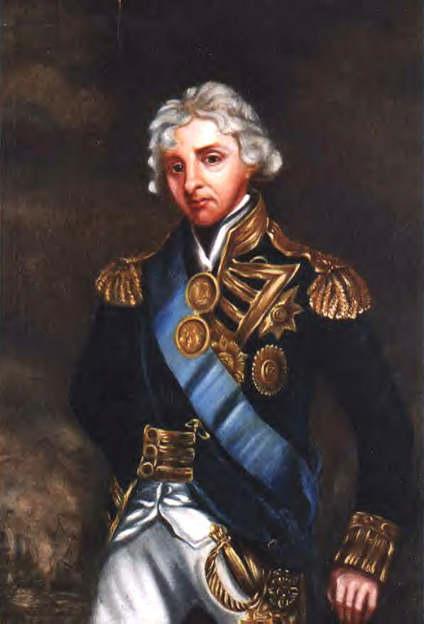
It is well known that the channel name is associated with Admiral Lord Nelson’s visit to the area in HMS Medusa in 1801. At the time, Napoleon Buonaparte’s France had three times the population of Great Britain2Populations – Demography of the United Kingdom and the resources of much of Europe at its command. Invasion armies were massing across the water. In July of that year, Nelson, newly promoted to Vice Admiral, had been recovering in Norfolk from the Battle of Copenhagen3Nelson Copenhagen – This site gives a useful background . With invasion imminent he was called away from his Mistress, Emma, and his new daughter, Horatia, and ordered to sea to command defence between Beachy Head and Orfordness4Orders – Pettigrew, Thomas Joseph. Memoirs of the Life of Vice-Admiral, Lord Viscount Nelson, K. B., Duke of Bronté, Etc., Etc., Etc. T. & W. Boone, 1849. .
HMS Medusa
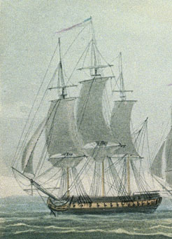
Nelson’s flagship was not, at this time, HMS Victory. He had, a few days earlier whilst attacking Boulogne, raised his flag in the new 32-gun Frigate HMS Medusa commanded by 29-year-old Captain John Gore5 John Gore, Royal Navy officer, born 1772 . She had been commissioned 614 April 1801 – Launch of HMS Medusa in April of that year at Northfleet on the Thames in Kent, as was Roughs Tower a hundred and forty years later during another episode of unpleasantness from our neighbours. Medusa had been built to the rules established by the seventeenth century Harwich shipbuilder Sir Anthony Deane. The great Nelson’s flagship, a 32-gun fifth rate, was modest but, as we shall see, a larger ship would have been a problem. In any case, he always wanted more frigates and had earlier written,
“Was I to die this moment, ‘Want of Frigates’ would be found stamped on my heart.”
On Saturday, August 8th 1801, Medusa had carried Nelson from Margate, fifty small boats full of people had been there just to catch sight of him depart. By Sunday, the 9th Medusa had anchored south of Bawdsey Bank. His pilots, from the Kentish Downs, were unwilling to navigate into Hollesley Bay or Harwich7HARWICH, Au . 9. evening Lord NELSON arrived in the Medusa Frigate, Capt. GORE, at’ the back of Landguard Fort, where he came to anchor, attended by an Advice Brig, the Providence hired Cutter, commanded by Lieut. COWAN, and two Revenue Cutters. Monday 10 August 1801
Newspaper: Sun (London) . The reticence of the pilots can be explained by the grounding of HMS Victorious on the Bawdsey Bank seven years earlier. It seems that the errant Lowestoft pilots were clapped in irons8Lowestoft pilots see Hussey – Ipswich Journal 19 April 1794 .
Rolling Ground
The strong easterly winds would have made the sea rough, and, on Monday, Medusa moved to the back of Landguard Fort to “anchor in the “Rowling Ground”(sic)9anchor in the “Rowling Ground – Published: Monday 10 August 1801 Newspaper: Sun London . As will be seen, it could have been better to have stayed at Bawdsey bank and used boats to reach Harwich. The original location of the Rolling Ground was just south of the fort, which was sheltered from the northeast, as well as deep enough to ride at anchor. The modern buoy is further to the East due to the changes in the harbour entrance put in motion by Captain John Washington later in the Century. At this time, he was one year old and would join the Navy in eleven years.
Local Defence
Nelson had to organise our coastal defensive forces on land and sea. The coast was defended by Navy blockships at anchor around the Estuary. Some of these had been captured from the Danes by him at Copenhagen. There were also barges with cannons manned by the Sea Fencibles at the river mouths. The ‘Sea Fencibles’ had been formed from fishermen and farmworkers to defend the shore by sea and land and five hundred of these in Suffolk and Essex were put under Lord Nelson’s command. The fencibles’ chaplain was Dr Frank whose house at Alderton appears as a navigational mark for the Gullet on some charts. One of the commanders was Sir Philip Broke(the elder).
Another navigational mark was the Harwich Low Lighthouse which, with its partner, gave the leading line into the harbour. When the Dutch were troubling our shores, a hundred and forty years earlier, Anthony Deane ordered that, in case of invasion, this was to be blown up and replaced by a lath and plaster mock-up to make misleading marks. It would still have been a sensible precaution10Low Light – Weaver, L.T. The Harwich Story, 1975. Also, see Hussey . The population were under orders to retreat inland using only the tracks so that roads were clear for troops. A black earth policy of destroying crops and livestock was to be implemented11 Black Earth policy – East Anglia Against the Tricolor: An English Region Against Revolutionary and Napoleonic France: Foynes, Julian Paul: 9781909796270 .
To avoid public adulation, Nelson did not step ashore and spent much of the day in a cutter briefing the commanders of the Sea Fencibles. He reported that this made him half seasick and, in any case, he was in poor health at this time. He also mentions in a letter that he was keen to leave our shores and return to the Mediterranean where he could win some prize money since he was down to his last £10,000. That said, he was at that time, buying a house for himself and Emma12The dispatches and letters of Vice-Admiral Lord Viscount Nelson .
HMS Conqueror
Had he taken a break on deck whilst in the Rolling Ground, Nelson could have looked across the harbour to where HMS Conqueror, a third-rate 74 nearing completion at the Graham yard, loomed over the town of Harwich. This was the same Navy Yard where Anthony Deane had built ships over a century earlier. The Admiral would be close to death when, only four years later, Conqueror’s captain received the surrender of the enemy fleet off Cape Trafalgar. HMS Conqueror’s figurehead was shot away in the battle and later replaced by a likeness of Lord Nelson13 HMS Conqueror – Wikipedia – https://en.wikipedia.org/wiki/HMS_Conqueror_(1801)# and Mostert, Noël. The Line upon a Wind a: The Great War at Sea, 1793-1815. New York : W.W. Norton & Co., 2008. http://archive.org/details/lineuponwindgrea00most. 14HMS Conqueror’s figurehead was shot away in the battle and later replaced by a likeness of Lord Nelson – Pulvertaft, David. Figureheads of the Royal Navy. Barnsley, S. Yorkshire: Seaforth Pub, 2011. .

James Wilson Carmichael, Public domain, via Wikimedia Commons
Departure
By Monday 10th August, his Lordship urgently needed to get to the Nore, in Kent, for discussions, and then to Boulogne to attack the waiting invasion fleet. Getting him there was the responsibility of Captain Gore. These are difficult waters and, as has been mentioned, pilots were reluctant. Usually, if anchored in Rolling Ground, in the prevailing SW wind, getting past Cork Sand and out to sea was straightforward. In an ENE wind, which it was at that time, Medusa was effectively windbound15Wind Direction Archie White says SE but this would have been impossible for the channel. White, Archie. Tideways and Byways in Essex and Suffolk, 1948. . Strong Easterlies are not common here in August16. Wind strength and direction see Wind Rose for August at Iowa State University , so they were unlucky. Robert Fitzroy had not been born yet which meant that a reliable weather forecast was some way off.
Hazards
The Navy works on the principle of ‘with the utmost dispatch’, so saying the wind was foul was not an option for Captain Gore. His orders came directly from his Admiral, who would not brook delay. From Rolling Ground, the hazards are the Ridge immediately east, Cork Sand further east, Naze Flats and Pye Sands to the west and Stone Bank and West Rocks to the south. It seems that the re-location to Rolling Ground from Bawdsey Bank had been because of rough weather. If so, the wind would have made it impractical to row the ship the five miles to clear water past Cork Sand. However, there was an occasion in 1629 when Captain Sir Richard Plumleigh17Sir Richard Plumleigh – Hussey, Frank. Suffolk Invasion: The Dutch Attack on Landguard Fort, 1667. Lavenham, Suffolk: T. Dalton, 1983. was in port to press men and had a disagreement with the fort about who should dip their flag in salute, the King’s Ship, or the King’s Fort. After a stand-off lasting several days with Landguard Fort, he had his wind-bound ship kedged out to sea by a windlass, but this was an extreme measure and impractical.
Routes to sea
So, the only option was to head south. To avoid giving satisfaction to Buonaparte, feet are used for measurements. Dividing by three is close enough to get metric. The charts are in fathoms (6′), but we will use feet for simplicity. It is necessary to add one foot to convert to modern Chart Datum. The relatively deep, but narrow, Gullet Channel was marked on the 1852 chart between Stone Bank and West Rocks and had sufficient depth but would require a two-mile pull into the wind, a willing pilot and still be risky.
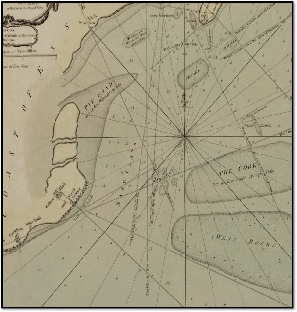
The then unnamed Medusa Channel was described, without depths, in the 1752 John Mount Sailing Directions. ‘Harwich Steeple on Beacon Cliff‘ was the mark, but this does not work today as the cliff has eroded. The 1794 Burns chart gives the marks of Pain’s Trees18This was Pain Tree – see Hussey , the High and Low lights, and the two mills, all now gone. Why Burns described the Medusa channel rather than the deeper Gullet to the east is unclear. In 1801 the channel was unmarked and would not have been considered passable for a ship of Medusa’s draught.
Stone Bank
The main hazard is the Stone Bank, so-called because it is covered with Septaria stones or rocks which were later mined for building and making Roman Cement. This activity did not start in earnest until 1812, so in 1801 the depth would be leven ess than on later charts as the rocks still lay on the seabed.
Today, there is a channel, about seven cables wide (1400m). A restriction on Spence’s 1804 chart is about half this width. On either side, the depth drops to 8′ or less where the ship would ground. The green line on the diagram below shows the passable course which, with care, offered a least depth of 10′ to 11′ although there is one area where the depth may have been only 9′. With an easterly wind, there would have been waves which, with tide would push the ship towards the western lee shore of Pye Sands.
Getting Under Weigh
Sailing ships could, at best sail six points, or sixty-seven degrees, off the wind but more likely at right angles when getting under weigh19Under weigh or underway?. Medusa could have made SSE to SE in the ESE wind. So, provided that the ship could be kept to windward the course could be made. With a flood tide of about one knot running into the harbour, it would have been difficult to make the course when getting under weigh. One option would have been to tow the boat as far east as possible towards the Ridge during the last of the ebb before dawn and re-anchor.
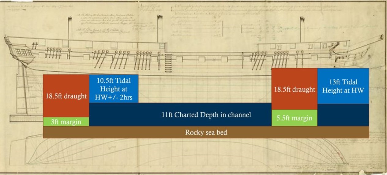
Apart from the wind direction and point of sail, there were three key factors that had to be considered so that Medusa did not ground. How much water did she draw? How deep was the channel? And, at what time would there be enough height of tide to make up the difference?
Medusa’s Draught
Medusa had a draught of 18’6” (5.6m). This would vary according to trim and load so was not an exact figure. The clearance over the seabed would have been, at best, 3′ two hours before HW and barely 5′ at HW itself. This would have been nerve-racking, to say the least as, in the conditions, the 150-foot-long ship would pitch, increasing the chance of touching. With luck, the easterly wind might have created a tidal surge of a few feet. We cannot know this and nor could they.
With extreme care, there was a minimum of 10′ depth to reach the Stone Bank area and pass through the narrow channel. Spence trusted his figures but, according to the earlier Burn’s Chart and later Washington Charts there may have been one, or even two, feet less.mfn] Depth of channel – Spence’s 1804 chart shows 1 1/3 fathom = 8′ at the Horn 1 3/4 fathoms = 10′ between North and Middle bars and 1 1/3 fathom = 8′ just to the west of the course. As he worked to LWOST it is necessary to add 1′ to get to the modern Chart Datum. The 1852 Chart shows a patch of 1 fathom = 6′ near Rolling Ground and 8′ between North and Middle Bar. Irving, in 1923, gives 11 feet which agrees with my own measurements – the least depth in the channel found was 5m less 1.5m at 1000 on Harwich tide gauge gives 3.5m CD[/mfn].
HMS Victory had a draught of 29 ft (8.7m – similar to a modern Cruise Liner) so would have grounded. She would hardly have been able to anchor in the Rolling Ground and have been in trouble in Harwich. This explains why Medusa was chosen as Nelson’s flagship. It is revealing to learn that Line of Battleships had the same depth constraints as modern ships, although would be more comfortable now in the 16m Deep Water Channel.
Tidal Height
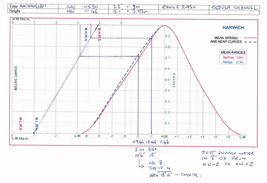
A rising tide with as much remaining increase as possible was needed so that if the ship grounded there would be a chance of recovery. On the other hand, departure had to be late enough to have sufficient depth. Two hours before HW gave negligible clearance but, on the other hand, waiting longer would give an adverse tide. By the next high tide, it would be dark with no extra depth.
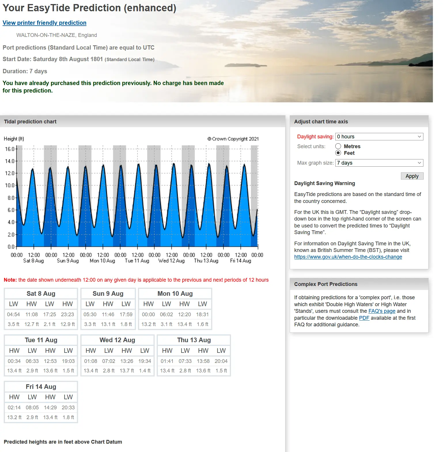
On Monday the 10th of August 1801 the tide was approaching springs with low water of 3 feet at 6 a.m., and 13’ 4” feet just after midday. They did not have such sophisticated methods as Easytide for their calculations so could not be as precise as this. So, there would have been 10’6,” or more, of water for two hours on either side of HW and 12′ one hour on each side, although, by this time, the ebb would already have started, resisting progress.
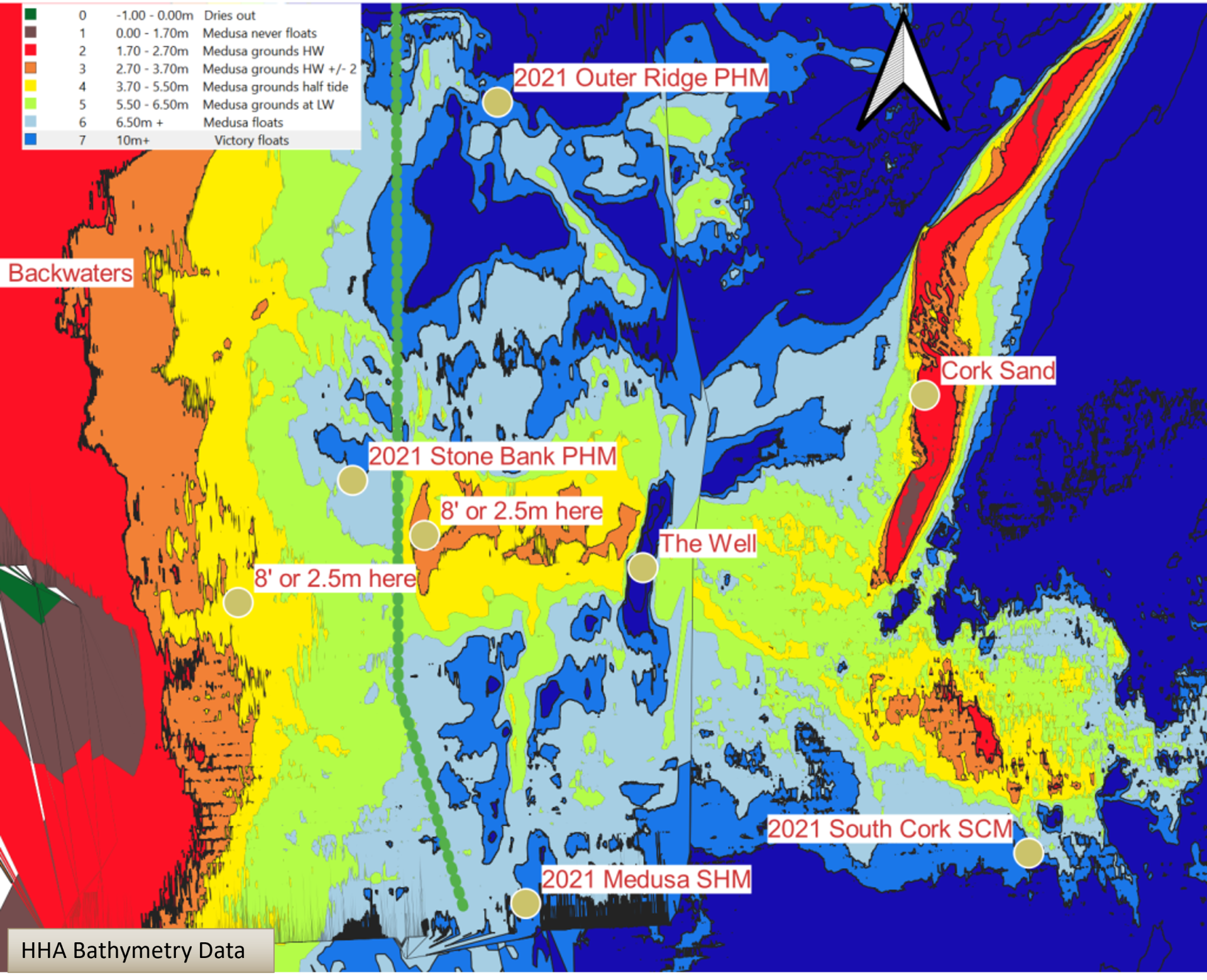
Using the draught and tidal information with modern bathymetry we can see the problem in more detail. The red areas are always too shallow for Medusa, brown areas will cause grounding at HW +/- 2 hours. The green areas will cause grounding at LW. The light blue areas show where HMS Medusa and the dark blue areas where HMS Victory could float at LW.
Navigation
So, the channel was known but no pilot was willing to guide the ship out to sea. However, in 1797 the civilian hydrographer Graeme Spence had covered the area concerned by producing the first detailed survey of the Haven area. Co-incidentally, Spence was the same age as Nelson, forty-three, and would survive him by only a few years. As the man who knew the waters best, he volunteered to pilot Medusa out to the head of the Gunfleet and was obviously successful. As the pioneer of the Double Sextant and Station Pointer, his charts were highly accurate. He named the channel on his 1804 chart shown here. Note, near the Horn, patches of 8′ and 9′ are less than half a mile apart. According to Hervey Benham20Nelson in the boat? Hervey Benham Once upon a Tide , Nelson was in one of the boats taking soundings ahead of the ship, but it is more likely both he and Spence were aboard the ship.
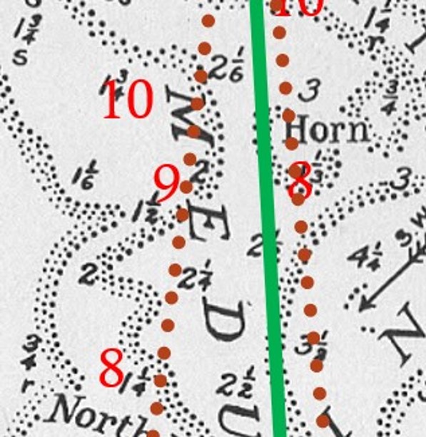
Modern surveys are made by a SONAR beam which maps the whole seafloor, and the position is known with great accuracy from GPS. Also, we now have accurate tide and water level data not available before the twentieth century. Whilst Spence had the best techniques and instruments of the time, he was measuring isolated spot depths, by line or pole, from a boat with a position determined by bearings. He would not have found every protruding rock unless he had swept the whole bank with a chain.
Landmarks
Probably they weighed anchor at around 10:30 a.m. as the passage should have taken less than an hour. The tide would be pushing the ship westward into the harbour mouth until the ship was under weigh. Spence is said to have used a back transit of the Fort between the Windmill, now a stump, and the Two Trimley Churches21Transits – Hervey Benham Once upon a Tide p41 . These are five to six miles away from the area concerned but work on the chart, although the Docks now present an obstacle. The harder to see Churches22Trimley St Mary Church once had a spire, but this is not shown on the chart and it had fallen by 1808 were the critical mark and needed to be kept almost on the Fort, The Mill on the Fort would mean a grounding. It is hard to see how he could have piloted the ship without visible landmarks. Once clear of the shoals, Medusa would have had a hard beat out to the deep-water channels but sufficient depth and sea room to tack her way out, and could use the Naze Tower, built eighty years earlier. as a landmark.
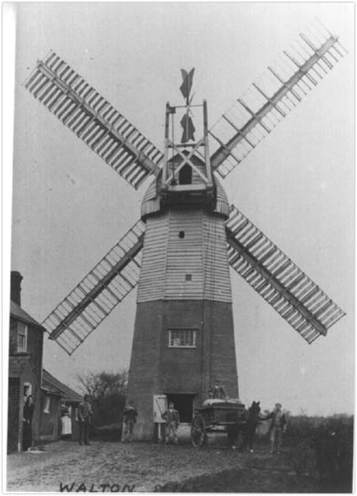
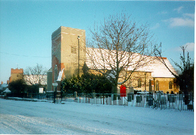
Getting Medusa to sea in these circumstances was a significant feat of hydrography and seamanship, Nelson appreciated this and commended Spence for his skill (the two ships mentioned were blockships off the Gunfleet Sand).
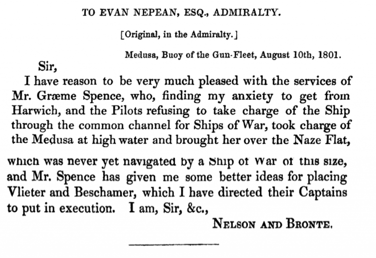
Graeme Spence was not only a superb hydrographer, but he could also work his tides with precision and was confident enough to trust his calculations.
The Medusa Channel was already described so it was not Spence’s discovery, but it was his detailed knowledge that made the passage possible, and he named it on his own 1804 chart.
Outcome
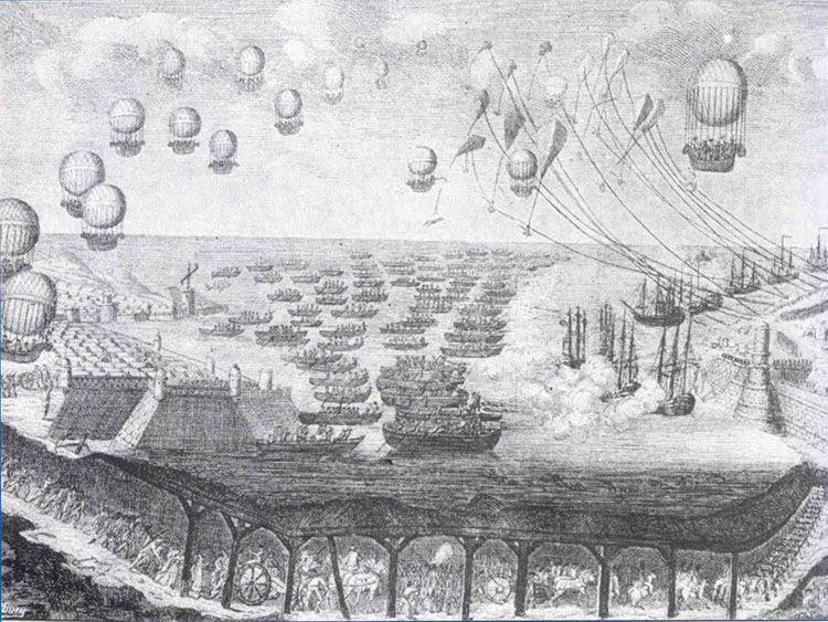
With a short intermission, while Buonaparte took an enforced break on Elba, the conflict continued for years. However, thanks to our Navy, Parliament was told by an Admiral,
“I do not say the French cannot come, I only say they cannot come by sea”23This was said by either Admiral St Vincent or Admiral Keith, Wikipedia British anti-invasion preparations of 1803–05
What became of HMS Medusa?
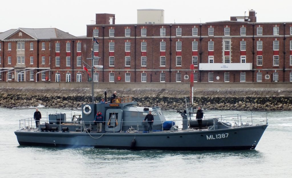
What became of HMS Medusa? She and Captain Gore missed the Battle of Trafalgar as they were in Bengal, then after a lively career, Medusa was converted into a hospital ship and broken up in 1816. Sadly, it is likely that her figurehead was lost then. Further ships carried the name, and it continues in the WWII Harbour Defence Motor Launch preserved at Portsmouth by The Medusa Trust.
In gratitude, Nelson asked Emma to purchase £50 worth of “plate” in the form of a kettle engraved with:
From Vice-Admiral Viscount Nelson, Duke of Bronté, to Captain John Gore, of His Majesty’s ship Medusa, in gratitude for the many acts of kindness shewn him when on board the Medusa in August 1801
Quite possibly this still exists as an heirloom. Nelson told Emma that he had to take care not to insult the Captain as Gore was rich. Gore had, in fact, recently won 40,000 Guineas in prize money, remember Nelson was down to his last £10,000. Gore was to become Vice-Admiral Sir John Gore after actions in early 180524Royal Naval Biography/Gore, John .
Hopefully, you now have a new perspective on one area of our waters and some new leading marks to try. You may also want to give Medusa a wide berth or take a mirror.
Notes
EasyTide Prediction and Tidal Height
Sources
Letters from Nelson on 9th
From 1844 The improved coaster’s guide
Q. Describe the Medusa channel.
A. The Medusa channel is bounded by the Stone banks, Horn, and Ridge, on the east side; the Naze ledge, Pye sand, and Holidays, on the west side.
Q. What buoys are there in the Medusa channel?
A. One buoy on the Stone banks, black, with a white cross painted on the top, and a white band round the top and middle; two buoys on the Ridge, one white and the other chequered red and white.
Q. How do Harwich lights bear when in a line?
A. N.W. by N.
Q What is the course and leading mark through the Medusa channel?
A. The course through is N.N.E. with a red brick house at Walton ferry open to the westward of Landguard fort.
Footnotes
- 1Medusa buoy was shown on the Kreigsmarine chart from that year. It would be interesting to know how the German Navy managed to maintain this chart up to 1945 and what they expected to use it for.
- 2Populations – Demography of the United Kingdom
- 3Nelson Copenhagen – This site gives a useful background
- 4
- 5
- 6
- 7HARWICH, Au . 9. evening Lord NELSON arrived in the Medusa Frigate, Capt. GORE, at’ the back of Landguard Fort, where he came to anchor, attended by an Advice Brig, the Providence hired Cutter, commanded by Lieut. COWAN, and two Revenue Cutters. Monday 10 August 1801
Newspaper: Sun (London) - 8Lowestoft pilots see Hussey – Ipswich Journal 19 April 1794
- 9anchor in the “Rowling Ground – Published: Monday 10 August 1801 Newspaper: Sun London
- 10Low Light – Weaver, L.T. The Harwich Story, 1975. Also, see Hussey
- 11Black Earth policy – East Anglia Against the Tricolor: An English Region Against Revolutionary and Napoleonic France: Foynes, Julian Paul: 9781909796270
- 12
- 13HMS Conqueror – Wikipedia – https://en.wikipedia.org/wiki/HMS_Conqueror_(1801)# and Mostert, Noël. The Line upon a Wind a: The Great War at Sea, 1793-1815. New York : W.W. Norton & Co., 2008. http://archive.org/details/lineuponwindgrea00most.
- 14HMS Conqueror’s figurehead was shot away in the battle and later replaced by a likeness of Lord Nelson – Pulvertaft, David. Figureheads of the Royal Navy. Barnsley, S. Yorkshire: Seaforth Pub, 2011.
- 15Wind Direction Archie White says SE but this would have been impossible for the channel. White, Archie. Tideways and Byways in Essex and Suffolk, 1948.
- 16. Wind strength and direction see Wind Rose for August at Iowa State University
- 17Sir Richard Plumleigh – Hussey, Frank. Suffolk Invasion: The Dutch Attack on Landguard Fort, 1667. Lavenham, Suffolk: T. Dalton, 1983.
- 18This was Pain Tree – see Hussey
- 19Under weigh or underway?
- 20Nelson in the boat? Hervey Benham Once upon a Tide
- 21Transits – Hervey Benham Once upon a Tide p41
- 22Trimley St Mary Church once had a spire, but this is not shown on the chart and it had fallen by 1808
- 23This was said by either Admiral St Vincent or Admiral Keith, Wikipedia British anti-invasion preparations of 1803–05
- 24
Image Sources and Credits
Image Credits and Sources
- Kreigsmarine: 'Reproduced with the permission of the National Library of Scotland'
- HMS Medusa – 1801 Public domain, via Wikimedia Commons: Public domain, via Wikimedia Commons
- 1794-Burns-Chart-extract: Biblioteca Nacional de España.
- Medusa Hull with depths: © National Maritime Museum, Greenwich, London
- Windmill at Walton – now Bloomfields: Facebook Rural East Suffolk In Old Photos Group
- text-letter-description-automatically-generated: Google Books
- Invasion1805: Wikipedia, public domain
- H.M.S. Medusa at Portsmouth – The Medusa Trust: The Medusa Trust
- 1Medusa buoy was shown on the Kreigsmarine chart from that year. It would be interesting to know how the German Navy managed to maintain this chart up to 1945 and what they expected to use it for.
- 2Populations – Demography of the United Kingdom
- 3Nelson Copenhagen – This site gives a useful background
- 4
- 5
- 6
- 7HARWICH, Au . 9. evening Lord NELSON arrived in the Medusa Frigate, Capt. GORE, at’ the back of Landguard Fort, where he came to anchor, attended by an Advice Brig, the Providence hired Cutter, commanded by Lieut. COWAN, and two Revenue Cutters. Monday 10 August 1801
Newspaper: Sun (London) - 8Lowestoft pilots see Hussey – Ipswich Journal 19 April 1794
- 9anchor in the “Rowling Ground – Published: Monday 10 August 1801 Newspaper: Sun London
- 10Low Light – Weaver, L.T. The Harwich Story, 1975. Also, see Hussey
- 11Black Earth policy – East Anglia Against the Tricolor: An English Region Against Revolutionary and Napoleonic France: Foynes, Julian Paul: 9781909796270
- 12
- 13HMS Conqueror – Wikipedia – https://en.wikipedia.org/wiki/HMS_Conqueror_(1801)# and Mostert, Noël. The Line upon a Wind a: The Great War at Sea, 1793-1815. New York : W.W. Norton & Co., 2008. http://archive.org/details/lineuponwindgrea00most.
- 14HMS Conqueror’s figurehead was shot away in the battle and later replaced by a likeness of Lord Nelson – Pulvertaft, David. Figureheads of the Royal Navy. Barnsley, S. Yorkshire: Seaforth Pub, 2011.
- 15Wind Direction Archie White says SE but this would have been impossible for the channel. White, Archie. Tideways and Byways in Essex and Suffolk, 1948.
- 16. Wind strength and direction see Wind Rose for August at Iowa State University
- 17Sir Richard Plumleigh – Hussey, Frank. Suffolk Invasion: The Dutch Attack on Landguard Fort, 1667. Lavenham, Suffolk: T. Dalton, 1983.
- 18This was Pain Tree – see Hussey
- 19Under weigh or underway?
- 20Nelson in the boat? Hervey Benham Once upon a Tide
- 21Transits – Hervey Benham Once upon a Tide p41
- 22Trimley St Mary Church once had a spire, but this is not shown on the chart and it had fallen by 1808
- 23This was said by either Admiral St Vincent or Admiral Keith, Wikipedia British anti-invasion preparations of 1803–05
- 24
Image Credits and Sources
- Kreigsmarine: 'Reproduced with the permission of the National Library of Scotland'
- HMS Medusa – 1801 Public domain, via Wikimedia Commons: Public domain, via Wikimedia Commons
- 1794-Burns-Chart-extract: Biblioteca Nacional de España.
- Medusa Hull with depths: © National Maritime Museum, Greenwich, London
- Windmill at Walton – now Bloomfields: Facebook Rural East Suffolk In Old Photos Group
- text-letter-description-automatically-generated: Google Books
- Invasion1805: Wikipedia, public domain
- H.M.S. Medusa at Portsmouth – The Medusa Trust: The Medusa Trust
