In the fourth century, a Roman fort protected Woodbridge and Orwell Havens. It was part of a defensive chain from the Wash to the South Coast mirrored on the coast of Europe.
Building
It was constructed in the late third century as part of the Saxon Shore defence network, there were similar forts at Brancaster, Burgh, Bradwell and around to the South Coast. These were commanded by the ‘Count of the Saxon Shore’ or ‘Comes Litoris Saxonici’: the ‘Saxon’ element most likely referred to the threat that the forts opposed. Archeological finds show that there was a reasonable size settlement in the vicinity. To the north of the fort, there was a graveyard, lost to the sea in the nineteenth century.
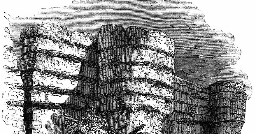
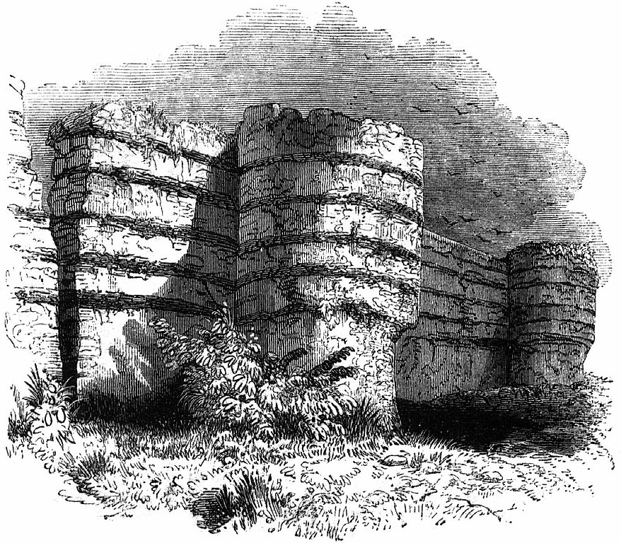
The walls were built with pebble, Roman bricks and Septaria, or cement stone taken from nearby Cobbold’s Point. They should have been similar to Burgh Castle in Norfolk.
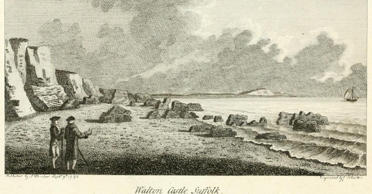
Ironically, removal may have accelerated the process that eventually destroyed the fort. Given the erosion experienced on the East Coast over the centuries, the coastline in the fourth century would have extended hundreds of metres seawards
The map shows the British section of the Saxon Shore Fort system.
As speculation, there could have been other forts on headlands now lost to the sea: Easton Ness and West Rocks are two candidates, and surely there should have been a fort of some kind near Shoeburyness. There have been indications of Roman buildings at the West Rocks1West Rock see Myers. ‘Account of the River of Orwell in Suffolk’. Transactions of the Antiquaries of London, 1793., offshore of Walton on the Naze, whilst this is an attractive idea, little is known about it; there are also mentions of possible Roman remains at the Kentish Knock2Kentish Knock see Astbury, A. K. Estuary: Land and Water in the Lower Thames Basin. 1st edition. London: Carnforth Press, 1981..
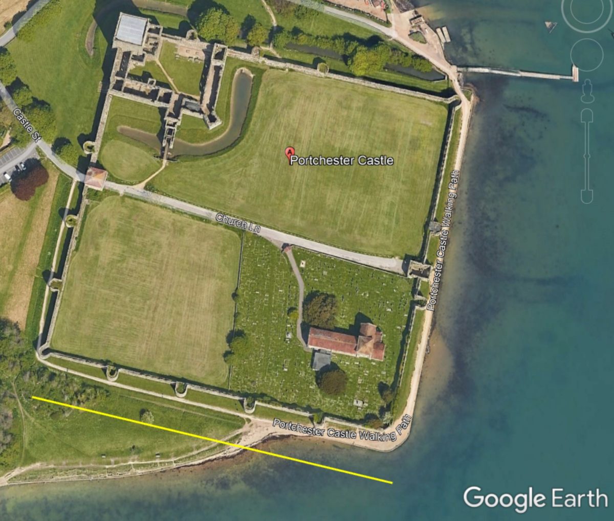
Whilst the documentary evidence for the fort is not definitive, the number of finds in the area and the close fit with the rest of the fort system make a compelling case. The Roman Road from the fort to Ipswich has been well described3‘Roman Roads in Suffolk’. Accessed 17 June 2022. http://www.twithr.co.uk/suffolk/ipswich-felixstowe.htm. and Fairclough, John. ‘Volume XLII Part 3 (2011)_Felixstowe Roman Fort J Fairclough_253 to 276’, n.d., 24., and it is likely that the ‘Great Long Dole’ marked on older Ordnance Survey maps was associated with the fort and later priory. It was probably similar to Portchester, the best surviving example.
The Roman name of the fort is unknown.4The Notitia Dignitatum was a list of officials probably compiled in the late fourth century and known only through later copies which are subject to error. One option is ‘Portus Arduni’, a name usually attributed to Porchtester.5Portus Arduni – Johnson, Stephen. The Roman Forts of the Saxon Shore. Elek, 1976., Antiquity D. Peacock 1973 It protected the havens either side and although the Roman names of these, or and Deben or Orwell, are unknown, the Stour was thought to be the Sturius.6Stour – Anthon, Charles. A System of Ancient and Mediæval Geography for the Use of Schools and Colleges. Harper & Bros., 1855
The purpose of this defence system is debated. An obvious purpose would be to protect the shores of Roman Europe from Scandinavian, or Saxon, harassment. Another view is that it was to protect Britannia against the established Roman Emperors when Carausius declared the First Millenium Brexit in the late third century.7Carausius – see Johnson, Stephen. The Roman Forts of the Saxon Shore. Elek, 1976. Other suggestions include a storage depot for imports and exports although it seems over-specified for that. It could have been a base of the Classis Brittanica, the naval element of the Roman Army, assuming that force was still active then.8THE CLASSIS BRITANNICA: WHAT DO WE KNOW ABOUT ROMAN BRITAIN’S REGIONAL FLEET? and What Happened to the Roman Fleet in Britain? Probably, for whatever reason it was built, the fort served most of these functions during the third to fifth centuries.
Size
There is evidence regarding the size of the fort since we have measurements and drawings from the seventeenth century, although there are doubts about some of them, for example, the image used in the header is misleading as the shape is thought to be in error. However, it is reasonable to suppose that it was similar to the examples at Brancaster and Portchester.
An analysis of the available evidence proposes that it was about 200 yards (180m West & East) by 150 yards (140m North and South) and 6.25 acres in area9Dimensions – JOHN FAIRCLOUGH and STEVEN STEVEN J. PLUNKETT. ‘DRAWINGS OF WALTON CASTLE AND OTHER MONUMENTS IN WALTON AND FELIXSTOWE ByJOHN FAIRCLOUGH and STEVEN STEVEN J. PLUNKETT’, n.d. although similar forts suggest that it may have been square. There were bastions at each corner and possibly elsewhere along the walls. The walls were around 3m thick and, in total, roughly 6m high including the parapet.
We know from one account that it was built upon raised ground, about 60 feet above the beach and another at 100 feet above, presumably, sea level. It is uncertain what buildings were inside the fort as no excavations were made before it collapsed.
After the Roman era, with the settlement of the Saxons in the fifth and sixth centuries, it became Walton Castle until its collapse into ruins.
Sources
The historical records have been described and analysed in the Suffolk Institute papers by Redstone, Fairclough and Plunkett. These are the main sources for this item.
- Volume XXIII Part 2 (1938)_Angulus Anglie A corner of Anglie V B Restone_155 to 164
- Volume XXXIX Part 4 (2000)_Drgs of Walton Castle and others in Walton J
- Volume XLI Part 4 (2008)_Bigods at Walton Hall and their successors J F
- Volume XLII Part 3 (2011)_Felixstowe Roman fort J Fairclough_253 to 276 [/mfn]
Heritage Gateway – Walton Castle
Dummoc (suffolkchurches.co.uk)
Walton Castle, Suffolk – Wikipedia
Pearson, A.F. ‘BARBARIAN PIRACY AND THE SAXON SHORE: A REAPPRAISAL’. Oxford Journal of Archaeology 24, no. 1 (February 2005): 73–88. https://doi.org/10.1111/j.1468-0092.2005.00225.x.
Rome’s Saxon Shore: Coastal Defences of Roman Britain AD 250-500: No. 56 (Fortress) : Fields, Nic, Spedaliere, Donato: This is a good discussion of past theories and very well illustrated. It is available online here. The claims about sea level are contentious.
Historic England Saxon Shore Forts also, see Historic England Roman Forts and Fortresses
There is a magazine article with some original observations: Hagar, Julian. ‘Archaeology Today’ 8 No.1 (February 1987).
Roger Pearse (roger-pearse.com) Blog entries
Roman Roads in Suffolk describes the route to the castle.
Keith Briggs on Roman Roads and Suffolk’s Roman Roads A Lidar Re-appraisal
Medieval Sourcebook: Notitia Dignitatum (Register of Dignitaries), c. 400
HISTORY OF BURGH CASTLE ROMAN FORT
1869 North Sea Pilot East Coast mentions remains and removal of stone from further south at Cobbolds Point, this was Felixstowe Ledge.
Records of names used in W.G.Arnott. The Place-Names of the Deben Valley Parishes. Norman Adlard, 1946.
Saxon Shore Forts Map and The Saxon Shore Forts
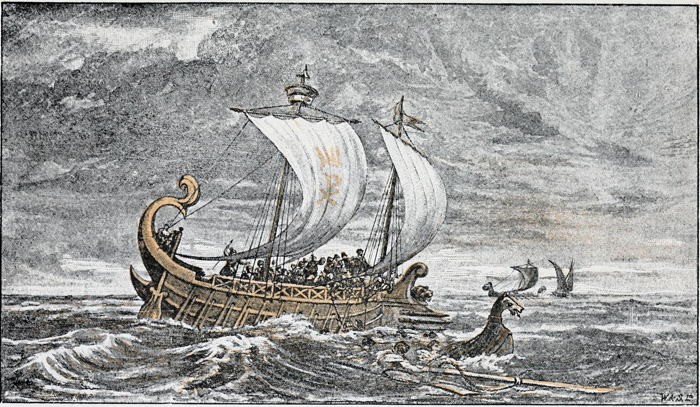
A fictionalised account of the departure of the legions from Britain is given in the ‘The Count of the Saxon Shore by Alfred John Church’, set in the early fifth century. An interesting snippet from this, the time was mid-October:
But I must say, saving your presence, that it is against all rules of a sailor’s craft as I have known it, man and boy, for nigh upon threescore years, to be at sea near about a month after the autumn equinox.
’Never let your keel be wet,
When the Pleiades have set;
Never let your keel be dry,
When the Crown is in the sky.’
That is what my father used to say, and his fathers before him, for I do not know how many generations, for we have always followed the sea.”
Footnotes
- 1West Rock see Myers. ‘Account of the River of Orwell in Suffolk’. Transactions of the Antiquaries of London, 1793.
- 2Kentish Knock see Astbury, A. K. Estuary: Land and Water in the Lower Thames Basin. 1st edition. London: Carnforth Press, 1981.
- 3‘Roman Roads in Suffolk’. Accessed 17 June 2022. http://www.twithr.co.uk/suffolk/ipswich-felixstowe.htm. and Fairclough, John. ‘Volume XLII Part 3 (2011)_Felixstowe Roman Fort J Fairclough_253 to 276’, n.d., 24.
- 4The Notitia Dignitatum was a list of officials probably compiled in the late fourth century and known only through later copies which are subject to error.
- 5Portus Arduni – Johnson, Stephen. The Roman Forts of the Saxon Shore. Elek, 1976., Antiquity D. Peacock 1973
- 6
- 7Carausius – see Johnson, Stephen. The Roman Forts of the Saxon Shore. Elek, 1976.
- 8THE CLASSIS BRITANNICA: WHAT DO WE KNOW ABOUT ROMAN BRITAIN’S REGIONAL FLEET? and What Happened to the Roman Fleet in Britain?
- 9Dimensions – JOHN FAIRCLOUGH and STEVEN STEVEN J. PLUNKETT. ‘DRAWINGS OF WALTON CASTLE AND OTHER MONUMENTS IN WALTON AND FELIXSTOWE ByJOHN FAIRCLOUGH and STEVEN STEVEN J. PLUNKETT’, n.d.
Image Sources and Credits
Image Credits and Sources
- : Google Earth
- The Count of the Saxon Shore: The Count of the Saxon Shore by Alfred John Church
- 1West Rock see Myers. ‘Account of the River of Orwell in Suffolk’. Transactions of the Antiquaries of London, 1793.
- 2Kentish Knock see Astbury, A. K. Estuary: Land and Water in the Lower Thames Basin. 1st edition. London: Carnforth Press, 1981.
- 3‘Roman Roads in Suffolk’. Accessed 17 June 2022. http://www.twithr.co.uk/suffolk/ipswich-felixstowe.htm. and Fairclough, John. ‘Volume XLII Part 3 (2011)_Felixstowe Roman Fort J Fairclough_253 to 276’, n.d., 24.
- 4The Notitia Dignitatum was a list of officials probably compiled in the late fourth century and known only through later copies which are subject to error.
- 5Portus Arduni – Johnson, Stephen. The Roman Forts of the Saxon Shore. Elek, 1976., Antiquity D. Peacock 1973
- 6
- 7Carausius – see Johnson, Stephen. The Roman Forts of the Saxon Shore. Elek, 1976.
- 8THE CLASSIS BRITANNICA: WHAT DO WE KNOW ABOUT ROMAN BRITAIN’S REGIONAL FLEET? and What Happened to the Roman Fleet in Britain?
- 9Dimensions – JOHN FAIRCLOUGH and STEVEN STEVEN J. PLUNKETT. ‘DRAWINGS OF WALTON CASTLE AND OTHER MONUMENTS IN WALTON AND FELIXSTOWE ByJOHN FAIRCLOUGH and STEVEN STEVEN J. PLUNKETT’, n.d.
Image Credits and Sources
- : Google Earth
- The Count of the Saxon Shore: The Count of the Saxon Shore by Alfred John Church
