See also Waldringfield Cuttings Marsh Survey.
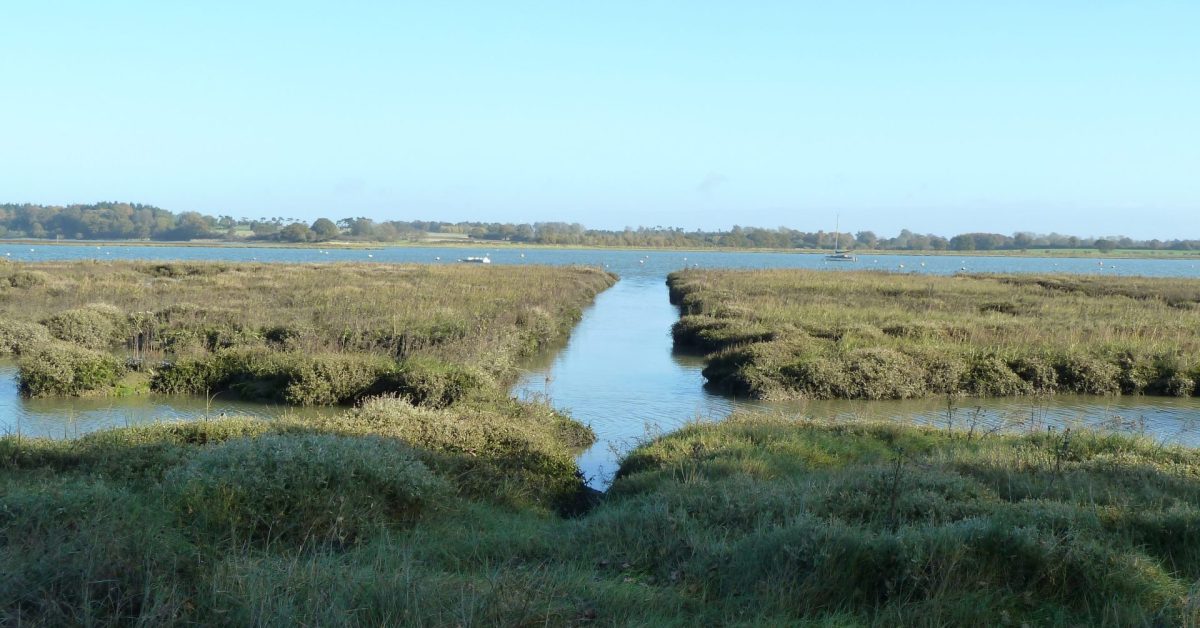
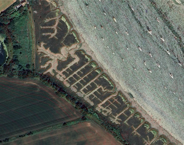
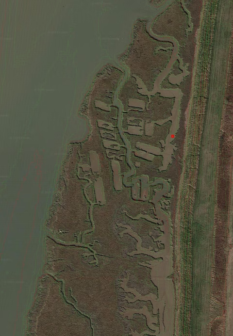
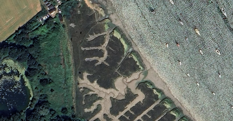
South of the sailing club along the seawall leading towards Hemley is a series of regular cuttings in the salt marsh extending for about 350m. They do not seem interesting until one wonders why there are no similar cuttings on the East Coast, and what they were for. The North and South cuttings are different, not made at the same time and divided by the remains of an irregular 19C central creek predating the cuttings.
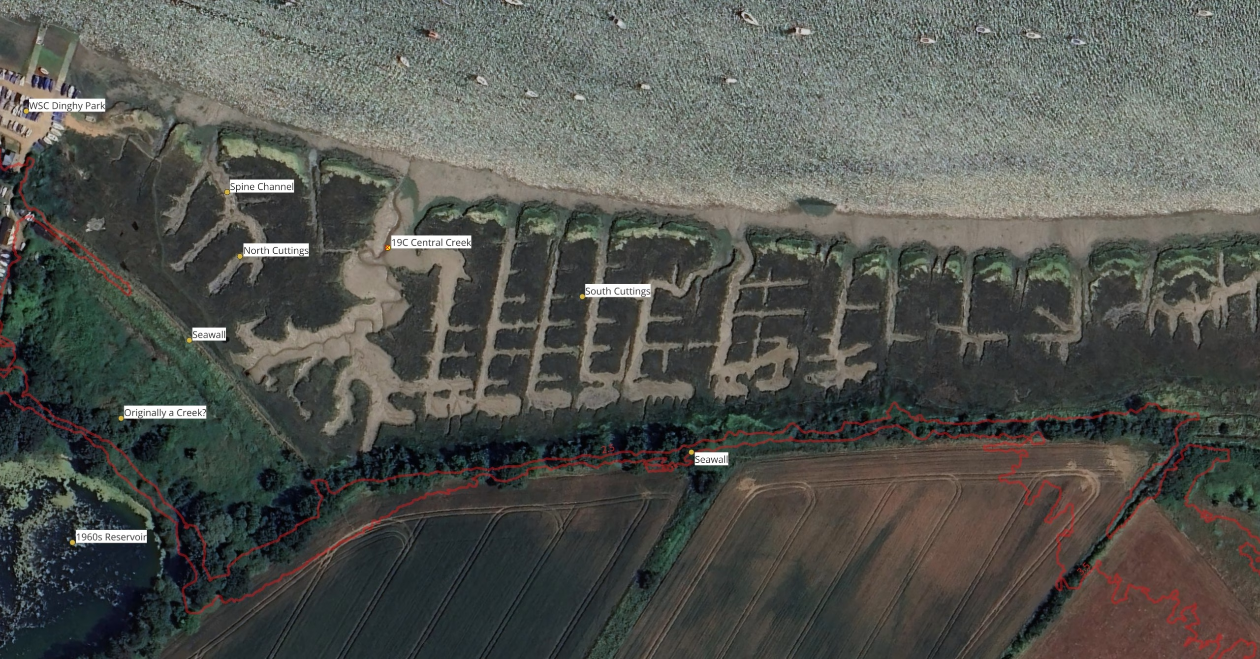
South Cuttings
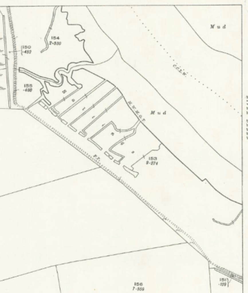
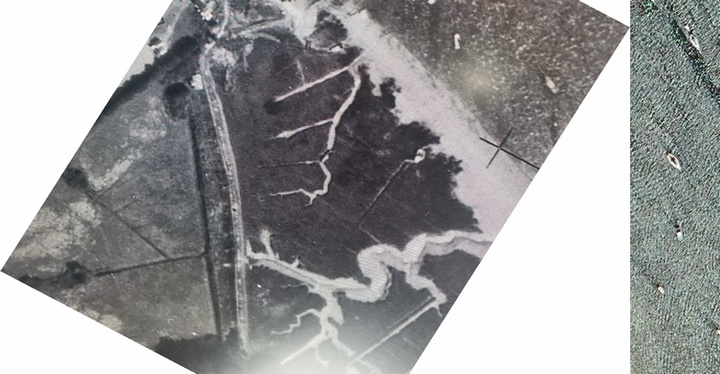
The channels to the south vary from 5m wide to less than 2m: the length varies from 50-80m and the depth is about 0.8m. Ordnance Survey maps show that the central creek existed late 19C but that the cuttings were not there in 1881 or 1902 , they were visible in 19251The revision dates on the maps are taken to be the date of survey which might not be the case.. This 1962 view, pre-reservoir, shows them well (click to zoom).
he side-by-side view shows the development.
What were the South Cuttings for?
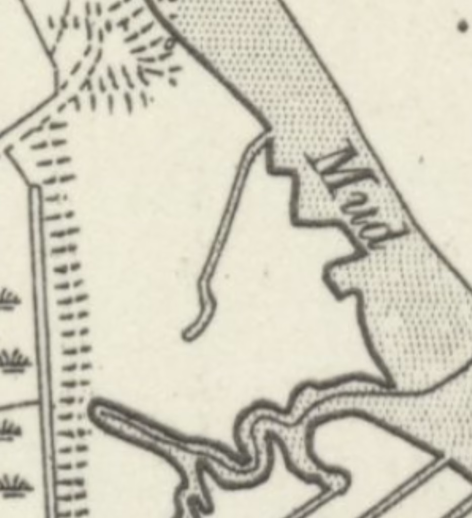
Falkenham Creek Oyster Beds
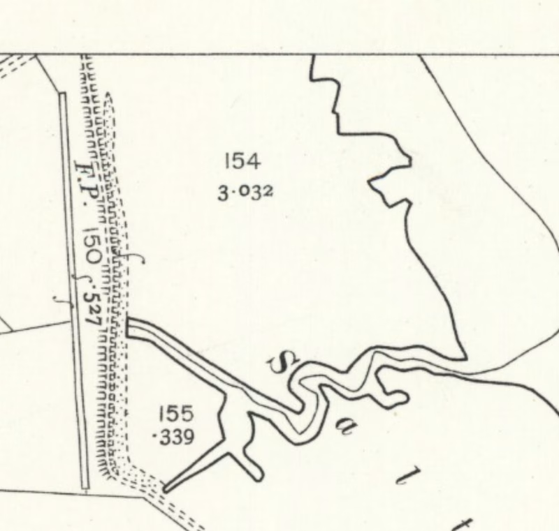
scale 1 to 1766 mud 1 to 1.5 marsh 1.8m AOD
- Construction of the Dummy Landing Craft was once suggested but these were built in 1944 on the current Dinghy Park.
- Mud digging for the Cement Works? – The total volume of mud removed is around 1,000 to 2,000 cubic metres, 500 to 1,000 tons. The total mud dug for the cement works was much greater, around 112,000 tons. There are no similar cuttings on the Medway, the centre of cement production. The width of the channels is generally smaller than the beam of a barge (circa 5.5m) and, as the cement works closed in 1907, a connection with cement is improbable.
- Oyster or shellfish beds? – There are no similar cuttings on the East Coast, patterned oyster bed cuttings are opposite Falkenham Creek, and those on the Ore bear a slight resemblance. Others exist near Nacton on the River Orwell and on the West side of West Mersea. None are like those at Waldringfield. Suffolk County Council Archaeological Service gave the opinion that: “Oyster pits seem rather unlikely, but the layout suggests a trap of some kind. They could be drainage related as the remains of a drain was found in the creek north of the cuttings.”
Later North Cuttings
The more irregular North cuttings are different. The spine channel was cut between 1902 and 1925 with the tributaries between 1925 and 1945. They are shown on the 1955 OS six-inch map2Survey date unclear see TM24SE – A Surveyed / Revised: Pre-1930 to 1957, Published: 1957 but this is inconsistent with the 1945 aerial photograph. Since 1945 the shape has softened but no new channels dug. The side-by-side view shows the development.
What were the North Cuttings for?
Why was the spine channel cut and then, at some later time, the straight tributaries? Boat storage has been suggested but this would not be appropriate in a tidal estuary. Another explanation could be removing material for reinforcing seawalls although there is no nearby construction that can be connected, the nearby reservoir dam was constructed later, in the 1960s.
The site has an SSSI sign, it is not shown as such on the Government SSSI map3Search for Land Based Designations / Site of Special Scientific Interest. The only one shown in the area is Waldringfield Pit on the BT site..
So, it is still not certain why either of these cuttings were made nor who made them.
Notes
Sources
Footnotes
- 1The revision dates on the maps are taken to be the date of survey which might not be the case.
- 2Survey date unclear see TM24SE – A Surveyed / Revised: Pre-1930 to 1957, Published: 1957
- 3Search for Land Based Designations / Site of Special Scientific Interest. The only one shown in the area is Waldringfield Pit on the BT site.