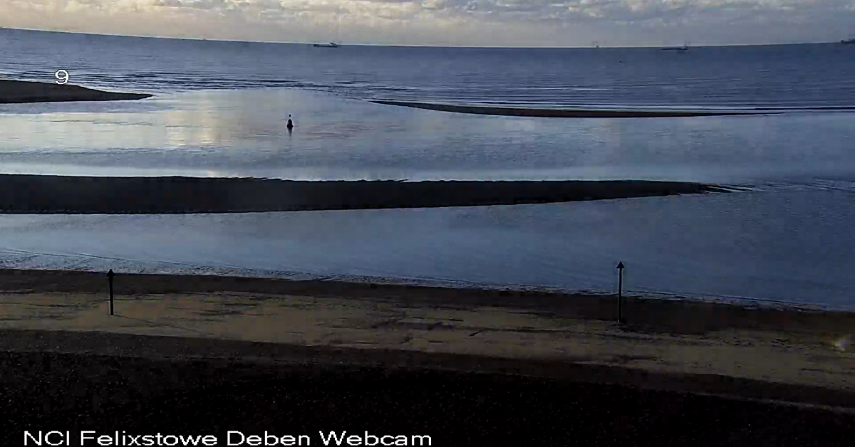
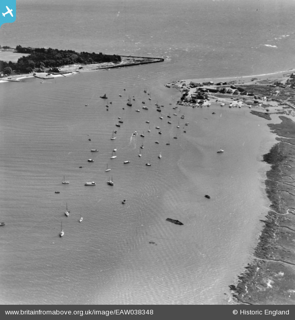
In Roman times the entrance, or Haven, was guarded by a Roman Fort which had collapsed into the sea by the seventeenth century. In Medieval times the lower Deben was the port of Goseford or Bawdsey Haven1SIAH Volume 43, Part 4 (2016) Port of Goseford Peter Wain 2W.G.Arnott, W G. Suffolk Estuary : The Story of the River Deben. N. Adlard, , 2D Impression, 1950. . In that era the entrance would not have had such a shallow bar and would have been both further out and wider than today’s narrow channel.
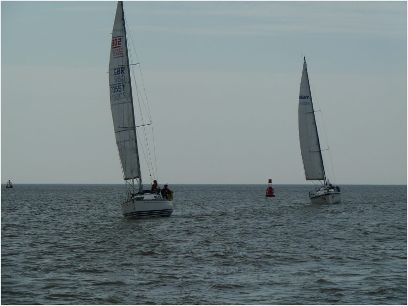
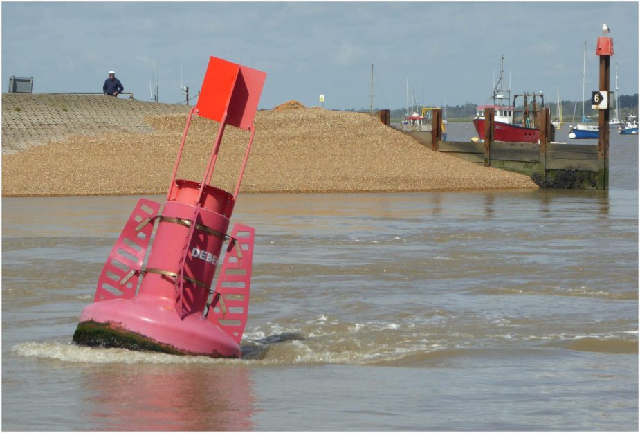
The modern Safe Water Mark, or on nineteenth century charts, Fairway Buoy, signals the entrance to the River Deben and heads a succession of buoys leading across the bar and along the narrow channel to the tidal estuary.
The shingle spit extending southwards from Bawdsey is part of a dynamic system which, over a fifteen to twenty-year cycle, progresses the entrance gradually south until it closes andthen re-opens at the northern end, as in the 1956 example. In 2021 the entrance was near its southern limit although, of course, there have been several cycles since 1956. There are scientific studies of the process specific to the Deben3Dr-Helene-Burningham-The-Deben-Knolls-and-Mouth 4Shoreface Dynamics on the Suffolk Coast Helene Burningham and Jon French Coastal and Estuarine Research Unit UCL Department of Geography University College London Final report for The Crown Estate Augus 5Karunarathna, H., et al. “Two-Dimensional Reduced-Physics Model to Describe Historic Morphodynamic Behaviour of an Estuary Inlet.” Marine Geology, vol. 382, Dec. 2016, pp. 200–09, http://dx.doi.org/10.1016/j.margeo.2016.10.014. 6Horrillo-Caraballo, J., et al. A HYBRID-REDUCED PHYSICS MODELLING APPROACH APPLIED TO THE DEBEN ESTUARY, UK. 2014, https://doi.org/10.9753/ICCE.V34.SEDIMENT.76. as well as a website showing the latest satellite images.
In the late sixteenth century, Bawdsey Haven was described thus:
“A barred haven so that none but small shipping can come…..”.
1587 “Touchyng the fortificacaons of the coast of Suffolk”71587 “Touchyng the fortificacaons of the coast of Suffolk” – TNA SP 12/206 føl 53r
It was not mentioned as a port in the 1588 Mariner’s Mirrour although does get a recommendation in the 1693 Greenvile Collins Coasting Pilot:
Lyeth just at the west end of Balsey-Cliff, and is a Bar-Haven, where is but three and four foot water at low-water; the Bar often shifts there, I advise such as are not acquainted to take a Pilot. After you are in ’tis a very good Harbour, and goeth up to Woodbridge. The water riseth and falleth on the Bar at a Spring-tyde fifteen foot, and at Full and Change it floweth south and south by east.
An invasion survey made early in World War Two shows little alteration:
A sand bar about ¼ mile offshore would limit passage to boats with a draft of four or five ft to half tide and above. The mouth to the Deben was narrow and difficult to approach.
The 1539 A Coloured Chart of the Coast of Suffolk shows beacons on either side of the Haven.

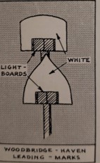
Two red and white wooden beacons were established by 1684, these had a candle-lit lantern head and remained until modern times to provide a safe transit across the bar. They were probably replaced in 1859 as, for that year, there is a cost of £4 16s 6d recorded for erecting ‘Two shifting beacons, entrance of haven’, these were topped by a square and triangle8Great Britain Commission Appointed to Inquire into the Condition of Lights Beacons Buoys and, Report of the Commissioners Appointed to Inquire Into the Condition and Management of Lights, Buoys and Beacons: Together with a Letter from Rear-Admiral W.A.B. Hamilton, Chairman of the Commission, and Appendix and Index (H.M. Stationery Office, 1861).. An illustration of the 1956 version is shown.
Frank Cowper’s 1892 guide gives a compelling description of entering, under sail alone of course, the Woodbridge River (Deben):
…for we are now approaching a rather risky bit of sailing, and they have a way of changing the position of the buoys while one is away. In the first place, of course, we are hailed by a pilot, and we are told we cannot possibly get in without one. We said we should like to try. …Well we are possessed of this strength of mind, and resolve to try to force the passage of the Woodbridge River. How pleased the local interest will be if we get ashore...
Cowper mentions the Bawdsey Seamark for Sledway on the northern cliff and informs us that the 1892 pilotage fee was 10 shillings, unchanged in the 1956 and 1965 East Coast Pilot9Pilotage fees – although in 1923 Irving tells us 1s 3p per foot under 10′ draught which would be rather more expensive.. He continues:
……we now notice the beacons on the shore are getting closer together; gradually the square and triangle come in a line, and judging this will be all right to lead through,’ we luff a little and slip on over the bar. A long heave of the sea, followed by a curl on the crest of the wave to our left, tells us there is an awkward shoal there. Our lead, how- ever, says we have 16ft. Presently it says 6ft., and we feel anxious. As the tide is running in and the beacons are still in line we hold on. The sea is now breaking on our right hand, and we notice that we are almost inside. “Two fathoms” says the lead. We are over the bar. The second martello tower is well on our beam. We are running in finely. We disregard the beacons now, and steer as near as possible in mid-channel. The flood is running up strong. In a few more minutes we have passed the beacons and are gliding by the marshes on the Bawdsey side.
Frank Cowper
The number and names of the buoys change with the configuration of the entrance and have increased over the years. The late eighteenth-century Chandler chart shows a buoy at the Deben entrance and, in the 1845 Deben Survey, a single black buoy called ‘Bar’ is positioned in conjunction with some posts on shore. By 1859, for the benefit of the Hollesley Lifeboat which was kept in the Haven, there were two fairway buoys. At around this time, Edward Fitzgerald was active on the river in his yacht Scandal and, through his influential contacts, he caused the entrance buoys to be upgraded.
In that same year it was agreed that, when it was impossible to enter haven,
…one red light should be shown from beacons instead of two bright lights, and a black ball by day, so that ships may at once run for Harwich.10Report of Her Britanic Majesty’s Commissioners, appointed to inquire into the Condition and Management of Lights, Buoys, and Beacons, Submitted March 5, 1861,
The 1896 Thames Estuary guide tells us:
Woodbridge Haven-The River Deben-The entrance to Woodbridge Haven lies N. W., 7 miles from the West Rocks B. conical buoy, and N.N.E. E., 3 miles from the Cork Light Ship. There is a B. conical buoy marking the end of the bar which partially closes the mouth.
This bar is of shingle and is frequently shifting, particularly after heavy winds. Consequently, no directions can safely be given for taking this harbour and a pilot is absolutely necessary. When waiting to enter, anchor close outside the R. buoy, marked N.E. Haven, which lies off the N. side in 3 fathoms.
Signal for Pilot. -Pilot Jack; at night a blue light, or riding light over the bows.
Pilot Charges. From sea over the bar to N. of Horse Sand, 10d. per foot; from Horse Sand to Waldringfield, 6d.; up to Woodbridge, 10d.
Set and force of Tide. -The flood runs about 3 knots and sets towards the S. beach. The tide runs in for 15 minutes after high water, on account of the sea ebb forcing its way in till it is high water at the Rocks.
The depth of water over the bar at low water is 2 feet; high water, 12 to 15 feet.
The British Library. ‘The Thames Estuary: Its Tides, Channels, Ports and Anchorages. A Practical Guide for Yachts, Coasters and Small Vessels. With a Chart’.
By 1927 there was a ‘Woodbridge East Haven’ fairway buoy in addition to the Bar buoy and the leading ‘meets’ were similar to the 1956 illustration. Irving describes how one is safe provided that daylight cannot be seen between the ‘meets’11Irving, Lt Cdr John. Rivers and Creeks of the Thames Estuary, n.d. . The bar is a common feature of tidal estuaries.
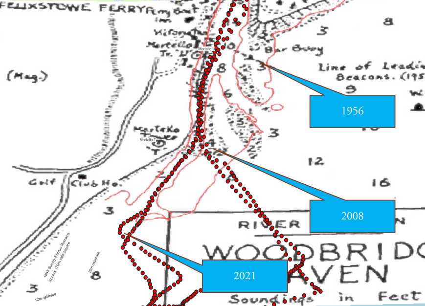
At the start of the 2023 season, the entrance moved towards the north again although it may soon go even further north. History by year here.
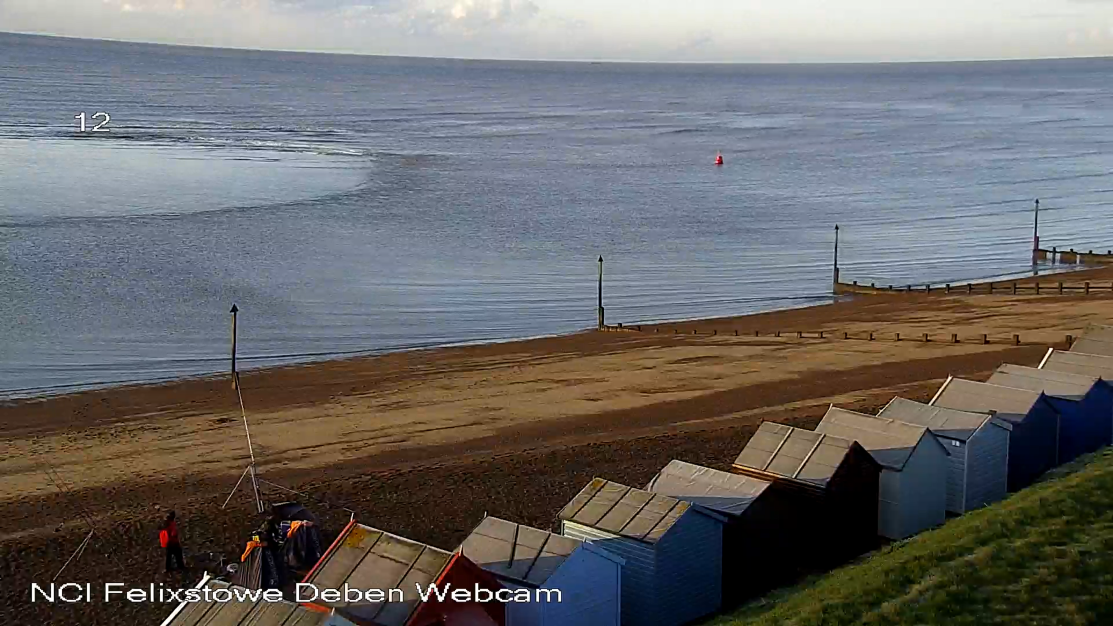
Chartlets have been produced for the entrance since around 2009 from a Trinity House survey in the Spring, available from East Coast Pilot, and by Deben Estuary Pilot. In stormy years the chartlet can be updated several times. Images from the NCI webcam at LW Springs for Spring 2022 are here.
Here is a drone video of the entrance in June 2024 (Monday 24th June 2024 around 8pm. W.Haven HW 1418 BST 3.6m, LW 2007BST 0.5)
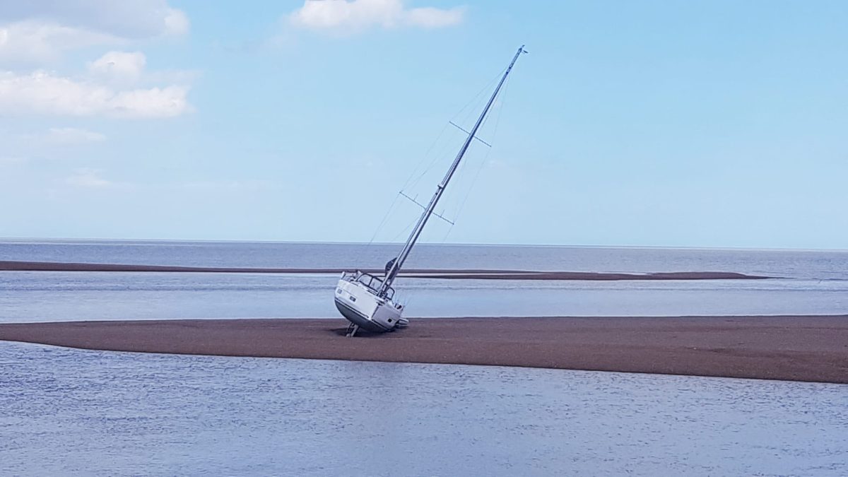
Every year there are yachts which fail to follow the advice on the charts of keeping to the channel and using transits. The helm feels the inbound flood but can be seduced by the southbound flood toward the shingle.
See Deben Reaches and Marks for buoyage up the river and Felixstowe Shoreline for the wider area.
Notes
For sea levels see Harwich Area Tidal Range. Tidal chart of Deben – note that the Tide Port is unspecified, chart is pre-2010.
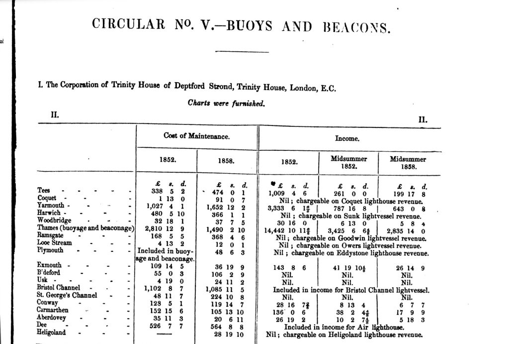
Extract from: Great Britain Commission Appointed to Inquire into the Condition of Lights Beacons Buoys and, Report of the Commissioners Appointed to Inquire Into the Condition and Management of Lights, Buoys and Beacons: Together with a Letter from Rear-Admiral W.A.B. Hamilton, Chairman of the Commission, and Appendix and Index (H.M. Stationery Office, 1861). – it would be good to find the cahrts mentioned.
Footnotes
Pilots at the Ferry – RDA’s Deben Magazine Autumn 2013 and Spring 2014
From Report of the Commissioners Appointed to Inquire Into the Condition and Management of Lights, Buoys and Beacons

- 1SIAH Volume 43, Part 4 (2016) Port of Goseford Peter Wain
- 2W.G.Arnott, W G. Suffolk Estuary : The Story of the River Deben. N. Adlard, , 2D Impression, 1950.
- 3Dr-Helene-Burningham-The-Deben-Knolls-and-Mouth
- 4
- 5Karunarathna, H., et al. “Two-Dimensional Reduced-Physics Model to Describe Historic Morphodynamic Behaviour of an Estuary Inlet.” Marine Geology, vol. 382, Dec. 2016, pp. 200–09, http://dx.doi.org/10.1016/j.margeo.2016.10.014.
- 6Horrillo-Caraballo, J., et al. A HYBRID-REDUCED PHYSICS MODELLING APPROACH APPLIED TO THE DEBEN ESTUARY, UK. 2014, https://doi.org/10.9753/ICCE.V34.SEDIMENT.76.
- 71587 “Touchyng the fortificacaons of the coast of Suffolk” – TNA SP 12/206 føl 53r
- 8Great Britain Commission Appointed to Inquire into the Condition of Lights Beacons Buoys and, Report of the Commissioners Appointed to Inquire Into the Condition and Management of Lights, Buoys and Beacons: Together with a Letter from Rear-Admiral W.A.B. Hamilton, Chairman of the Commission, and Appendix and Index (H.M. Stationery Office, 1861).
- 9Pilotage fees – although in 1923 Irving tells us 1s 3p per foot under 10′ draught which would be rather more expensive.
- 10
- 11Irving, Lt Cdr John. Rivers and Creeks of the Thames Estuary, n.d.
Image Sources and Credits
Image Credits and Sources
- 1951 Deben at Felixstowe Ferry from English Heritage Britain From Above EAW038348: English Heritage Britain From Above EAW038348
- 1538 Harwich to Yarmouth 1 cr: The British Library
- 1956 East Coast Rivers extract Marks at Deben: 1956 East Coast Rivers
- 1956 Deben Entrance from 1956 East Coast River: 1956 East Coast Rivers
- The Deben Bar at LW of 0.3m at 0707BST on April 2nd 2022 from NCI Webcam: NCI Webcam
- Lyn-Skelton-Facebook-East-Coast-Rivers-13June22: Lyn Skelton Facebook East Coast Rivers 13June22
- 1SIAH Volume 43, Part 4 (2016) Port of Goseford Peter Wain
- 2W.G.Arnott, W G. Suffolk Estuary : The Story of the River Deben. N. Adlard, , 2D Impression, 1950.
- 3Dr-Helene-Burningham-The-Deben-Knolls-and-Mouth
- 4
- 5Karunarathna, H., et al. “Two-Dimensional Reduced-Physics Model to Describe Historic Morphodynamic Behaviour of an Estuary Inlet.” Marine Geology, vol. 382, Dec. 2016, pp. 200–09, http://dx.doi.org/10.1016/j.margeo.2016.10.014.
- 6Horrillo-Caraballo, J., et al. A HYBRID-REDUCED PHYSICS MODELLING APPROACH APPLIED TO THE DEBEN ESTUARY, UK. 2014, https://doi.org/10.9753/ICCE.V34.SEDIMENT.76.
- 71587 “Touchyng the fortificacaons of the coast of Suffolk” – TNA SP 12/206 føl 53r
- 8Great Britain Commission Appointed to Inquire into the Condition of Lights Beacons Buoys and, Report of the Commissioners Appointed to Inquire Into the Condition and Management of Lights, Buoys and Beacons: Together with a Letter from Rear-Admiral W.A.B. Hamilton, Chairman of the Commission, and Appendix and Index (H.M. Stationery Office, 1861).
- 9Pilotage fees – although in 1923 Irving tells us 1s 3p per foot under 10′ draught which would be rather more expensive.
- 10
- 11Irving, Lt Cdr John. Rivers and Creeks of the Thames Estuary, n.d.
Image Credits and Sources
- 1951 Deben at Felixstowe Ferry from English Heritage Britain From Above EAW038348: English Heritage Britain From Above EAW038348
- 1538 Harwich to Yarmouth 1 cr: The British Library
- 1956 East Coast Rivers extract Marks at Deben: 1956 East Coast Rivers
- 1956 Deben Entrance from 1956 East Coast River: 1956 East Coast Rivers
- The Deben Bar at LW of 0.3m at 0707BST on April 2nd 2022 from NCI Webcam: NCI Webcam
- Lyn-Skelton-Facebook-East-Coast-Rivers-13June22: Lyn Skelton Facebook East Coast Rivers 13June22
